
You wouldn't want to be sailing across the Tasman Sea this weekend
Monstrous waves and howling winds will develop over the Tasman Sea later this week, sending a dangerous swell towards NSW.
A large bend in the polar jet stream - a stream of powerful winds flowing through our upper atmosphere - will cause a deep low pressure system to develop near New Zealand and a firm high pressure system to form near southeastern Australia towards the end if this week.
The proximity of these two contrasting system will create an exceptionally strong air pressure gradient across the Tasman Sea from Friday into the weekend.
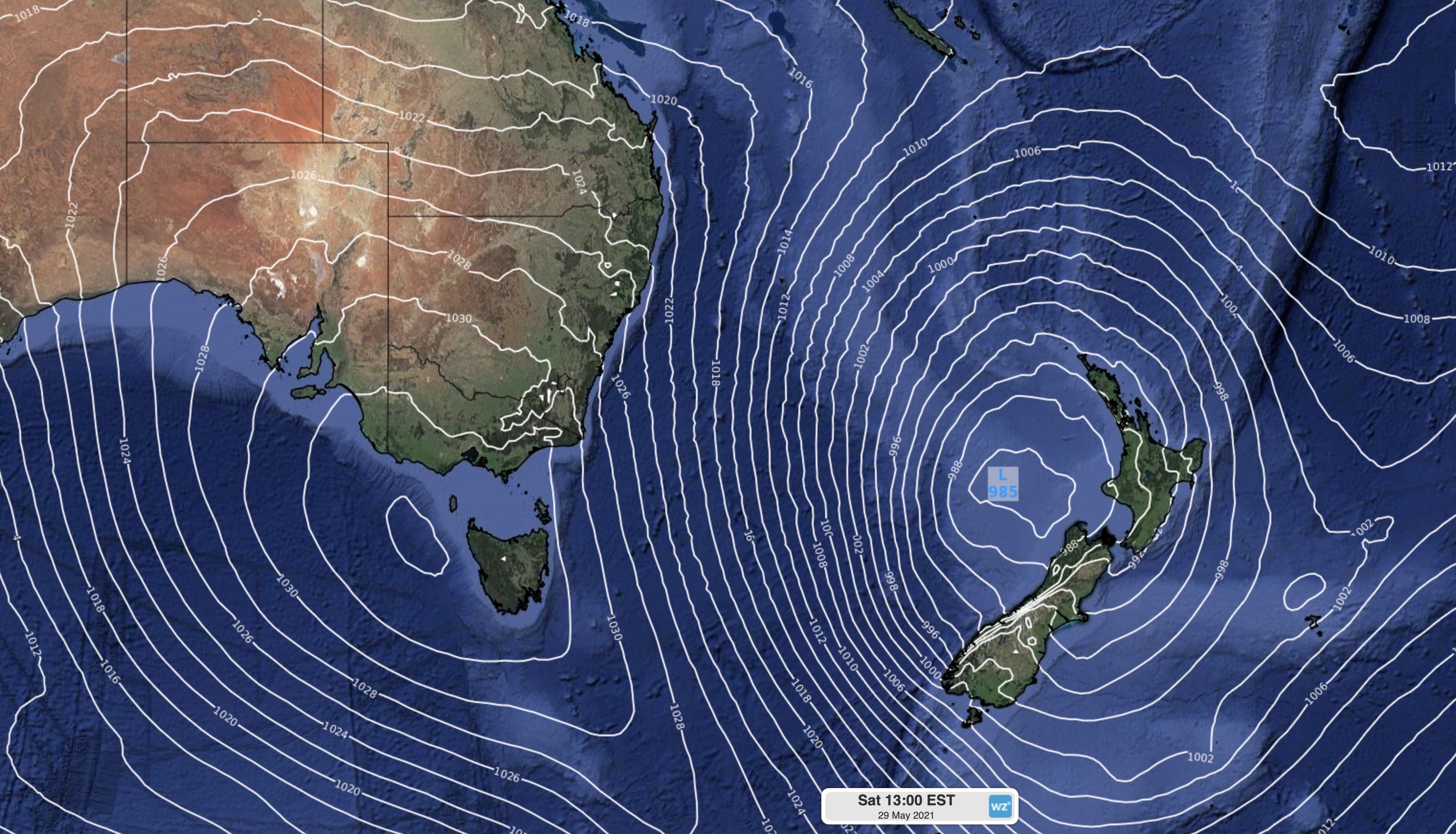
Image: Mean sea level pressure chart for 1pm AEST Saturday, May 29, according to the ECMWF-HRES model. The map shows a deep low pressure system near New Zealand and a high pressure system near Tasmania. The closely-spaced isobars (whilte lines) in between these systems reveals a steep pressure gradient over the Tasman Sea.
By Saturday, computer models suggest that mean sea level pressure could reach up to 1037 hPa at the centre of the high and as low as 982 hPa at the core of the low, establishing a pressure gradient of more than 50 hPa over a distance of 2,200 km.
This pressure gradient will generate a large and persistent area of south to southwesterly winds above the Tasman Sea that will relentlessly blow at around 30-40 kt (55-75 km/h) between Friday and Sunday.
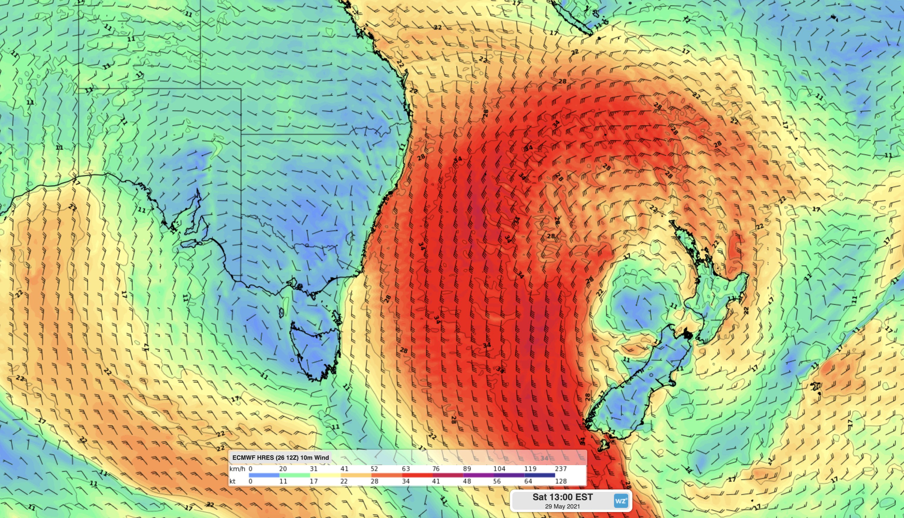
Image: Forecast surface wind speed and direction showing a large area of strong to gale force winds over the Tasman Sea on Saturday.
This prolonged and widespread area of powerful winds is going to churn up some massive waves.
Models suggest that significant wave heights, which is an average of the highest one-third of waves measured at any given location, could reach 9-10 metres around Lord Howe Island on Saturday.
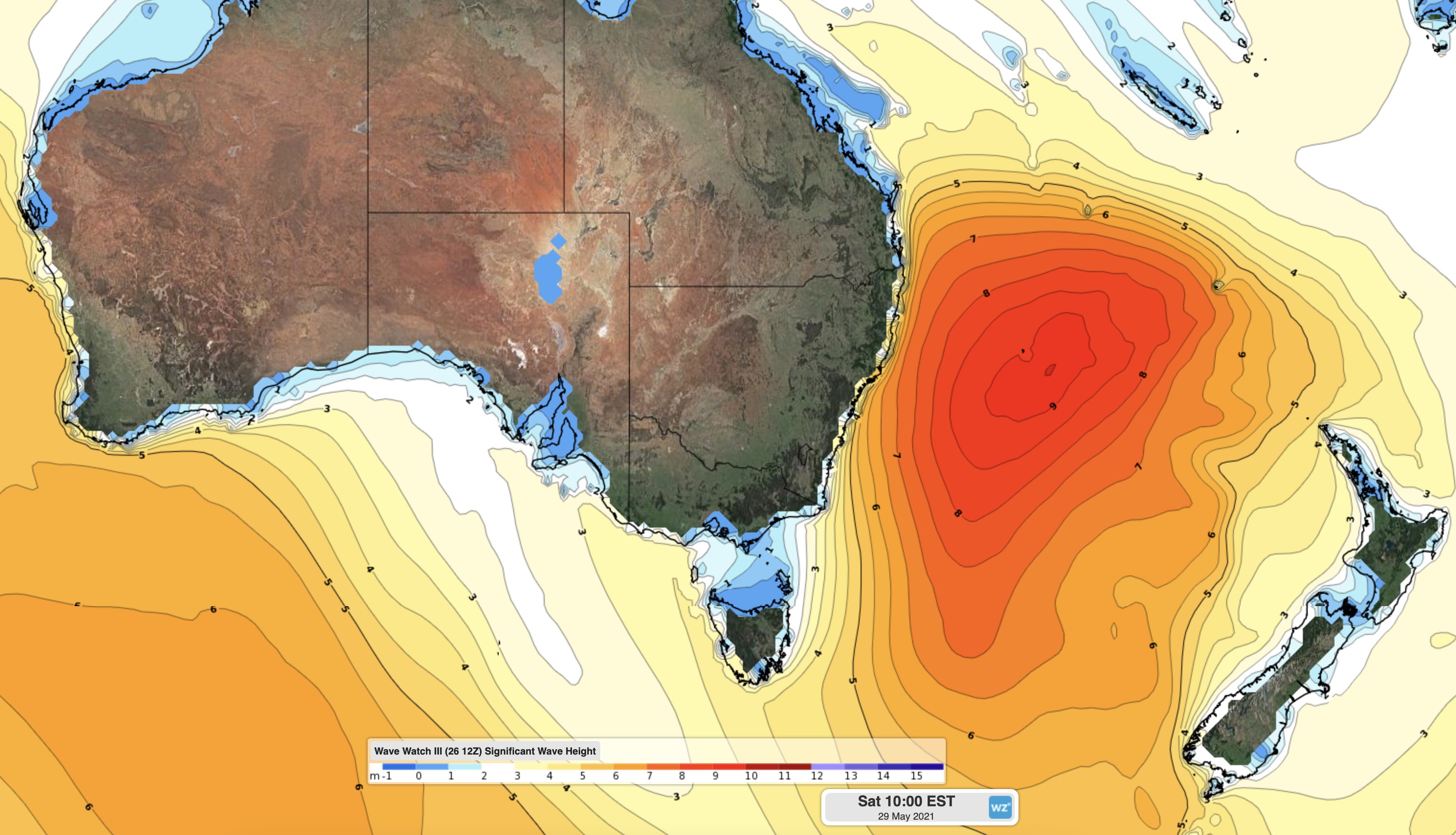
Image: Wave Watch III model showing a region of 7-10 metre significant wave heights over the Tasman Sea on Saturday.
Wave heights won’t be quite as large along Australia’s east coast, but they could still reach about 5-7 metres not too far offshore between Friday and Sunday. South-facing beaches will see the biggest waves from this swell event.
Check that latest marine forecasts and surf warnings if you plan on heading to the coast on Friday or the weekend.