
World Meteorological Organization tells world to "Prepare for El Niño" in 2026
The World Meteorological Organization has not minced its words when issuing a clear climate warning for the coming months: “Prepare for El Niño.”
The statement comes as the WMO predicts an 80% likelihood of El Niño occurring during the June-to-August period this year – winter in the Southern Hemisphere – and, if established, a near or above 90% likelihood of El Niño persisting until at least November.
The WMO also predicts that this will be a moderate to strong El Niño, while noting that “some uncertainty remains about El Niño peak strength and timing.”
Clear signs that El Niño is on the way
This warning about a looming El Niño will not come as a surprise for those who have been following long-range forecasts in recent months.
Computer models have been predicting the emergence of El Niño since the start of this year, and the tropical Pacific Ocean has been showing signs of an emerging El Niño since April.
The atmosphere is also showing clear signs of a developing El Nino pattern. The Southern Oscillation Index (SOI) – a key monitoring index for the atmospheric component of El Niño – has now crossed the El Niño threshold, showing that ocean-atmosphere coupling is occurring in the Pacific region. This ocean-atmosphere coupling is a critical aspect of a maturing El Niño signal bacause it shows that the ocean signal is not occurring in isolation.
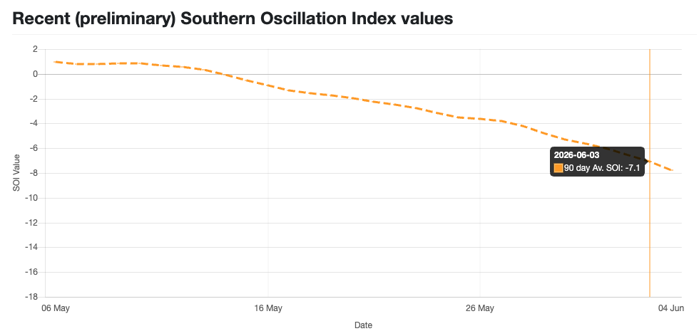
Image: Observed 90-day average SOI index values, showing the index dropping below the El Niño threshold of -7 earlier this month. Source: Queensland Government.
How will El Niño affect weather in the next few months?
Every El Niño is different, and so are its impacts. However, there are certain types of weather that become more likely across the world when El Niño is underway.
Rainfall patterns can be strongly influenced by El Niño, with some areas of the globe typically seeing below-normal rainfall – including large areas of Australia and Southern and Southeast Asia – while others can see more rain than usual.
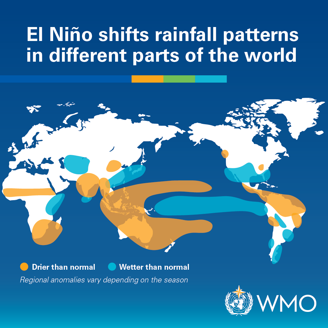
Image: Typical rainfall anomalies seen during El Niño. Source: WMO.
In Australia, El Niño is typically associated with below-average rainfall and above average daytime temperatures, with its strongest influence during winter and spring.
The WMO is forecasting an abnormally dry and warm winter for large areas of Australia, which is fitting with the typical El Niño narrative.
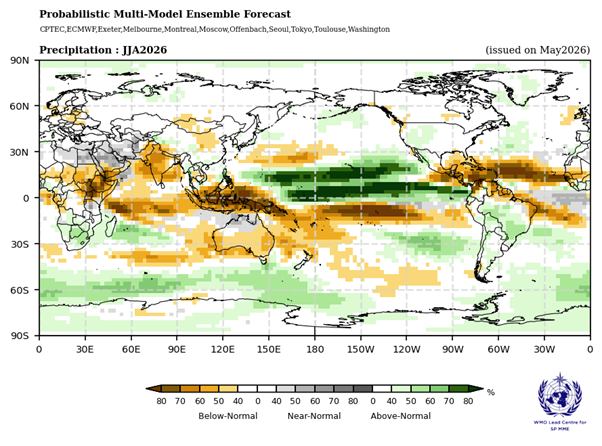
Image: Forecast rainfall probabilities during the July-to-August period. Source: WMO
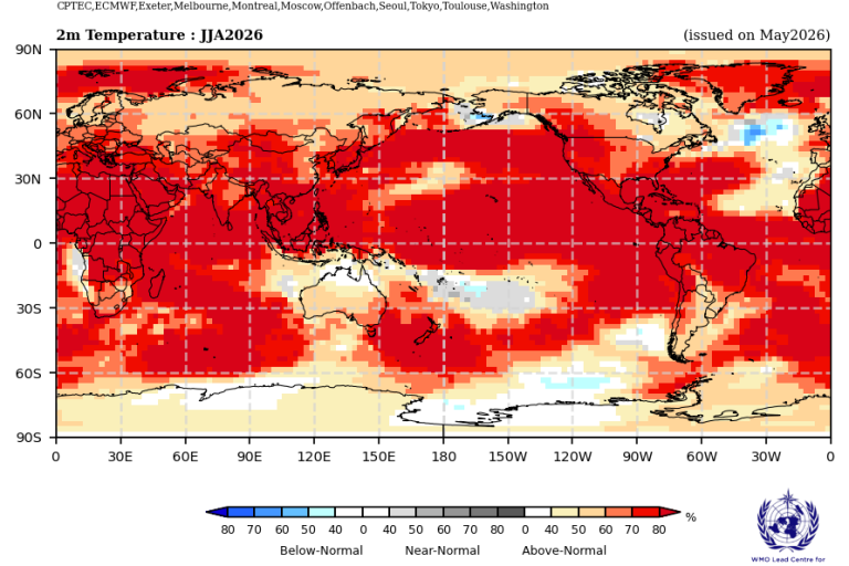
Image: Forecast temperature probabilities during the July-to-August period. Source: WMO
It’s important to note that the strength of El Niño does not determine the intensity of its impacts. The best way to stay up to date with the latest information on weather and climate impacts over the coming months is to check the latest seasonal forecasts from organisations including the WMO, the Bureau of Meteorology and Weatherzone.