
Wintry weather returns to southeastern Australia
A cold front and upper trough are combining to bring a cold spell to the southeast, feeling more like winter than spring.
A cold front is currently moving off the east coast, leaving cold and gusty winds in its wake. An upper level trough is virtually stationary over parts of NSW, Victoria, eastern SA and northern Tasmania, and will remain for the next few days.
On Sunday, Adelaide, Melbourne, Hobart, Canberra and Sydney are all running around six degrees below what is normal for this time of year.
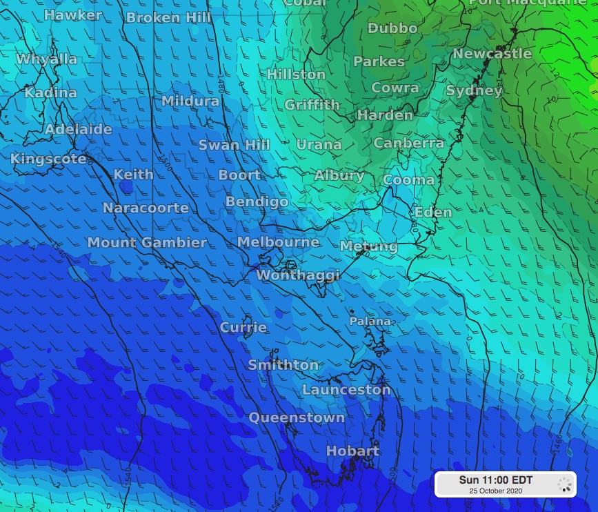 Image: 850hPa temperature, wind and height on Sunday morning using the ECMWF model.
Snow has been falling overnight into Sunday over parts of the alpine region, and by the end of the weeknd, some of the higher peaks may have accumulated around 10cm of fresh snow.
The cooler temperatures will hang around into Monday for some parts of the southeast. Canberra is looking at a maximum of 12 degrees on Monday, although Sunday will not reach much higher.
A warning trend will start from Tuesday, although it will be a slow increase in temperature for most places in southeastern Australia.