
Wintry chill with subzero temperatures in five states
Southeastern Australia is in the grip of a wintry chill, as cool southerly winds send a shiver across the most heavily populated corner of the country in the second week of spring.
Overnight, temperatures fell below zero in five of the eight states and territories, with the coldest reading in each one being:
- NSW: -5.5°C at Perisher Valley
- VIC: -4.3°C at Falls Creek
- TAS: -2.4°C at Liawenee
- ACT: -2.0°C at Mt Ginini
- SA: -1.0°C at Keith West and Gluepot
- QLD: 3.0°C at Dalby
- WA: 7.0°C at four locations: Manjimup, Bridgetown, Dalwallinu, and Morawa Airport
- NT: 11.9°C at Jervois (a cattle station NE of Alice Springs)
Cold days as well as cold nights
Daytime temperatures across the southeast early this week have also been significantly cooler than the recent unseasonable warmth, and will continue to be relatively chilly.
Melbourne's Monday maximum of 14.6°C was the city's coldest day in three weeks, and 2.7°C degrees below the September average of 17.3°C.
Sydney's Monday maximum of 21.3°C was still more than a degree above the long-term average September peak of 20.2°C, but it was sweet relief from the weekend when the mercury exceeded 32°C in the city and 33°C in the western suburbs.
Monday's high of 3.2°C at Thredbo Top Station was the coldest maximum in more than two weeks at Australia's highest weather station, and a notch below the long-term September average of 3.3°C.
Why the cool outbreak in the second week of spring?
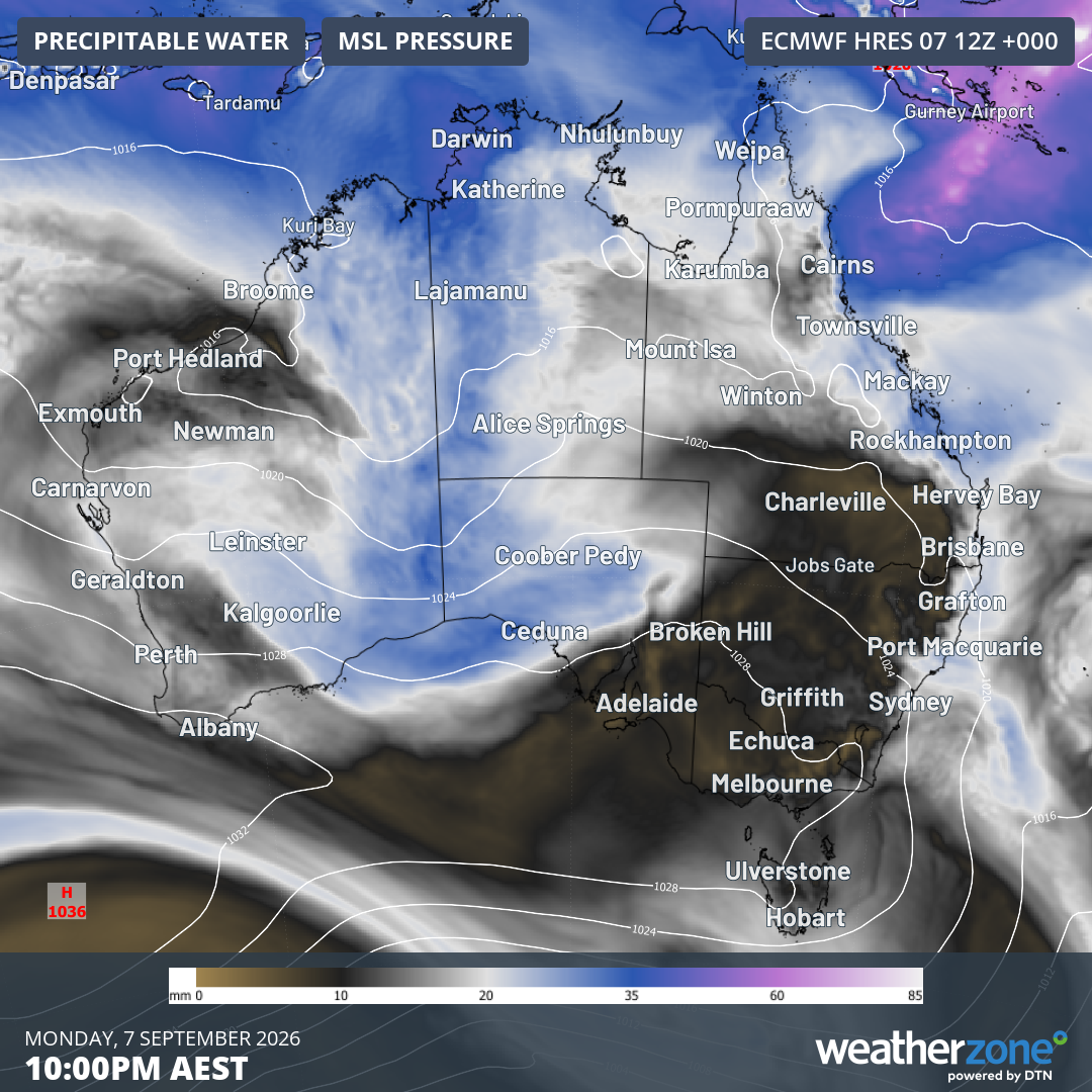
Image: Mean sea level pressure and precipitable water at 10 pm (AEST) on Monday, September 7, 2026, showing the dry airmass as cool southerly winds push across the southeast. Source: Weatherzone.
The first significant cold front in about three weeks crossed the southeast on Sunday, reaching the east coast by Monday morning.
A little snow fell on the Australian Alps right when the lifts were closing at all but two Australian ski resorts, because the weather gods apparently have a sense of humour.
The airmass in the wake of the cold front is cool and relatively dry, which is why widespread frigid temperatures were experienced last night.
Second surge of chilly weather coming to Tasmania, Victoria, southern NSW
A cold front is currently located over the Great Australian Bight this Tuesday. The front will cross Tasmania overnight, delivering snow as low as 500 metres above sea level in the state's south. That would be a low snow level for midwinter, which indicates how cold the airmass is.
The frigid air will push into Victoria and southern NSW on Wednesday, with Melbourne facing a maximum of just 13°C after the expected high of 16°C this Tuesday.
A few snowflakes could also fall in the Australian Alps, although most of the moisture will stay south of the mainland.
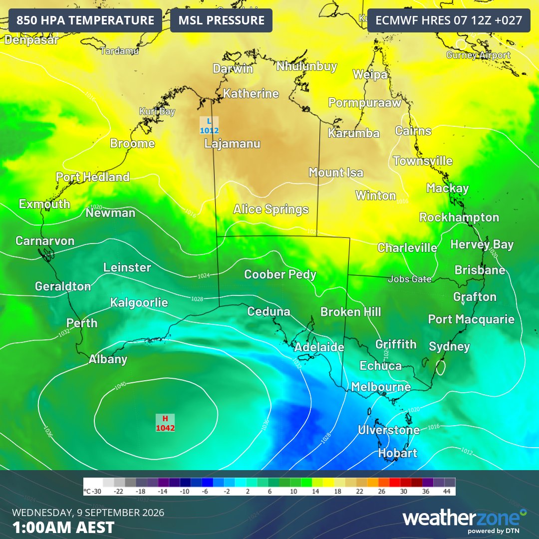
Image: Mean sea level pressure and 850 hPa temperatures predicted for 1 am (AEST) on Wednesday, September 9, 2026, showing the fresh surge of cold air across the southeast. Source: Weatherzone.
Gradually warming up for the NFL at the MCG
America's National Football League comes to Australia for the first time this Friday, with the match between the San Francisco 49ers and Los Angeles Rams starting at 10:35 am at the MCG.
That's Thursday night prime time on the East Coast of the USA and early evening on the West Coast.
The good news for fans attending the match – and for those watching on television hoping for a dry surface which is conducive to a free-flowing game – is that clear sunny skies are expected, with no rain.
Melbourne could see some morning fog on Friday after a cool start to the day, but the fog should burn off quite quickly. The temperature at kickoff should be around 12°C to 13°C (approx. 53°F to 55 °F).
Melbourne's maximum is expected to reach 18°C, which is 64.4°F.