
Wintry blast looms for King's Birthday long weekend
Millions of Australians will be rugging up over the King’s Birthday long weekend as an icy blast brings a mix of rain, hail, thunderstorms, blustery winds and snow to southeastern Australia.
All states and territories except Queensland and Western Australia will have a long weekend this weekend thanks to the King’s Birthday public holiday on Monday.
Cold snap in southeastern Australia
Australia’s southeastern states will be hit by a burst of wintry weather over the long weekend, featuring rain, hail, thunderstorms, icy winds and quite a bit of snow.
A complex low pressure system will drive a large pool of polar air over southeastern Australia on Friday and Saturday and hold it there throughout the whole long weekend.
This system will spread rain and hail over large areas of SA, Tas, Vic, NSW and the ACT over the long weekend. This will include wet weather in Melbourne, Adelaide, Canberra and Hobart. While this rain will not be welcome everywhere, it will be appreciated in the drought-affected areas of SA and Vic.
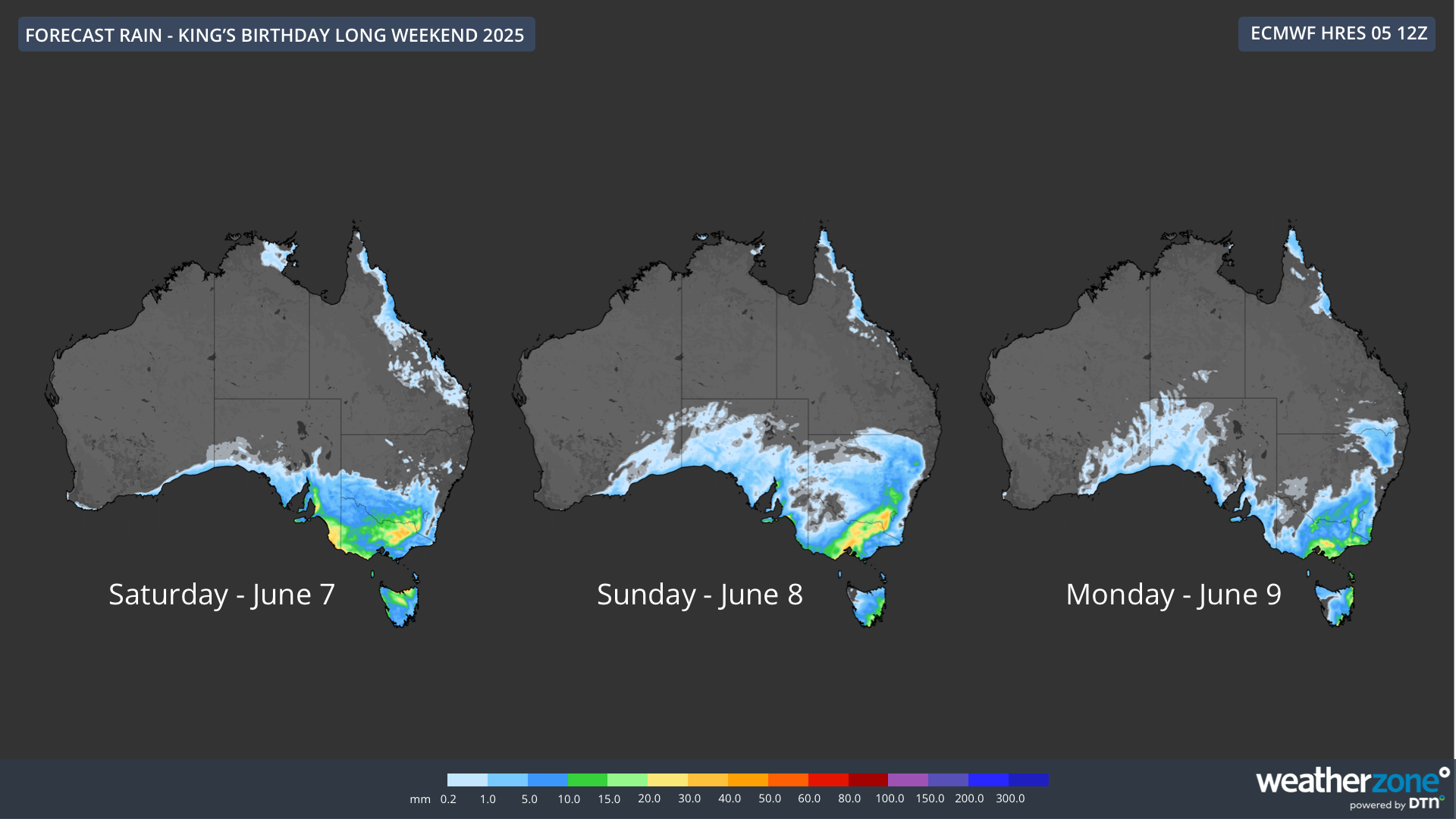
Image: Forecast daily rainfall over the King’s Birthday long weekend.
This weekend’s rain will also be accompanied by a burst of cold and windy weather:
- Maximum temperatures are only forecast to reach 12 to 13°C in Adelaide and Melbourne on Sunday, but it will be feeling much colder than this due to cloud, rain and wind.
- The feels like temperature in Canberra will struggle to get above 2°C for most of the long weekend.
- Most of Sunday and Monday will feel colder than 10°C in Sydney as chilly westerly winds buffet the city.
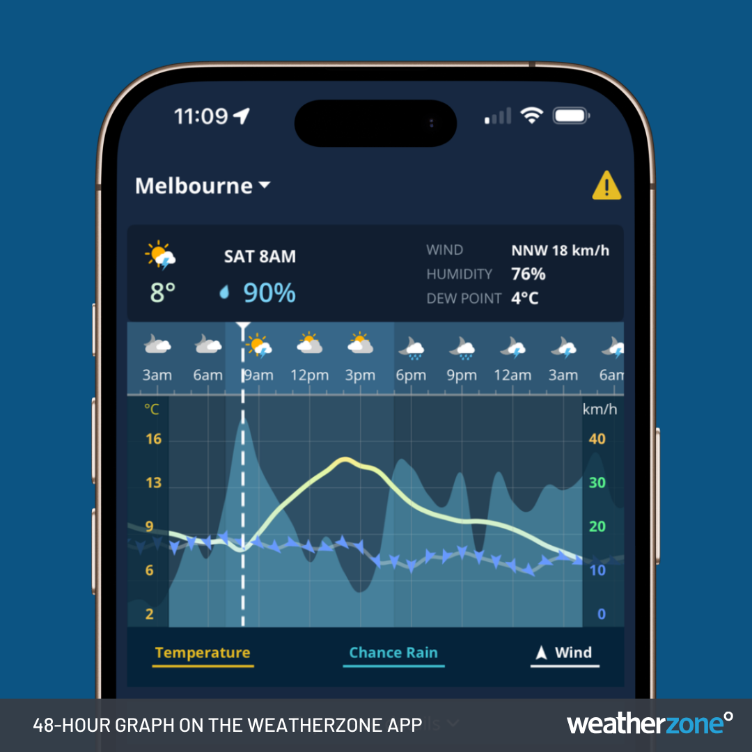
Image: 48-hour forecast graph for Melbourne on the Weatherzone app.
One big feature of the long weekend cold snap will be heavy and low-level snow. The persistent nature of this system will allow snow to fall in the mainland alpine region from Saturday until at least Tuesday next week.
This system will deliver enough natural snow to kick-start the ski season in NSW and Vic, which officially starts at most ski resorts this weekend. Tasmania’s highlands will also get snow over the long weekend, and we should also see snow settling outside the alps in Vic, NSW and the ACT.
Drier and warmer in the west and north
There won’t be much noteworthy weather outside of southeastern Australia during the weekend.
People in Central Australia will notice a drop in temperatures as colder and drier air moves up from the south. Minimum temperatures at Alice Springs could dip to about 4°C on Sunday and Monday mornings, although days will be clear across the Interior.
A few showers will affect parts of eastern Qld and southern WA, mainly on Saturday, although most of both states will be dry over the weekend.
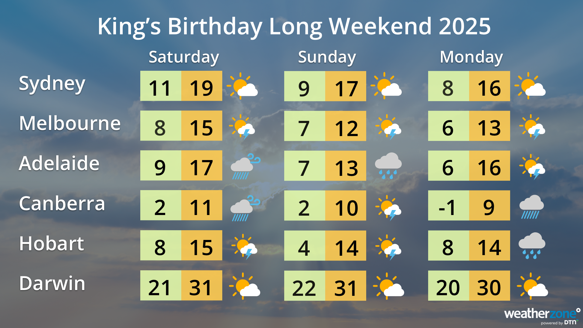
Image: Capital city forecasts for the King’s Birthday long weekend.
Be safe this long weekend
The cold, wet and windy weather impacting southeastern Australia over the long weekend will cause hazardous conditions in some areas, particularly in the mountains where temperatures will be cold enough to cause ice and snow. Damaging winds will also be a threat in some areas.
Be sure to check the latest weather warnings and road conditions before heading out this long weekend.