
Wintry weather on the way for southeast Australia
Although it will be hot across much of the continent, it will be cool and cloudy over the southeast this week becoming showery and windy later in the week. After reaching 34.2°C yesterday, Melbourne won’t see a day reach 25°C during this week. Friday 3rd will be the coldest day, not even reaching 20°C.
Why will Friday be so cool? A cold pool of air about 5-6 km above the surface will drift from near Antarctica towards Tasmania. This will help to develop a low-pressure system at the surface with a cold front.
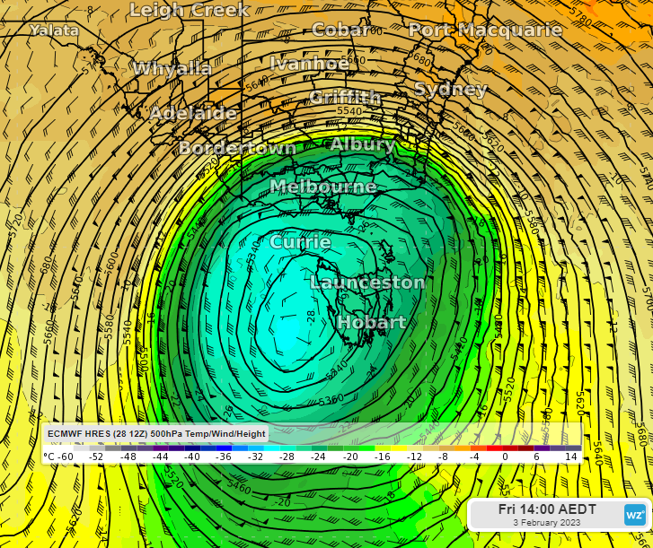
Image: Cold pool of air at about 5-6km above the surface (500hPa) according to the ECMWF model.
The cold front should cross southeast Australia on Thursday into Friday, dragging up cold air from the south during Friday. Together with cloud cover and cooling showers and thunderstorms, this will make Friday as much as 10-15°C cooler than average across a large area as shown in the purple and pink shading below. There may even be a dusting of snow over the Victorian and NSW alps and Tasmania’s highlands.
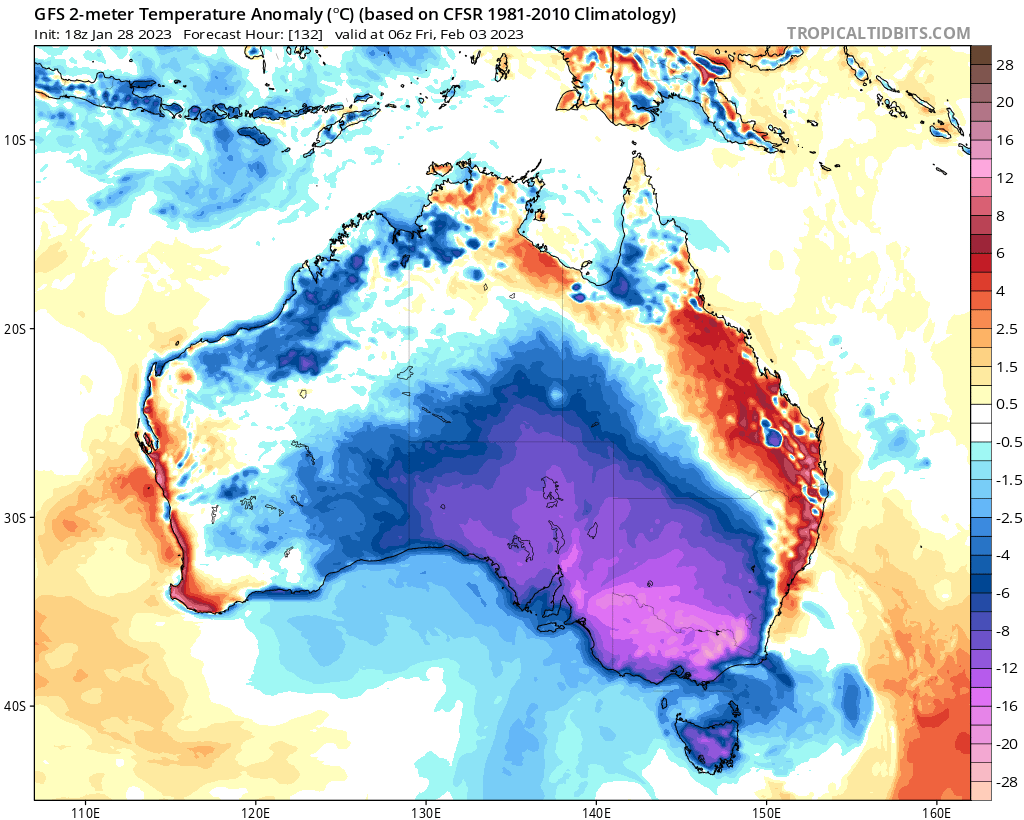
Image: Surface temperature difference from average at 5pm AEST Friday 3rd according to the GFS model. Source: tropicaltidbits.com
The low-pressure system will also cause gusty winds from the west and southwest to howl across southeast SA, Vic and over the NSW ranges on Friday, possibly reaching 80-90km/h over the NSW ranges. The wind chill factor will also make it feel several degrees colder than the actual temperature.
There’s an interesting comparison for Melbourne this week with a week in January 100 years ago. The Bureau of Meteorology’s records show that January 14, 1923, reached a sweltering 38.2°C but January 18, 1923, struggled to a chilly 14.6°C (the lowest maximum January temperature record). According to a news story from the Argus on 19 January 1923: “Seldom have the vagaries of Melbourne weather been more pronounced than during the last few days.” They went on to say that people “shivered in overcoats and sought shelter from the driving rain and cold winds which made conditions out of doors unpleasant.” According to the Bureau of Meteorology at the time, the mid-summer cold snap was due to “a very deep atmospheric depression over the south-eastern part of the continent.” Which is the same kind of weather system that will cause this week’s cold snap.
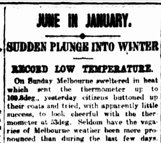
Image: News story from the Argus (Melbourne) Friday 19 January 1923. Source: trove.nla.gov.au.
Although the temperatures in the southeast this week won’t be as uncomfortable as those in January 1923, the vagaries of the weather there will be on display and people might just wonder where summer went. However, it will be a different story further north across northeast NSW and eastern QLD as the low and an associated trough bring hot, dry, and windy conditions. So, wherever you are, stay up to date with the latest forecasts at Weatherzone.