
Winter-like cold blast headed for Australia
While this weekend, conditions are rather warm (or hot) and humid across most of Australia, a powerful cold front is on its way that will send chills over much of the south, and even some parts of the north.
Right across the country this weekend, temperatures are fairly typical or hotter than is expected for January. Furthermore, humidity is quite high across the east and north of the country, thanks to several troughs, one being the monsoon trough.
In fact, the only location that isn’t quite so humid, is southern/western parts of WA, where the low humidity is offset by the mercury climbing into the high thirties and forties.
But a lot of that will change this week as a powerful cold front sweeps over the country.
Southern WA will be the first to feel the chill, as it clips the south early on Monday morning. While this is where the front will have the least effect, it will help push the hot airmass over the region further north, with the monsoon then taking over to cool the airmass itself down during the week.
South Australia will be next from Tuesday morning, pushing away some of the humidity and warmth over the last few days. Adelaide is forecast to reach 34°C on Monday, but only 25°C on Tuesday and 23°C on Wednesday.
Victoria and Tasmania will soon follow on Tuesday afternoon, where the change will be pretty gusty and abrupt. After a summery top of 27°C in Hobart on Tuesday, the front could cool the city by 8-12 degrees in the first hour as it blows over in the late afternoon/early evening. The cold air and showers left in its wake may mean that some of the Tasmanian highlands receive a light dusting of summer snow on Wednesday morning.
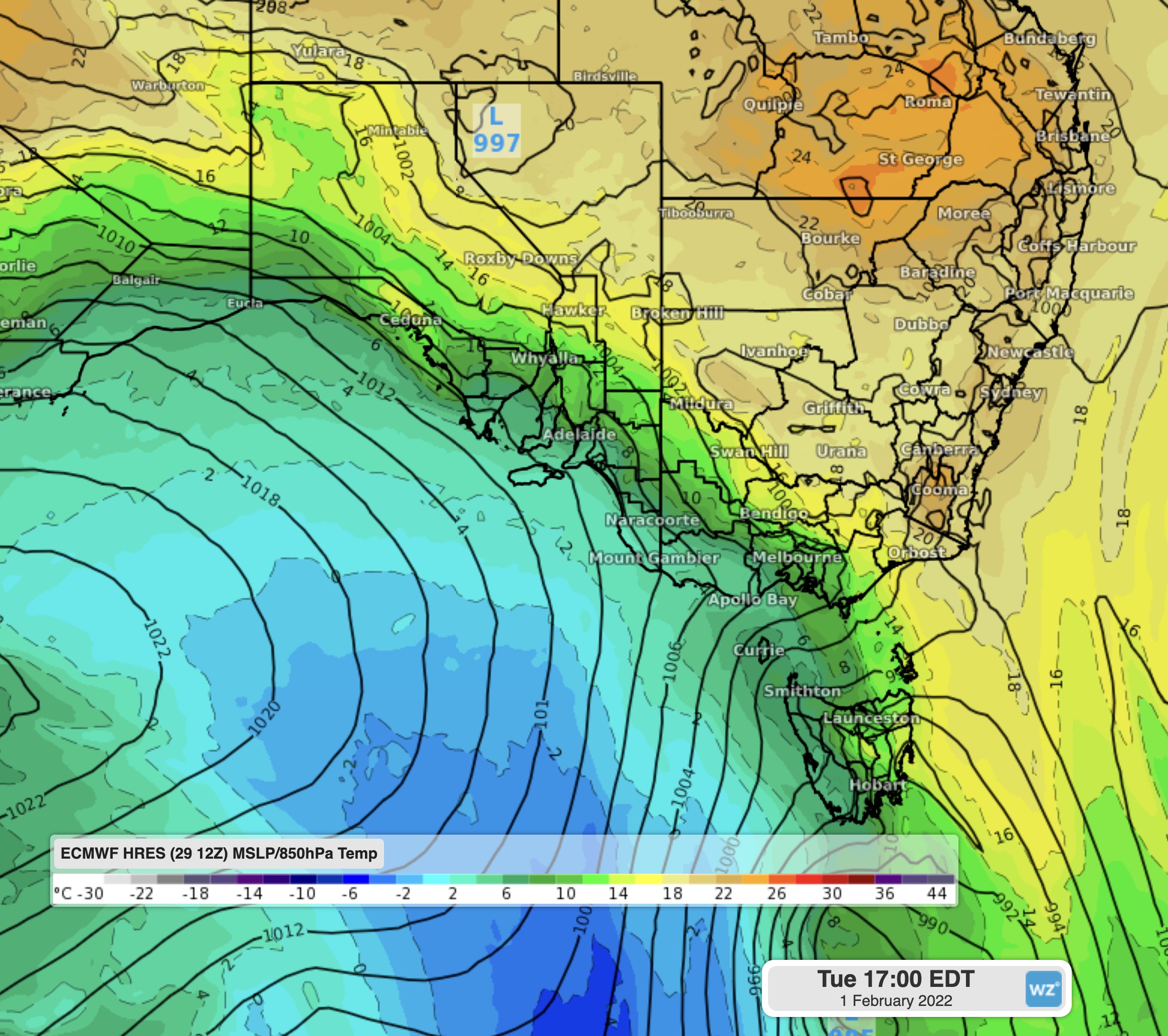
Image: 850hPa temperatures and MSLP showing the cold front pushing out the warm air on Tuesday
On Wednesday, the front will start to push up the NSW coast, likely becoming a ‘southerly buster’, bringing a sharp drop in temperature and humidity as it rolls through.
However the truly unusual aspect of this front will be from Thursday when the front reaches Queensland. It is quite rare for a cold front to reach into the Sunshine state during summer, let alone send a southeasterly surge that moves all the way up the coast to reach Townsville and Cairns by next Saturday. Most of the cold fronts in autumn and spring can’t manage to do this, and still not all accomplish this in the heart of winter.
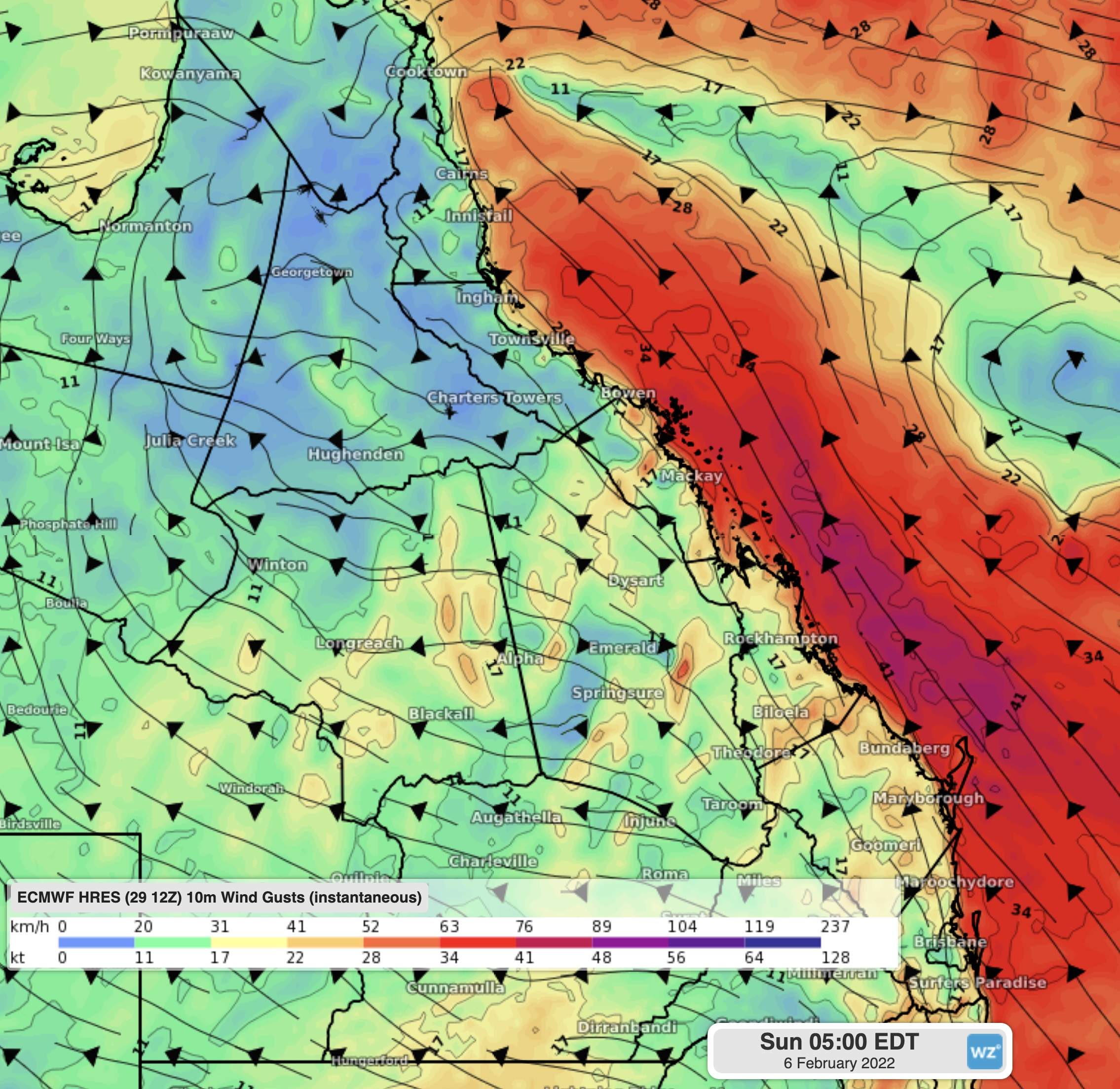
Image: Wind gusts over the Qld coast showing the cold front making it all the way north to Cairns
The front will help keep temperatures a bit cooler and the humidity a fair bit lower for several days following, before they both start to slowly rise next week.