
Winter to return with a pair of cold fronts
Winter retreated during July with record warmth and very dry conditions across large parts of eastern Victoria, Tasmania and southeast NSW, including alpine areas. This led snow depths to plummet, backing up rhetoric from snow lovers that this is the worst August in terms of snow for many years. Snowy Hydro records from Spencers Creek show that snow levels in August have not dipped so low since 2006, with low years also in 2010 and 2020.
However, the unseasonable spring-in-winter is about to turn, like a slidy spring skier.
Upper winds that help steer cold fronts have been sitting decidedly south of eastern Australia over recent weeks but are about to push north once more. Cold fronts during July were largely steered over WA and New Zealand, consistently dipping south when moving towards eastern states and taking any snow with them.
That is in the process of changing.
A cold front skimmed Tasmania this morning and cold air behind that front is going to slowly slide north on Sunday and Monday, allowing temperatures in the eastern capitals to drop below average and also allow some welcome snow showers to persist in alpine areas. The linking up of cold air with moisture from the east means that this system is going to favour snow and rain over eastern NSW as shown in the figure below. Snow falls of the order of 10cm can be expected for NSW resorts over the coming 48 to 60 hours.
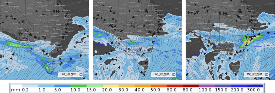
Image: GFS model imagery showing cold front sliding north between Saturday and Monday afternoons, pushing cold air over the south and with rainfall (shown as 24 hour accumulations) concentrated over NSW.
Then a strong cold front is due to be steered over southeast Australia around Thursday. With temperatures in the area already cool, snow potential is maximised. In addition, a second cold front forecast for Friday provides an ideal set-up for a good snow dump, with the second front's moisture over-cutting the first front's cold air.
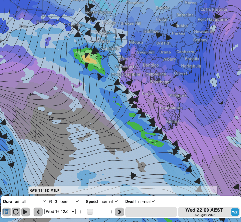
Image: Loop showing a pair of cold fronts and associated 6-hrly rainfall amounts Thursday 17th, Friday 18th and Saturday 19th August this week.
Snow amounts look like tipping half a metre for the event, heaviest on Thursday and Friday afternoons. The 7-day meteogram forecast for Hotham Heights shows rainfall probability and below zero temperatures coinciding on these days and precipitation amounts in the loop above will be missing local highs produced by topography as winds surge up over mountains and enhance rainfall/snow. As ever, snow forecasts 5 days out are a slippery beast and after a number of false alarms of late where snow forecasts have petered out as fronts weakened on approach, we'll be watching this system closely.
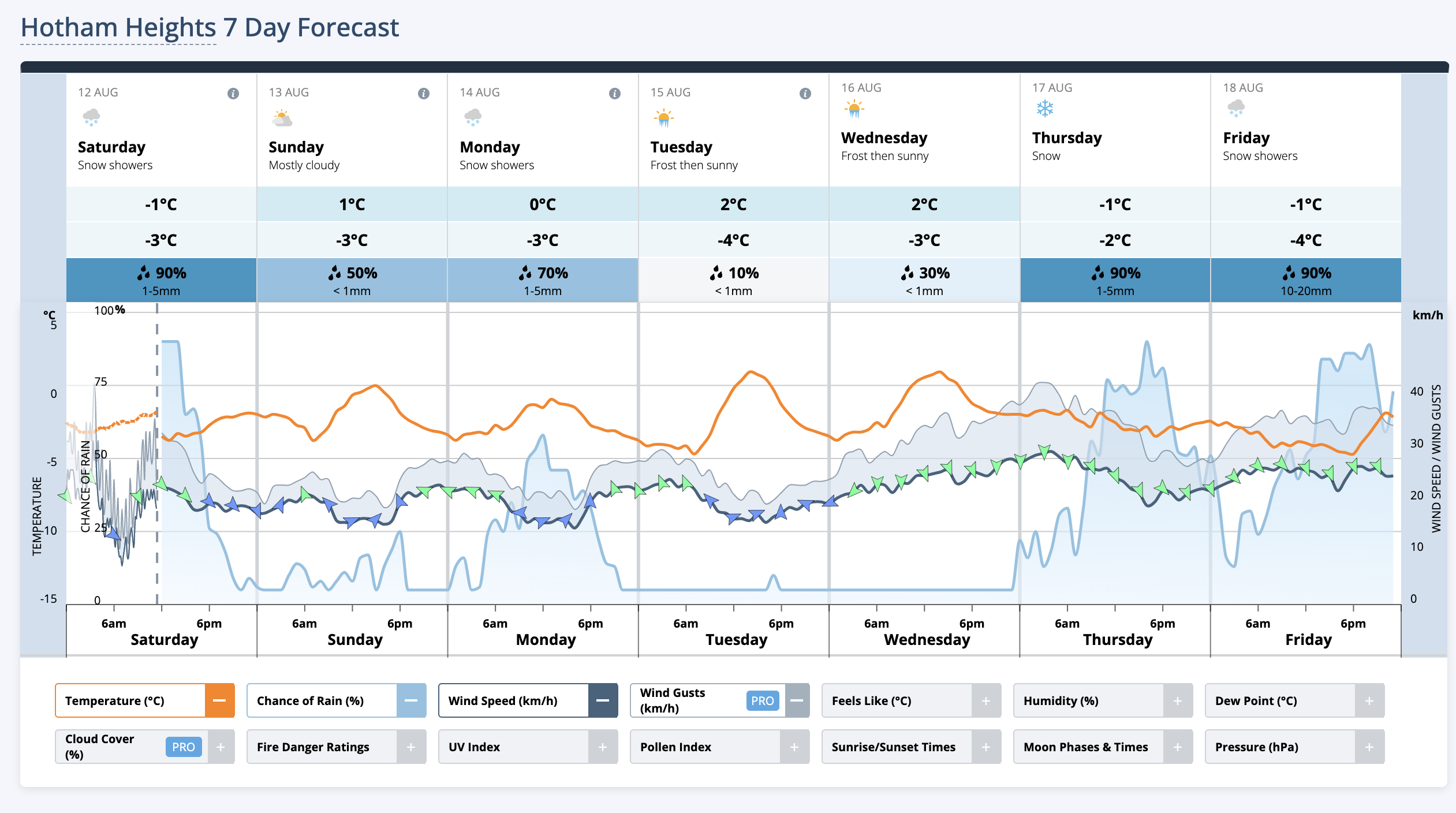
Image: Forecast meteogram for the next 7 days for Hotham Heights from weatherzone.com