
Winter bites Melbourne, with Thursday 'feels like' temperatures below 10°C all day
Wet, wintry weather has arrived in Melbourne, with showers and strong winds on the menu for Wednesday, and especially Thursday, as a cold front surges across Victoria.
Thursday should be one of Melbourne’s wettest and coldest days of 2026 to date, as the low pressure system currently centred over waters just south of western Victoria pushes cold, moist air across the state.
How wet will Melbourne be?
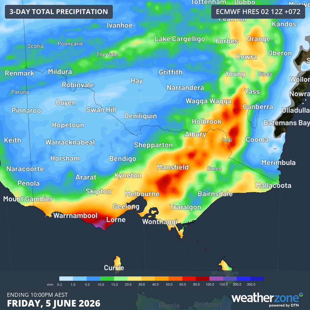
Image: Accumulated rainfall in Victoria and nearby areas up uintil 10pm (AEST) on Friday, June 5, 2026, according to the ECMWF model. Source: Weatherzone.
While only a few showers are expected this Wednesday, Thursday’s predicted rainfall range in Melbourne is 10 to 30mm, meaning it could potentially be the city’s wettest day so far this year.
Melbourne’s wettest day of the year to date was March 27, with 19 mm. A similar total on Thursday would be welcomed by most locals, as Melbourne accumulated only two-thirds of its average running rainfall total over the first five months of 2026.
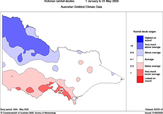
Image: Rainfall deciles across Victoria for the first five months of 2026, showing deficiencies in the south and southwest of the state, including around Melbourne. Source: BoM.
Elsewhere in Victoria, the heaviest falls on both Wednesday and Thursday will likely be in the high country, with precipitation falling as snow down to 1300 metres above sea level this Wednesday and 1100 m on Thursday.
Numerous high country locations have already seen heavy rain this week, with Mt Buffalo Chalet recording the state’s highest rainfall total in the 24 hours to 9am Wednesday, with 78.2mm.
But as mentioned, that rain will start to turn to snow up high, which is good news for the official opening of the 2026 ski season this coming long weekend.
How cold will Melbourne be?
On Thursday, Melbourne is heading for a top of just 14°C, which would be the first day this winter when the maximum is below the long-term June average of 14.1°C.
The city’s coldest day to date in 2026 was May 7, when a strong autumn cold front kept the maximum to exactly 14.0°C.
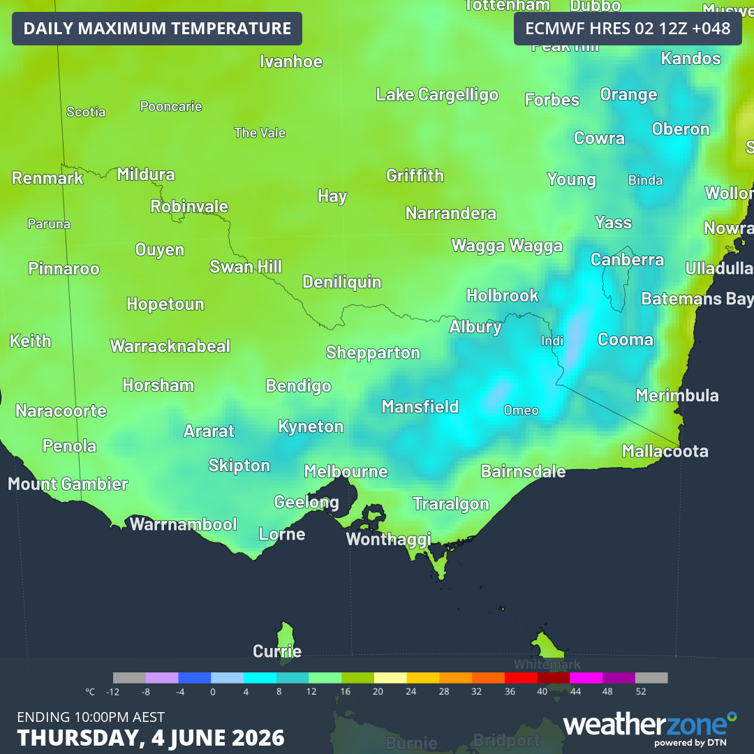
Image: Essentially the whole state of Victoria will see maximums of 15°C or lower on Thursday, June 4, 2026, according to the ECMWF model. Source: Weatherzone.
But Thursday will likely feel considerably colder than 14°C due to strong northwesterly winds which will turn southwesterly in the afternoon. The apparent or "feels like" temperature should fluctuate between just 7°C and 9°C during daylight hours.
After an unseasonably warm May when Melbourne’s minimums were 2.4°C above average and maximums were 1.9°C above average, not too many Melbourne folk will have reason to complain when winter starts feeling like winter.
But the chilly spell will only be brief, with relatively mild maxiumums in the mid-to-high teens expected for the weekend and skies clearing after a possible shower or two on Saturday morning.