
Winter bites back over SA
Warmth associated with a trough is being channelled away from South Australia this afternoon, but the real cold air will not arrive until tomorrow.
A cold front will bring gusty winds, thick cloud, rain and showers over southern parts of South Australia on Sunday.
Damaging winds are possible over Kangaroo Island and the coastline between Cape Jervis and Cape Jaffa. Blustery winds will affect other coastal areas between Coffin Bay and Cape Buffon, whilst also extending well inland. The strongest winds are expected between around dawn and the late afternoon on Sunday.
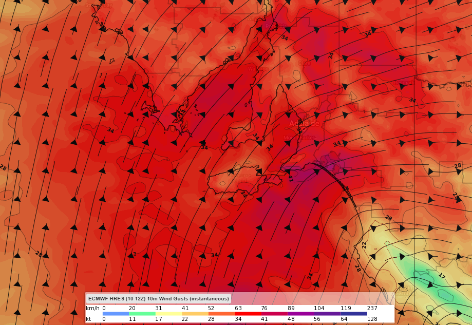
Image: Forecast near-surface wind gusts on Sunday afternoon according to ECMWF.
The heaviest rainfall should be confined to the Mount Lofty Ranges and Lower South East, where 10-15mm is possible on Sunday.
Daytime temperatures will peak around 6-10 degrees below average across much of the state for the middle of September. Maximum temperatures are not expected to even reach double digits in Mount Lofty and Mount Crawford.
Cold air will linger into early next week, but the warmth will return by Thursday.