
Winter arrives in Western Australia

A strong cold front is crossing southwest Western Australia, bringing gales, rain, storms, and the potential for snow on the Stirling Ranges tonight.
While the southeast endured an unusually prolonged cold outbreak during the second week of June, the southwest has largely been warmer than average—the exception a brief cool spell Monday 7th and Tuesday 8th. A strong cold front is now crossing the southwest, bringing gales, rain, and much cooler temperatures.
Cape Leeuwin has been gusting over 90 km/h this morning, peaking at 102 km/h around dawn, and around 15mm of rain has fallen over South West, South Coastal and southern parts of Great Southern. Temperatures will remain in the low-to-mid teens for Monday, about 4 degrees below previous days. As cold post-frontal air sweeps over the region, Monday night will see the freezing level drop to around 1200m, bringing the potential for a few snow flakes about the Stirling Ranges.
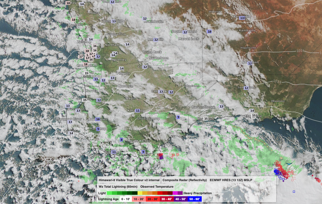
Image: Satellite imagery and temperature observations showing cold air surging over southwest WA behind a cold front, Monday 14th June, 2021.
The typical post-frontal high pressure system will then move in, bringing the potential for frost late in the week. The high will also slingshot cold northwards, with even the Kimberley seeing temperatures drop 3-4 degrees late in the week.
Next weekend is getting a long way out for forecasts, but indications are firming for another vigorous low and cold front. This system looks to encroach further northwards, bringing 20-30 mm of rain over the southwest and more gale-force southwesterlies.
All what one would expect in a southwest WA winter.