
Winter about to hit back in southeastern Australia
One of the strongest cold outbreaks of the year will hit southeastern Australia later this week, bringing rain, thunderstorms, damaging winds, low level snow, icy temperatures, and possibly a dangerous squall line.
Australia just experienced its warmest winter on record thanks to a noticeable lack of strong cold fronts over southern Australia. However, winterlike weather is about to make a comeback in the opening fortnight of spring.
The satellite image below shows a region of speckled clouds to the southwest of Australia, highlighting a large cold air mass moving over the Indian Ocean towards Australia.
.gif)
This frigid air will pass over southern WA on Wednesday, before spreading over SA on Thursday and southeastern Australia from Thursday into Friday.
The images below show forecast air temperatures around 1.5km above sea level on Wednesday and Friday, revealing how warm spring-like air in the middle of the week will be replaced with a much colder wintry air mass by Friday.

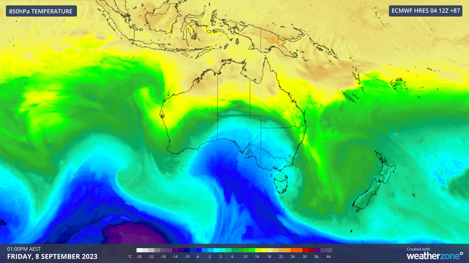
Images: Forecast 850 hPa temperature at 1pm AEST on Wednesday and Friday this week, according to the ECMWF-HRES model.
The approaching cold air mass and its interaction with much warmer air sitting over the Australian continent will produce a dynamic mix of weather:
- Showers will develop over parts of southern WA, SA, Vic, TAS, the ACT, NSW and southern Qld between now and Saturday, spreading from west to east as the week unfolds
- Thunderstorms are likely to affect parts of SA, NSW, Vic and Qld on Thursday and Friday. A few storms are also possible in parts of the ACT and Tas
- Some storms could become severe, with damaging winds and large hail the most likely threat
- A squall line may develop over western NSW on Thursday as the front passes over the state. If this does form, it will increase the risk of damaging winds and lightning as it moves from west to east.
- Blustery winds will accompany the passage of the front, with damaging gusts possible in parts of Tas, Vic and NSW, most likely about elevated terrain
- Increased wind and warm air ahead of the front will briefly increase fire danger ratings in parts of central and eastern Australia
- Low temperatures will pose a threat to livestock in parts of southern and southeastern Australia in the wake of the front
- Snow should settle in Tas, Vic and NSW, with low-level snow a good chance in Tas, Vic and southern NSW. Snow may also reach central NSW on Friday or Saturday.
Warnings are likely to be issued for this system later in the week. Be sure to stay up to date with the latest forecasts and warnings in your area for the most up-to-date information.