
Winter 2026 Australian bushfire outlook
Australia’s seasonal bushfire outlook for winter 2026 has been released by the Australian and New Zealand National Council for fire and emergency services (AFAC) and it predicts increased fire risk across the northern parts of Western Australia and a large area of central and northern New South Wales.
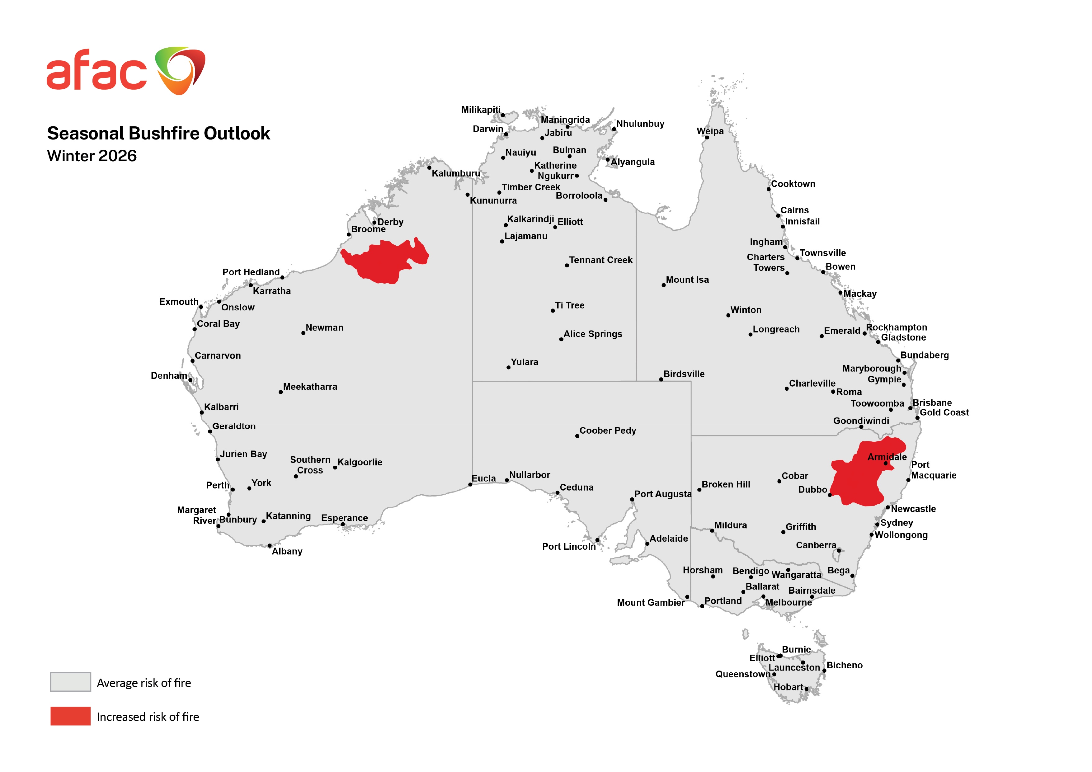
Image: Winter 2026 seasonal bushfire outlook. Source: AFAC
While winter is typically a quiet time for bushfires in the southern half of Australia, the middle of the year is peak season for fires in the country’s north. Fire risk typically shifts to northern Australia during the cooler months of the year as the region enters its dry season. This year however, the above-average risk extends further south than usual, reaching around 1,500 kilometres south of the traditional northern fire zone into the mid-latitudes of NSW.
Increased fire risk in NSW this winter
The northeast inland of NSW has seen some welcome rain in recent weeks. One weather system in late May delivered between 50 and 100 mm of rain to some areas in the space of a week, with some places recording more than 100 mm. This heavy rain caused road closures and left the ground visibly saturated.
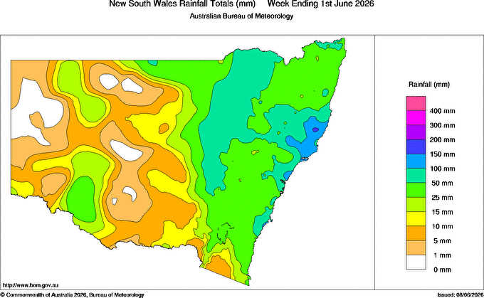
Image: Weekly rainfall map, week ending 1 June 2026, Source: Bureau of Meteorology.
While the recent rainfall increased soil moisture, slowed the curing of fine fuels and will likely dampen fire risk for the next month or so, it was not enough to replace the long-term rainfall deficiencies that have been building across the region in recent months.
Across the five months to May 2026, parts of the Northern Tablelands and Northwest Slopes and Plains districts recorded rainfall in lowest 10% of historical records. This is a rainfall deficit that will take more than one or two decent weather systems to undo.
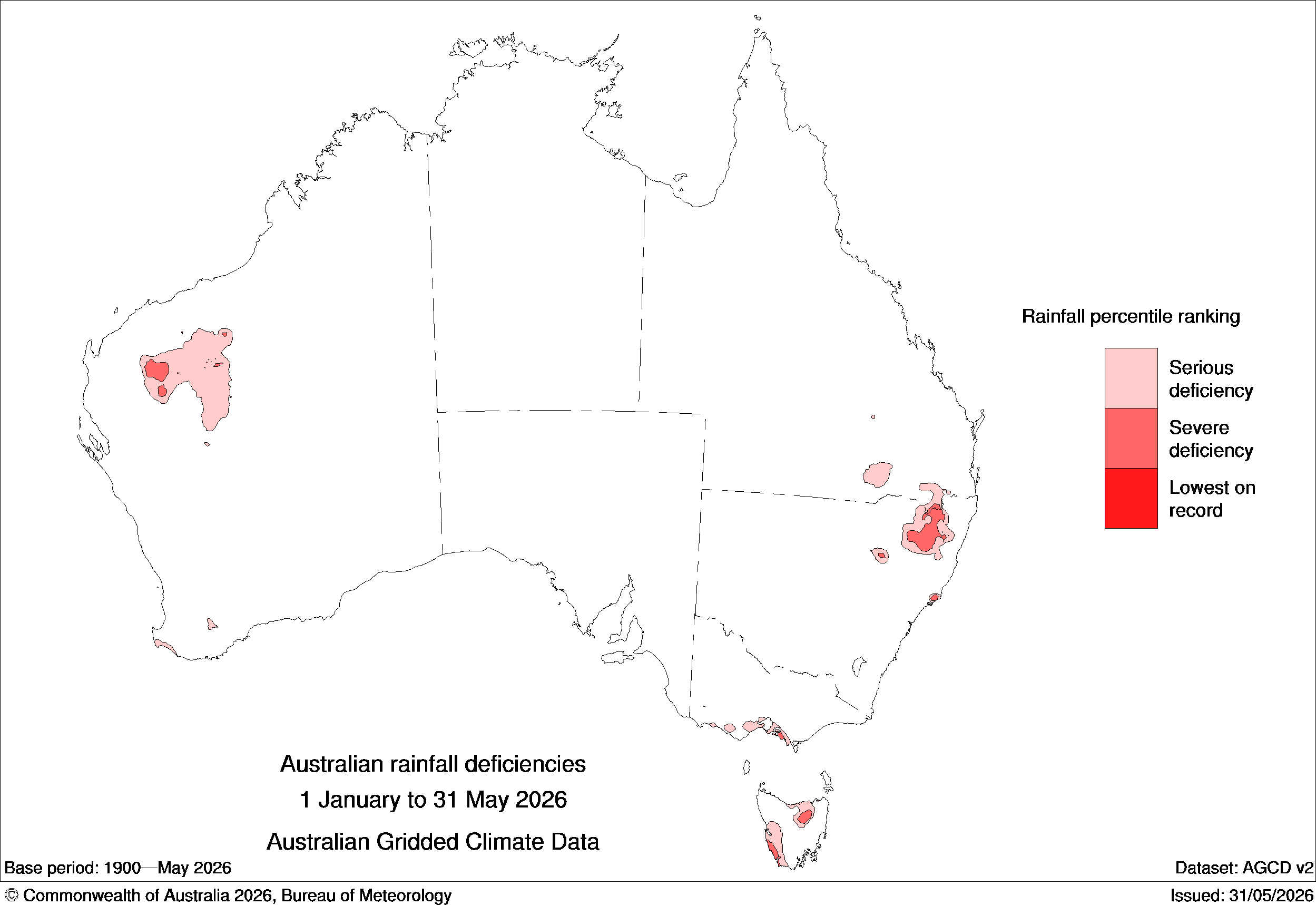
Image: Five-month rainfall deficiencies between January 1 and May 31, 2026. Source: Bureau of Meteorology.
Looking ahead, the outlook offers little relief. Warmer and drier-than-average conditions are forecast across much of eastern Australia through winter, with climate drivers shifting toward El Niño, which historically has amplified fire risk across much of Australia.
Above-average wet season rain fuels WA fire risk
On the other side of the continent, above-average wet season rainfall across the Kimberley and northern parts of the Great Sandy Desert has produced elevated bushfire fuel loads across the region. As the dry season progresses and conditions dry out, that fuel will cure rapidly, creating an increasingly elevated fire risk.
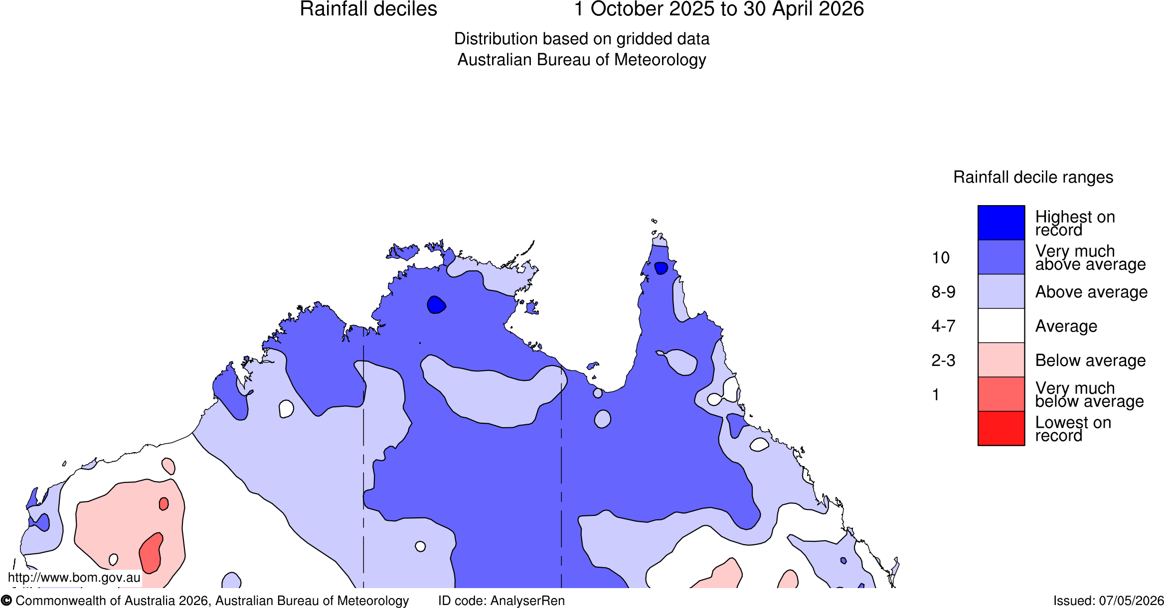
Image: Rainfall deciles between October 1, 2025, and April 30, 2026. Source: Bureau of Meteorology.
For parts of the Pilbara, Ex-Tropical Cyclones Mitchell and Narelle brought above-average wet season rain, but the region's sparse and discontinuous vegetation limits the fire risk compared to the Kimberley. While AFAC has assessed the region as carrying an average fire risk, dry, warm and windy conditions will still pose a significant threat.