
Wind, waves and rain focus on southeast NSW, eastern Victoria
A deep low-pressure system over the Tasman Sea is moving south, moving the focus of the most intense wind, waves and rain with it to southeastern NSW and eastern Victoria for the remainder of this weekend.
Severe Weather Warnings have been issued due to the risk of damage from the wind, waves and rain.
Wind is expected to be strongest in eastern Victoria where gusts could exceed 100km/h, most likely near the coast east from about Bairnsdale.
Waves are likely to be largest on the coast between about Eden and Orbost, potentially exceeding five metres high in the surf zone. Waves of this height have already been affecting the Sydney, Illawarra and South Coast, leading to significant erosion.
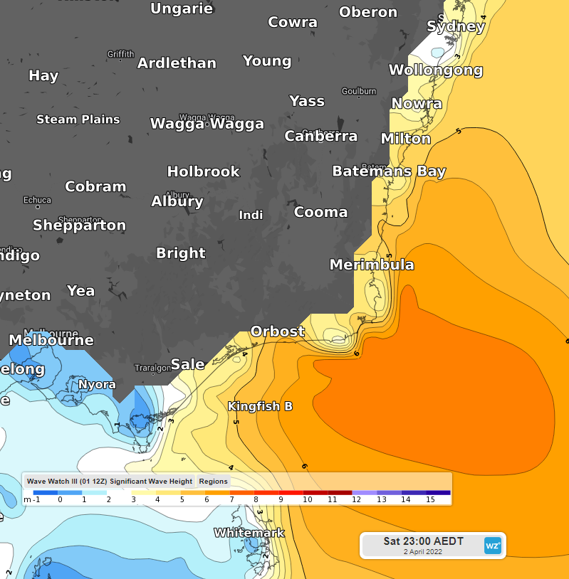
Possible significant wave heights for 11pm EDT Saturday 2nd April.
Rain should be heaviest between about Sale and Merimbula, likely receiving 100-to-200 millimetres and potentially more than 300mm. The wettest places are expected to be on the south-facing slopes in East Gippsland.
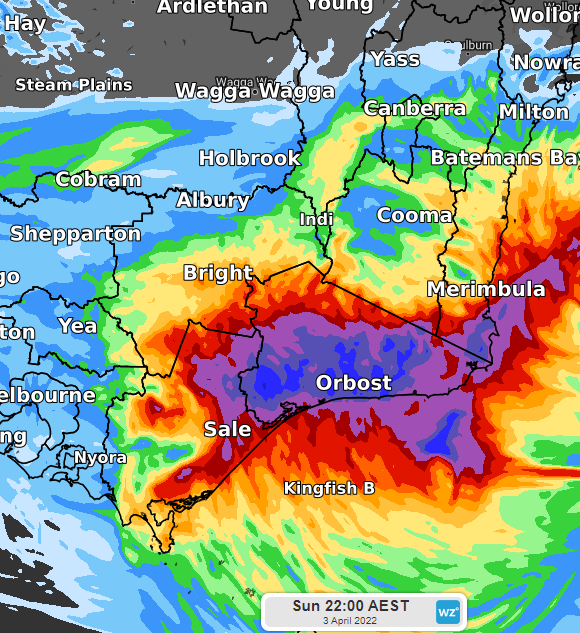
One scenario for rainfall accumulated in the 36 hours to 10pm EST Sunday 3rd April (Dark blue shade indicates more than 200mm).
From Sunday night, the offending low should begin moving southeastwards, away from Australia's southeast, causing rain, wind and waves to all ease.