
Wind chill sending shivers across southeastern Australia
A blast of polar air is forcing millions of Australians to rug up in the final days of autumn as icy winds cause severe wind chill across several states and territories.
A complex series of low pressure systems and cold fronts are currently causing a sustained surge of powerful winds over Australia’s southeastern states. These winds are combining with a cold air mass to create wintry conditions, with the lowest temperatures so far this year being exacerbated by wind chill.
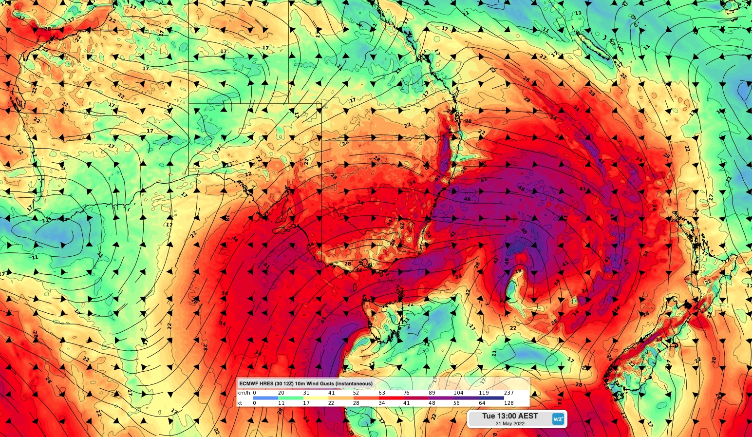
Image: Modelled wind gust speed and direction on Tuesday afternoon, according to the ECMWF-HRES model.
The term wind chill refers to the cooling effect wind has on the human body. It occurs when air that is cooler than our body’s temperature passes over exposed skin and causes heat loss. As wind speed increases, the heat lost through our skin also increases, which makes us feel colder.
So, while the air temperature being recorded by an outdoor weather station might be 20ºC, wind chill can make it feel like 10ºC.
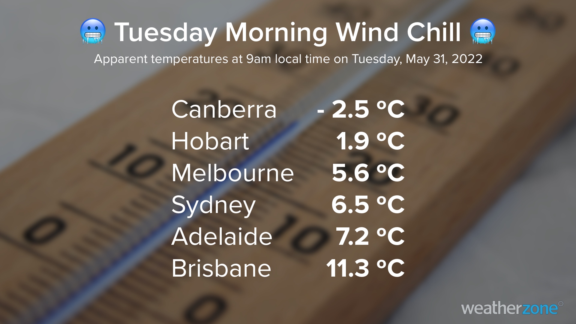
On Tuesday morning, temperatures in Australia’s southeastern capital cities were feeling about 4 to 8ºC colder thanks to wind chill. Some other areas had apparent temperatures that were more than 10ºC below the actual air temperature.
Wind chill will continue to cause bitterly cold apparent temperatures in parts of southeastern and eastern Australia on Tuesday and Wednesday. Severe weather warnings have also been issued for damaging wind gusts in some states and territories.