
Will a tropical cyclone hit Queensland next week?
There are growing concerns that a tropical cyclone could strike Queensland’s east coast next week. Here’s what we know about this developing system so far.
A tropical low, designated 05U, is currently developing over warm water in the Coral Sea, more than 1,000 km to the east northeast of Cairns.
Tropical Low 05U is in an environment that will allow it to gain strength over the next few days, likely becoming a tropical cyclone on Sunday or Monday. The system will be named Kirrily once it becomes a tropical cyclone, becoming the second cyclone named in the Australian region so far this season.
Most forecast models expect the system to move towards the south or southwest between Sunday and Tuesday, remaining well away from Australia’s east coast. However, the movement and strength of the tropical cyclone becomes less certain from Wednesday onwards.
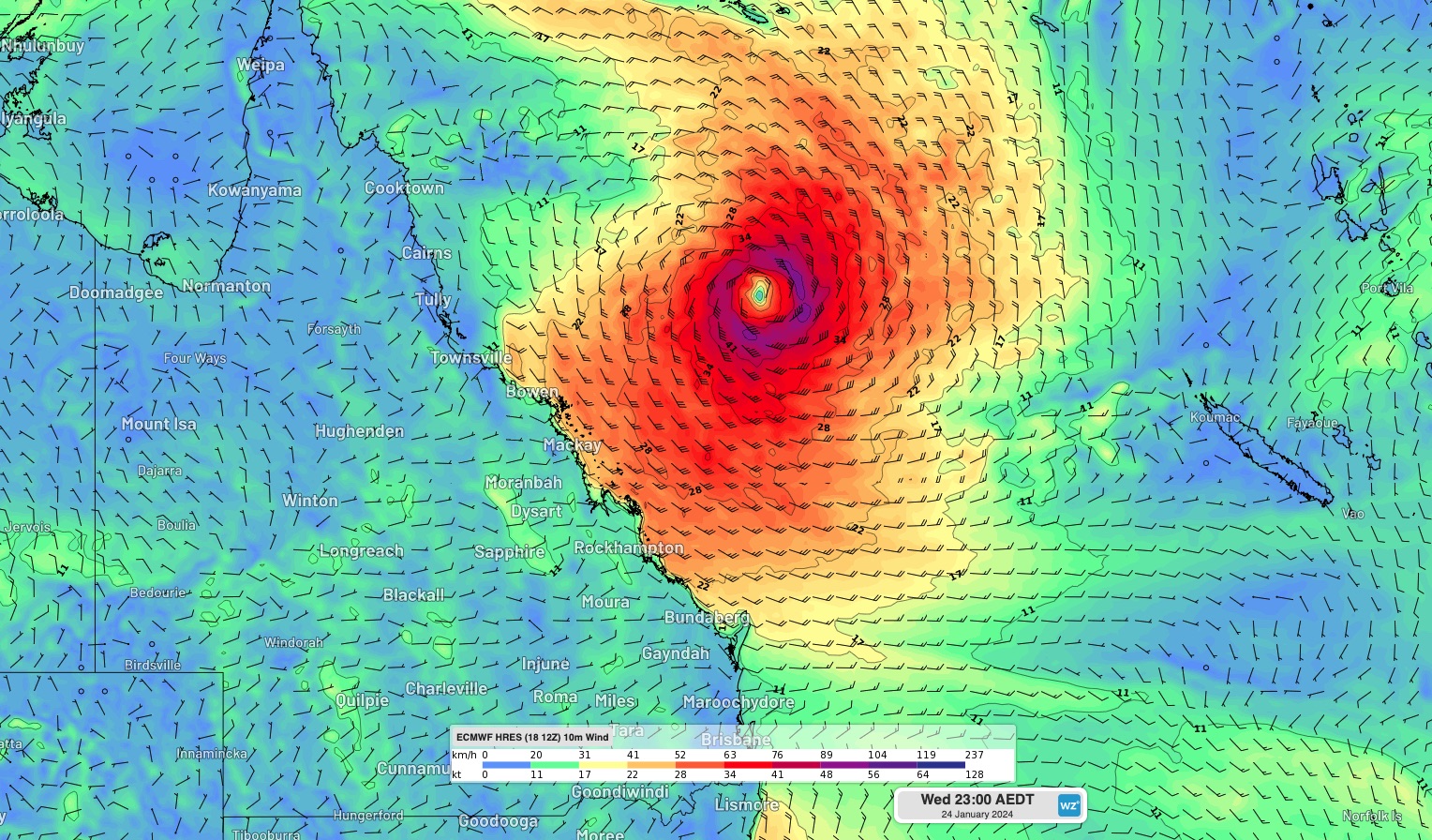

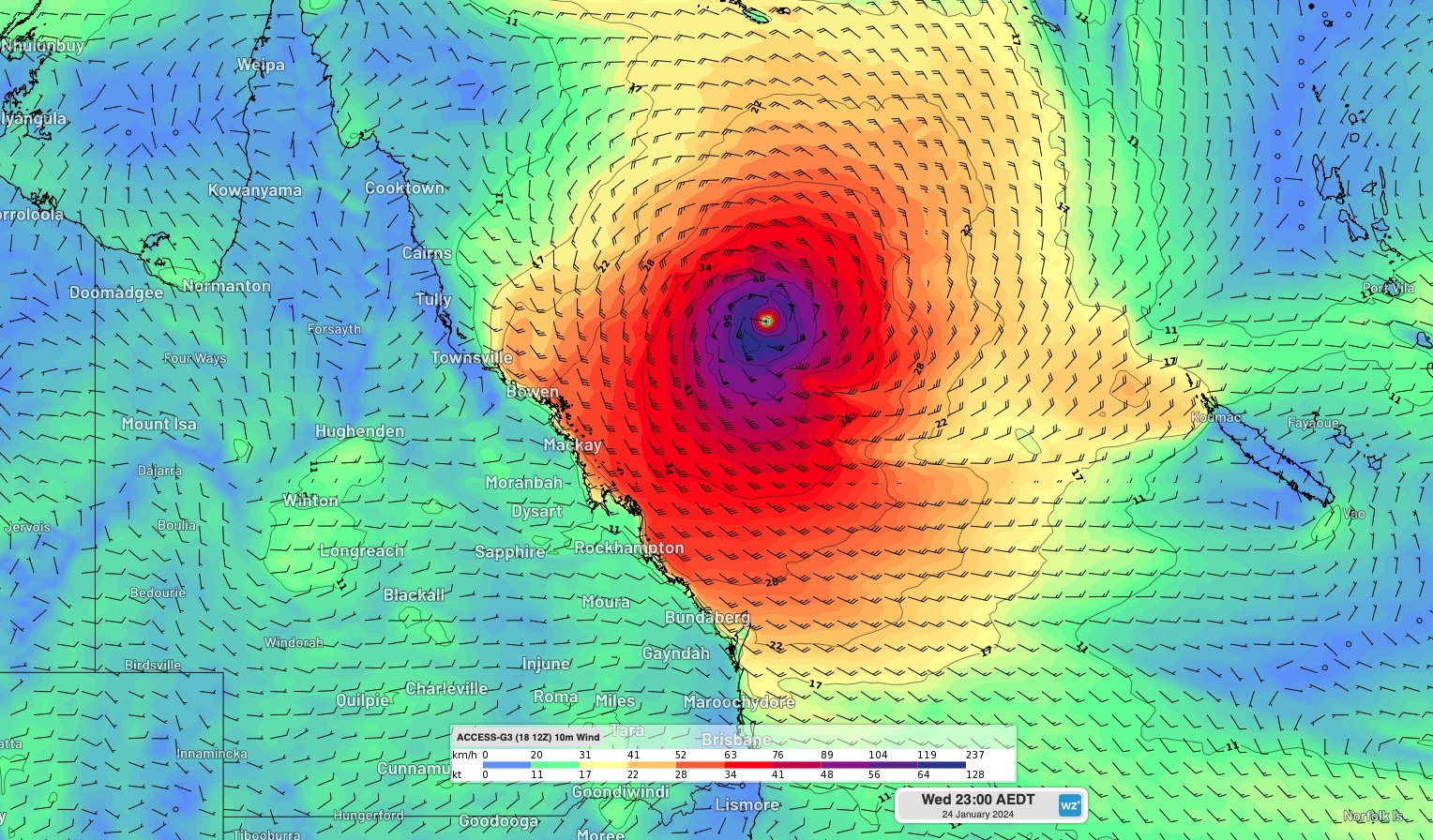
Images: Forecast 10m wind speed and direction at 11pm AEDT on Wednesday, January 24, from the ECMWF-HRES (top), GFS (middle) and ACCESS-G (bottom) models.
Some models predict the soon-to-be cyclone will track in a westerly direction towards the Qld coast from Wednesday or Thursday, while other models expect it to move in a southeasterly direction, taking it further away from Australia.
The large range of possible future tracks for the system means it’s too early to know whether it will actually reach Qld or not, although this scenario is certainly a risk.
The image below shows ‘ensemble’ forecast tracks for Tropical Low 05U, from one weather model. The colourful lines on the map show the range of possible future tracks this model is predicting for 05U, with each line representing a separate forecast track that is based on slightly different starting conditions.
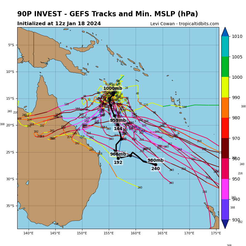
Image: Ensemble forecast tracks for Tropical Low 05U from the GEFS model. Source: TropicalTidbits.com
The wide spread of the lines on the map above highlights the high uncertainty regarding the future movement of this developing low pressure system. Roughly one third of the GEFS model’s ensemble forecast tracks cross the Qld coast, while the other two thirds remain offshore. This suggests that there is a 30-40% chance of Kirrily reaching the Qld coast and a 60-70% chance that it will remain offshore, according to this model.
Another ensemble model from the ECMWF also gives a roughly 40% chance of this system crossing the Qld coast late next week.
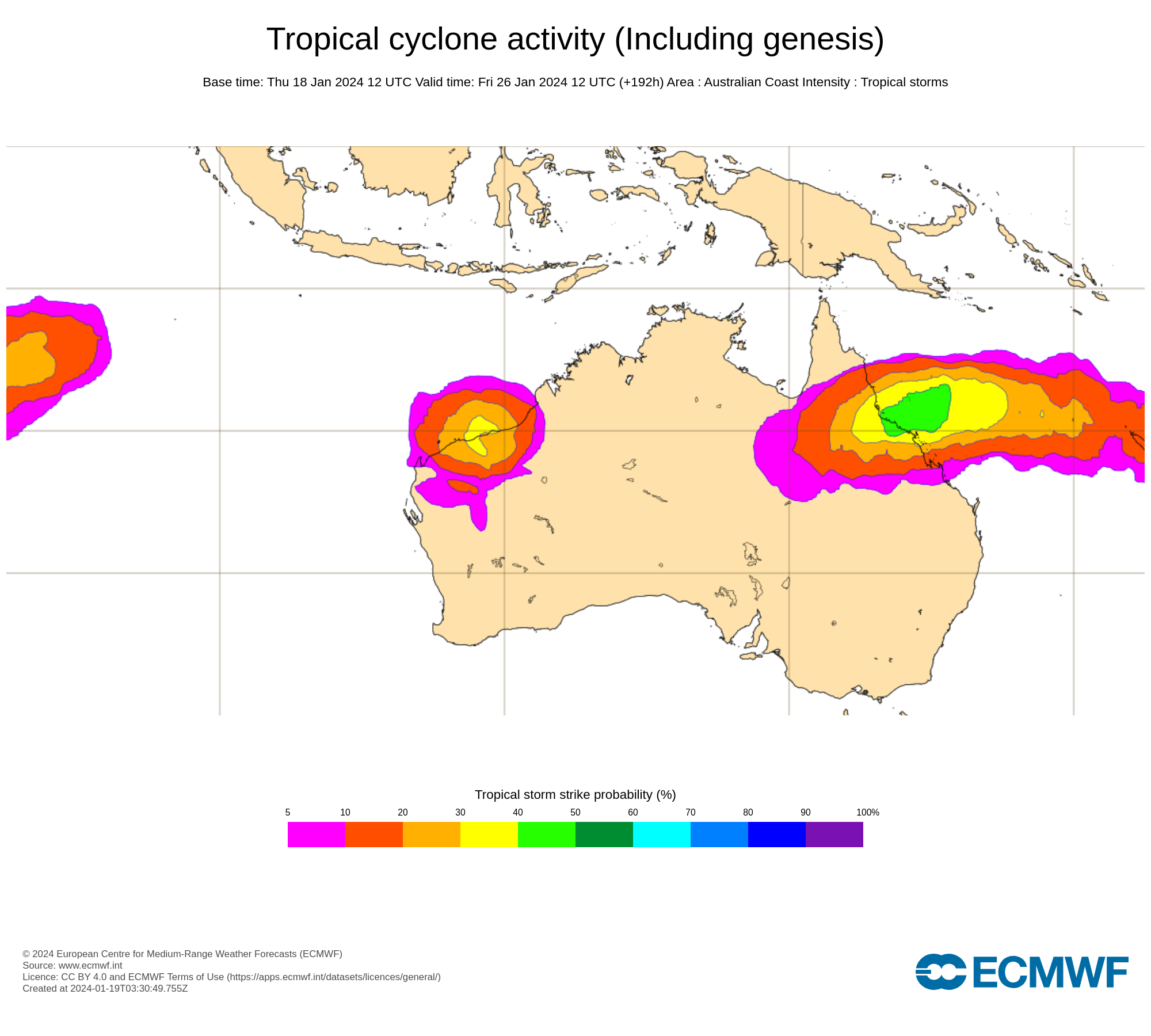
Image: Tropical cyclone strike probability from the ECMWF-ENS model for Friday, January 26, 2024. The strike probability is the probability that a tropical cyclone will pass within a 300 km radius from a given location and within a time window of 48 hours. Source: ECMWF
Forecasters will start to get a better idea of where this tropical low is heading as more data comes in during the next few days. At this stage, anyone living in eastern Qld should go over their tropical cyclone plan and keep an eye on the latest tropical cyclone outlooks over the coming week.