
Wild winds ease in Tasmania as low-pressure system heads east
Tasmania's recent streak of windy days is set to end today, as the system responsible for the gale-force winds tracks away from the state.
The low-pressure system made its last hurrah in TAS yesterday, with over 10 observation stations recording wind gusts exceeding 75km/h. Some noteworthy areas were Tasman Island (80km/h), Maria Island (93km/h), Kunanyi Mount Wellington (117km/h), Cape Grim (104km/h) and Swan Island (91km/h).
Parts of Victoria and New South Wales were also hit with these intense winds. Hogan Island (VIC) was smashed with 122km/h wind gusts, and NSW’s Perisher Valley recorded 82km/h. Even with winds weakening yesterday afternoon, wind gusts of over 50km/h were also felt by Tasmanian residents living further inland.
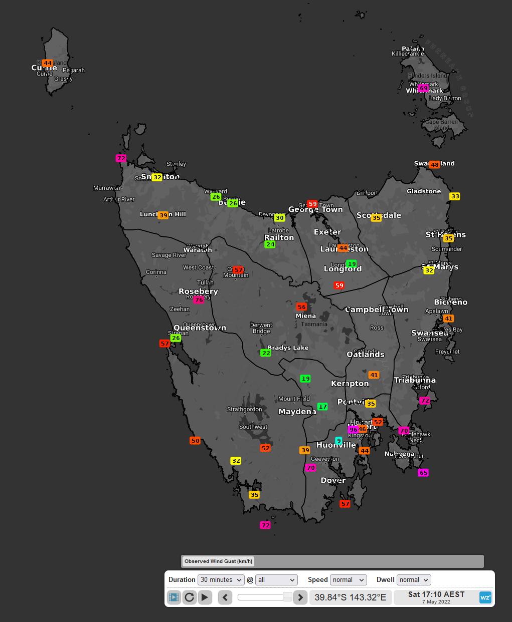
Figure 1: Observed wind gusts (km/h) over Tasmania on Saturday 7th at 17:10 AEST
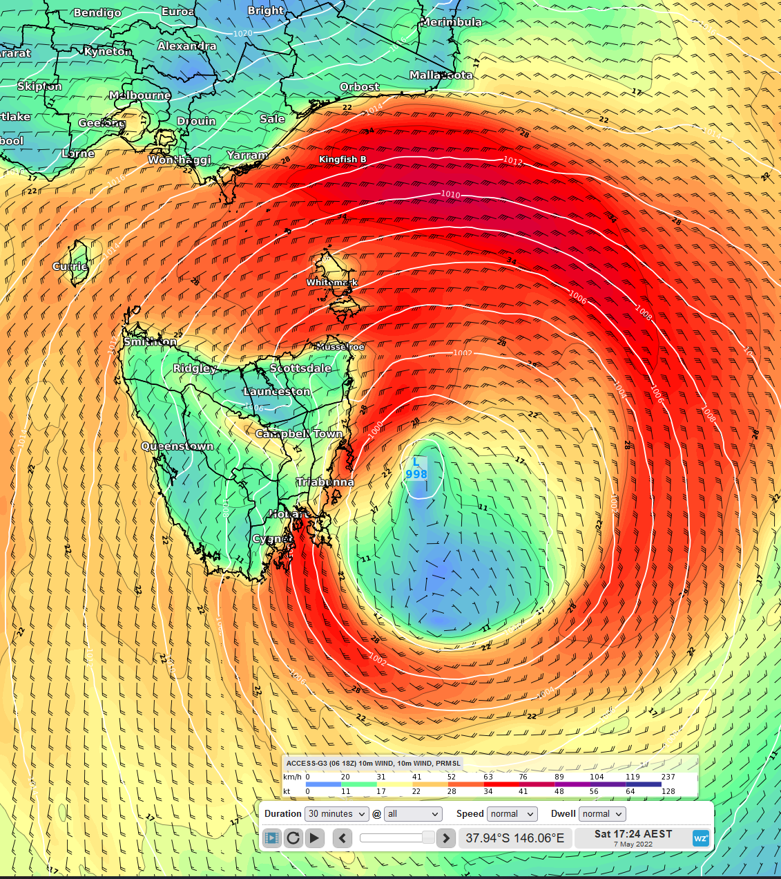
Figure 2: ACCESS-G 10m sustained winds and mean sea level pressure on Saturday 7th at 17:24 AEST
As if it wasn't cold enough, the brisk winds made it even more unpleasant, with windchill making temperatures feel over 6 degrees cooler than actual in many places. One such town was Hobart, feeling like 4.6°C when the mercury only measured 10.8°C. This large difference in the 'feels-like' and actual temperature will thankfully lessen over the coming days, as a high-pressure system eases winds and rainfall over the region.
.png)
Figure 3: Hobart temperature forecast, where the orange line is temperature (Celsius), and the brown line is feels-like temperature
Tasmania's east coast will continue to see strong winds today, although will continue to ease tonight as the low-pressure system weakens and shifts eastward. The Bureau of Meteorology still have marine wind warnings active in some districts so be sure to check them out here.