
Widespread severe weather in WA
A large severe weather system has impacted Western Australia, leaving a trail of damage and tens of thousands without power.
The remnants of Tropical Cyclone Mangga interacting with a strong cold front produced an explosive weather system off the west coast of Western Australia on the weekend.
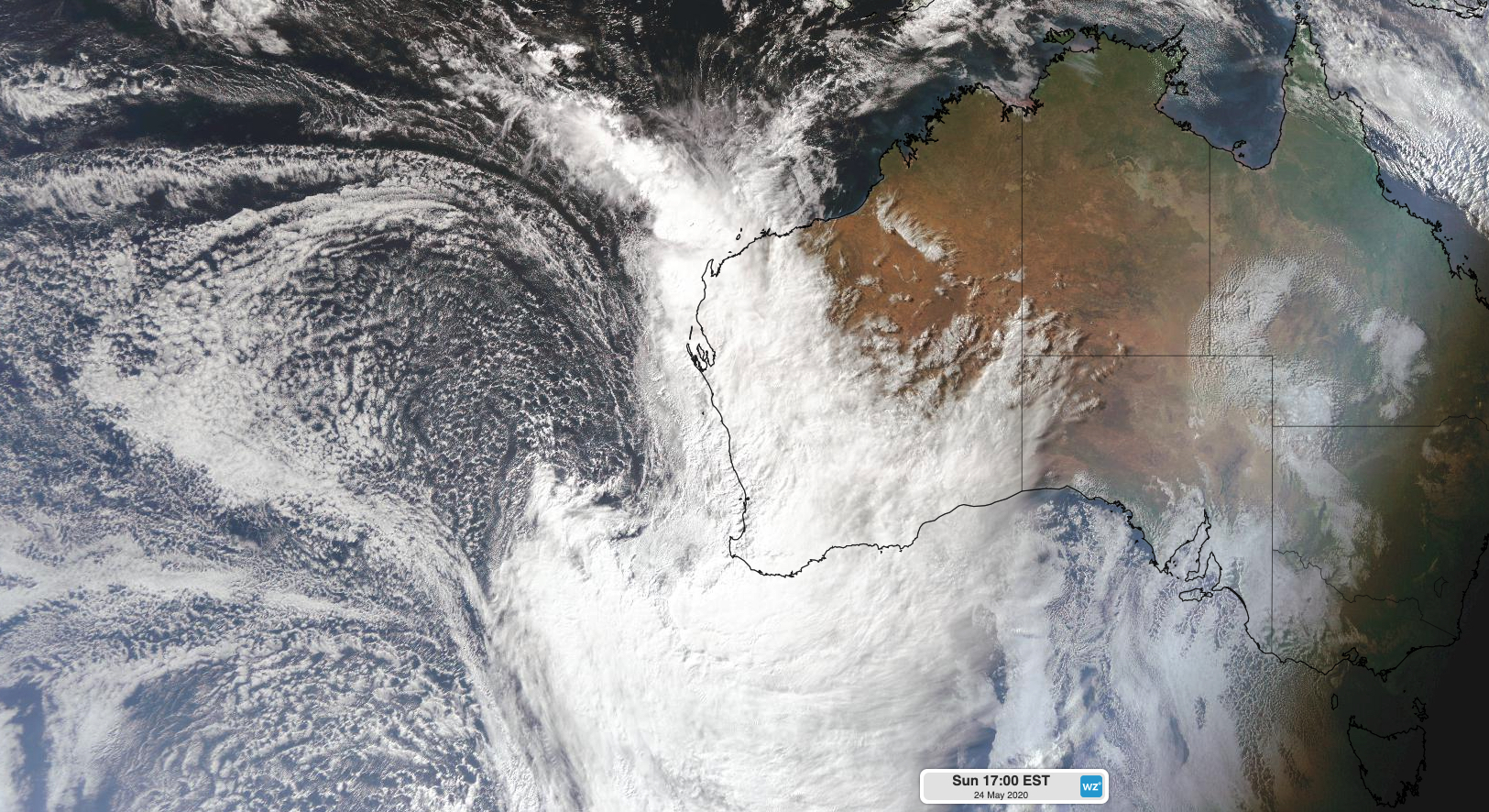
Image: Visible satellite image showing the large and dangerous weather system starting to move over Western Australia on Sunday afternoon.
As this intense and complex system moved ashore, it brought destructive winds, heavy rain, raised dust, huge waves and coastal inundation to western parts of the state from Sunday. This severe weather continued overnight and was still affecting a broad area of the state's south and southwest on Monday morning.
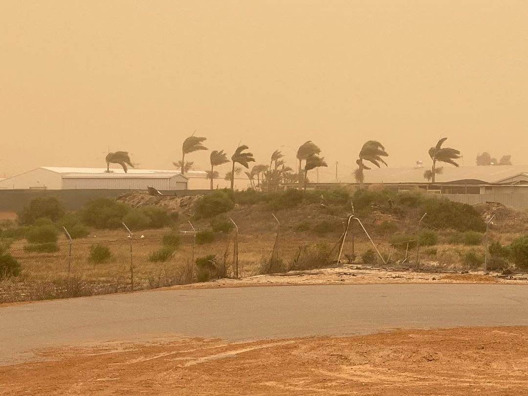
Image: Dust blows through Geraldton on Sunday as blustery winds hit Western Australia. Source: @the.pascoe.clan / Instagram
As of 8am on Monday, the strongest wind gusts from this system had been recorded in the South West Capes early on Monday morning. Cape Leeuwin registered a gust of 132km/h shortly after 4am, which is only 3km/h shy of its record for May. This weather station also reported a mean sea level pressure of 977 hectopascals in the early hours of Monday morning. These wind and pressure observations are what you would typically see from a category two tropical cyclone.
Other notable wind gusts between Sunday afternoon and Monday morning included 117km/h at Gooseberry Hill near Perth, 113km/h at Geraldton, 111km/h at Rottnest Island, 109km/h at Busselton Jetty and 94km/h at Kalgoorlie Airport.
In addition to the wind, a few rain gauges in the state's southwest and northwest picked up more than 50mm of rain during the 24 hours to 9am on Monday. This included 60mm at Learmonth and 53mm at Margaret River. Most locations in and around Perth picked up 20-40mm during this period.
Large waves and a storm surge also combined to cause coastal inundation in some areas during the last 24 hours. As powerful winds churned up the sea, a waverider buoy at Cape Naturaliste reported significant wave heights of around nine metres on Monday morning. These waves helped water levels along parts of the state's western and southwest coasts exceed the highest astronomical tide of the year during this event.
According to Western Power, more than 60,000 customers were without on Sunday as a result of severe weather. This number was still at around 50,000 by Monday morning as windborne debris continued to cause damage to infrastructure.
ðŸŒ©ï¸ STORM RESPONSE UDPDATE: Currently around 50k customers impacted by storm-related outages, down from 62k yesterday. New damage from the windborne debris has meant the overall number of impacted homes and businesses remains high | Full update: https://t.co/p6itGLPliZ pic.twitter.com/w8hu2gtV3M
— Western Power (@westernpowerwa) May 24, 2020
Showers, damaging-to-destructive winds, abnormally high tides and dangerous surf will continue to affect some southern and southwestern parts of WA during Monday, before calmer weather returns by Tuesday. Rain and thunderstorms will also spread across the Interior and parts of the Pilbara and Kimberley on Monday and Tuesday.
Check the latest severe weather warnings for the latest information on this dangerous weather event.