Widespread rain soaks inland regions and the outback
A widespread belt of rain has drenched parts of every state and territory in Australia, and there’s more to come for many areas as a vast northwest cloudband continues to stream across the country.
Fed by moisture from the Indian Ocean, the cloudband has delivered some of its heaviest rain to parched outback areas.
Notable rainfall totals in recent days have included:
South Australia
- 100.6mm in the 24 hours to 9am Sunday at Arkaroola, a wildlife sanctuary located at the far northern end of the Flinders Ranges, around eight hours’ drive from Adelaide. This was 40% of the annual rainfall in a day.
- 51mm in the 24 hours to 9am Monday at Tieyon, in the North West Pastoral district.
- 19.8mm over three days at Andamooka, which was not one of the state’s biggest totals but is worth mentioning because Andamooka had previously received just 2.2mm this summer and was one of two SA locations that reached 50.0°C in late January.
NSW/ACT
- 45.5mm in the 24 hours to 9am Monday at Tibooburra (Fort Grey) in the state’s far NW corner. The weather station at Tibooburra Airport has now received rainfall exceeding 6mm for four days straight, which is unusual in any season.
- 39mm at Dubbo, a welcome soaking which brought the running monthly total to 56.2mm in the city on the Central West Plains, after each month from October to January saw less than a third of the monthly average.
- 34.4mm at Mt Ginini on the NSW/ACT border, the heaviest daily fall since last autumn at the weather station which sits high in the Brindabella Ranges overlooking Canberra to the northeast.
Victoria
A few drops of rain were recorded at locations in all nine official BoM forecast districts in the 24 hours to 9am Monday, but the heaviest falls were in central Victoria, with at least 10 locations exceeding 25mm.
- Mena Park, a rural locality just west of Ballarat, had the state’s highest total to 9am Monday, with 37mm.
- Cowwarr Weir in the far western part of East Gippsland received 31.8mm in the 24 hours to 9am Monday.
- Goorambat, just east of Shepparton, had 29mm in the 24 hours to 9am Monday.

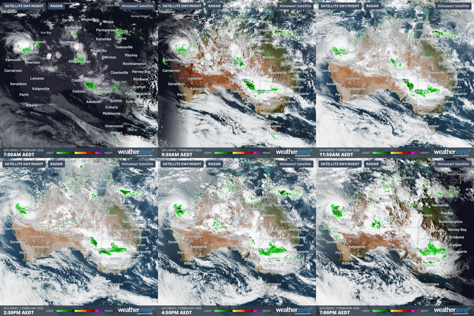
Image: Combined 12-hour satellite and radar loop from 7am to 7pm (AEDT) on Sunday February 8, 2026, showing the feed of moisture across Australia from the northwest with intermittent areas of heavy rain.
Queensland
- Birdsville Airport received 29mm, which was more rain in a day than the far SW Qld town had received in any entire month since last autumn’s deluge that helped fill South Australia’s Kati Thanda-Lake Eyre.
Northern Territory
- Plenty of rain fell in and around Alice Springs in the 24 hours to 9am Monday, with a high reading of 66mm at Upper Bond Springs, just north of the city.
- Alice Springs itself has now had five days straight with recorded rainfall, including 29.6mm in the 24 hours to Saturday morning.
- Yulara, near Uluru, has also had healthy rainfall, with four days straight of 6mm or more, including 32.4mm and 23mm in the 24 hours to 9am Sunday and Monday respectively.
Western Australia
- 19.4mm fell in the 24 hours to 9am Sunday at Giles, near the NT border in the far northeast of WA’s Southern Interior forecast district.
- The heaviest recent WA rainfall totals (of more than 100mm in 24 hours) have obviously been in the vicinity of Tropical Cyclone Mitchell in the Pilbara region. But that’s a different weather system to the northwest cloudband.
Tasmania
Yes, Indian Ocean moisture made it all the way to Tasmania, and while there were no large rainfall totals on Sunday, virtually the whole state picked up a few millimetres.
What’s next with this broad-scale weather system?
A persistent trough across the centre of the continent will continue to generate showers with the potential thunderstorms across a large area of the country for the first half of the working week. Moisture will tend to contract north as the week progresses.
Unfortunately, parched parts of southern SA and Victoria – including Melbourne and Adelaide – will largely miss out on any meaningful rain this week.