
Widespread rain about to soak Australia
A massive northwest cloudband is about to spread rain across about 80 percent of Australia, including much-needed falls in drought-affected areas of southern Australia.
A cut-off low pressure system will interact with a stream of tropical moisture over the next four to five days, producing one of the biggest rainbands Australia has seen in recent years.
This hefty rain-bearing system will start to take shape over WA on Wednesday and Thursday, before spreading eastwards across Australia from Friday to Sunday. By the end of the week, rain from this system will have soaked large areas of every state and territory.
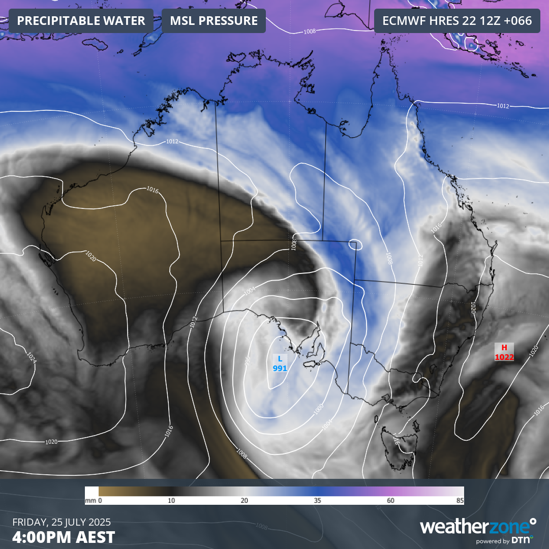
Image: Mean sea level pressure and precipitable water, showing a large low pressure system dragging a band of tropical across Australia.
This system will be notable for the widespread nature of its rain. While many areas in central, northern and eastern Australia have had decent of rain in recent months and years, parts of southern Australia have been abnormally dry for a long time. Fortunately, this week’s colossal cloudband will deliver rain to areas that are trying to recover from record-breaking rainfall deficiencies over the last couple of years.
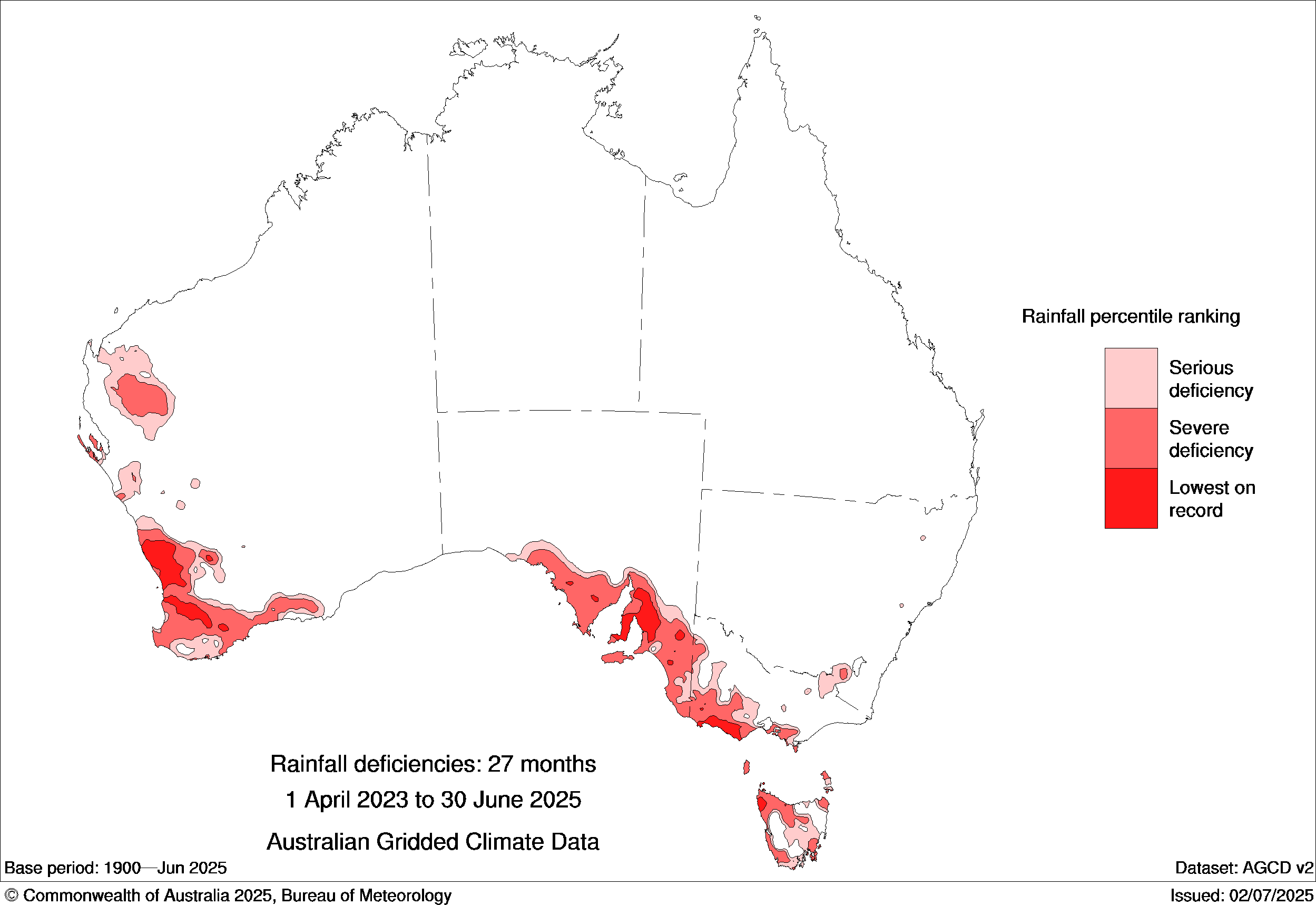
Image: Observes rainfall deficiencies during the 27-month period from April 2023 to June 2025. The red areas on the map show where rainfall was in the lowest 10 percent of historical records for this period, while the darkest red shading highlights places that had their lowest rainfall on record. Source: Bureau of Meteorology
Forecast models suggest that widespread falls of 10 to 30 mm are likely from the WA Interior down to southeastern Australia and up through inland areas of NSW and Qld this week. Some areas will see more than this, with falls of 30 to 60 mm possible in parts of southern and eastern Australia, with heavier localised falls in some areas.
There are also signs that another system could deliver follow-up rain across the southern half of Australia early next week. While this system isn’t likely to deliver as much rain as this week’s cloudband, it does have the potential to cause further decent falls in several states.
The map below shows how much rain is expected to fall across Australia during the seven days ending on Tuesday next week. Most of this rain will be caused by the system passing over Australia between Wednesday and Sunday this week.
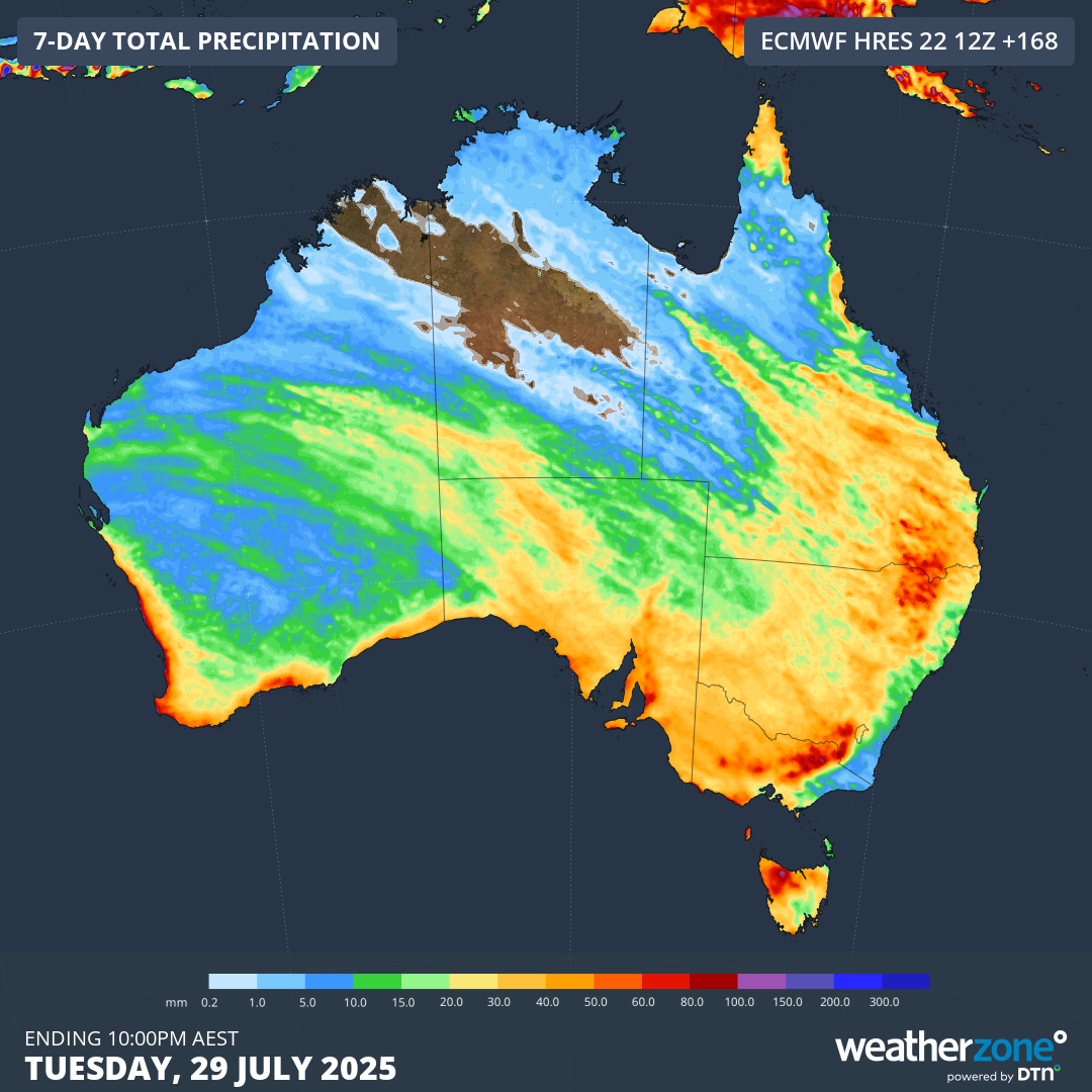
Image: Forecast accumulated rain during the seven days ending on Tuesday, July 29, 2025.
The coming week’s rain won’t be enough to completely make up for the large long-term rainfall deficiencies that have built up across southern Australia in recent years. However, it will be a big step in the right direction and some drought-affected areas could see the best rain they have had in months or years.