
Why was Hurricane Melissa so strong when it hit Jamaica?
Hurricane Melissa became the strongest hurricane on record to strike Jamaica when it made landfall as a ferocious category 5 system on Tuesday.
Melissa crossed the Jamaican coast near New Hope on Tuesday, October 28, with a central pressure of around 892 hPa and one-minute sustained winds reaching 160 knots (around 296 km/h) near its core.
Hurricane Melissa was one of the strongest systems ever recorded in the Atlantic. Based on preliminary central pressure estimates, Hurricane Melissa tied with the 1935 Labor Day hurricane as the strongest landfalling hurricane on record in the Atlantic region. These two systems are also tied as the third most intense Atlantic hurricane on record, beaten only by Wilma (882 hpa in 2005) and Gilbert (888 hpa in 1988).
Video: Hurricane Melissa approaching and making landfall over Jamaica on Tuesday, October 28, 2025. Source: CIRA
The destruction caused by this powerful hurricane will be severe and long-lasting. On Tuesday night local time in Jamaica, there were reports of damage to hospitals, residential properties and other infrastructure including roads, while more than 500,000 residents were without power. It will take time for the full extent of the damage to be surveyed.
Cuba, Bahamas next in line
Hurricane Mellisa weakened as it passed over Jamaica’s mountainous terrain on Tuesday, emerging off the country’s north coast as a category four hurricane. The system is expected to intensify as it moves north towards Cuba, where it should make a second landfall late Tuesday night into early Wednesday morning. Melissa should then track across the southeastern and central Bahamas on Wednesday before moving quickly towards the northeast and passing near Bermuda late on Thursday.
As of 0300 UTC on Wednesday (11pm Tuesday local time in Cuba), hurricane warnings from the US National Hurricane Center were in place for Cuban provinces of Granma, Santiago de Cuba, Guantanamo, Holguin, and Las Tunas, and the Southeastern and Central Bahamas.
What made Melissa so strong?
All hurricanes, tropical cyclones and typhoons need the following key ingredients to intensify:
- Warm sea surface temperatures, which provide energy.
- Low vertical wind shear, meaning wind speed and direction don’t change much with height, to help keep the system symmetrical.
- Good outflow of air at the upper levels of the system, making space for more air to rise through the atmosphere as the system gains strength.
Melissa encountered an ideal environment for cyclone intensification as it traversed the Caribbean Sea in the last few days. Wind shear was low, there was good outflow in the upper-levels and sea surface temperatures were close to 30°C, more than 1°C warmer than average for this time of year and well above the 26.5°C threshold required for hurricane formation.
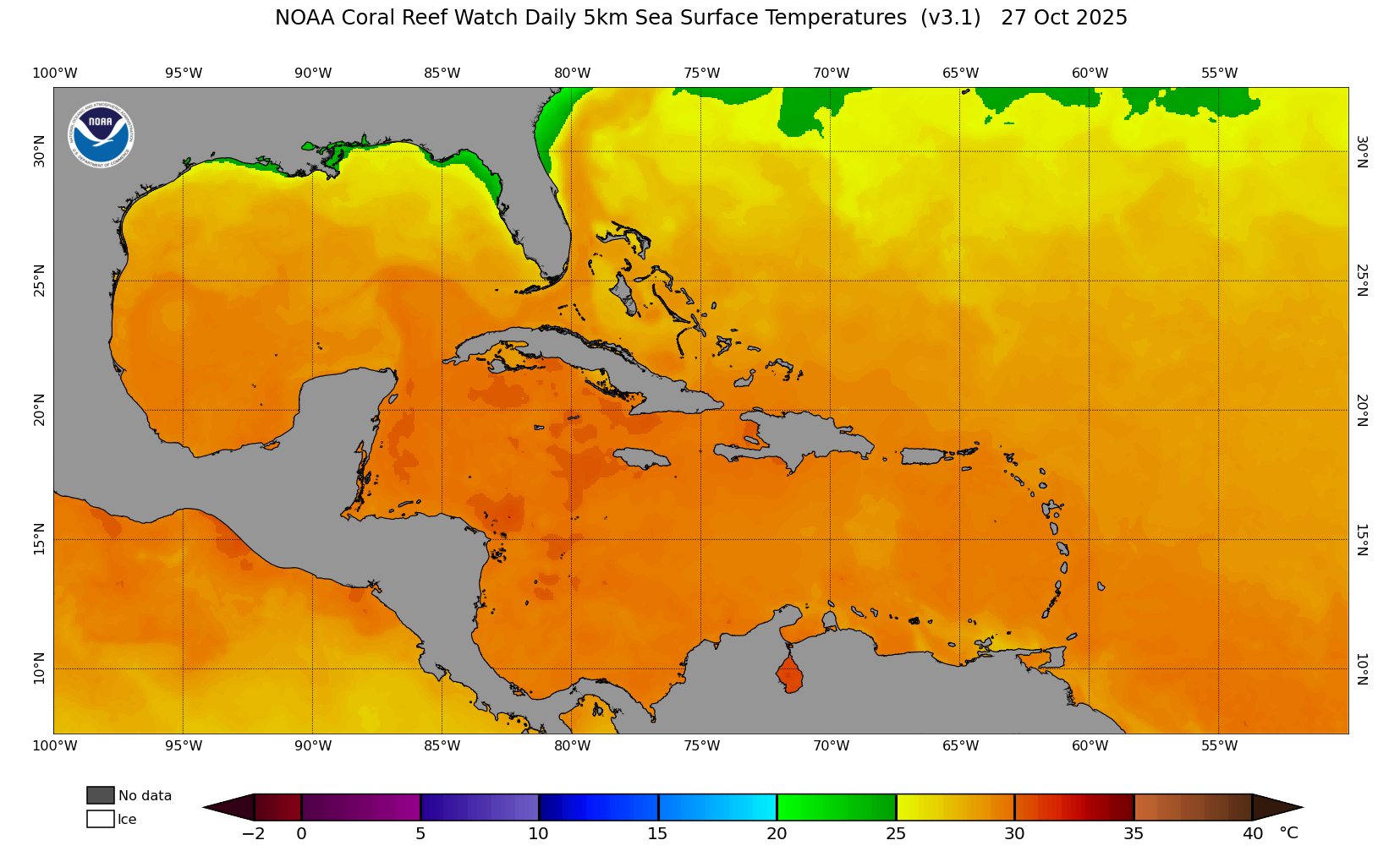
Image: Sea surface temperatures in the Caribbean Sea on October 27, 2025. Source: NOAA
How does Melissa compare to Australia’s strongest tropical cyclones?
The strongest tropical cyclones on record in the Australian region, based on central pressure, were Tropical Cyclone Gwenda in 1999 and Tropical Cyclone Inigo in 2003. These systems both had a central pressure of 900 hPa at their peak intensity.
When Hurricane Melissa hit Jamaica on Tuesday, it was more powerful that any tropical cyclone that has been recorded in the Australian region.