
Where have all the Atlantic hurricanes gone?
The Atlantic basin is experiencing a prolonged lull of hurricane activity that has not been seen for 85 years.
The Atlantic hurricane season runs from the start of June to the end of November. During this six-month period, there are an average of seven hurricanes and three major hurricanes in the Atlantic basin – a region which includes the Atlantic Ocean, Caribbean Sea and Gulf of Mexico.
Despite just passing the climatological peak of the Atlantic hurricane season – September 10 – there have been no hurricanes in the Atlantic basin so far this season.
This is now the longest a season has gone in the satellite era (since 1966) with zero hurricanes in the Atlantic basin. When including observations prior to the satellite era, this is now the longest a season has gone without a hurricane since 1941. However, data from the pre-satellite era is less reliable due to sparser observing techniques.
Why has this season been so quiet?
Hurricanes require three main ingredients to form:
- Warm sea surface temperatures
- Atmospheric moisture
- Low vertical wind shear (meaning wind speed and direction doesn't change too much with height)
There is plenty of warm water and atmospheric moisture over the Atlantic basin this season. However, wind shear has been stronger than usual, which has helped suppress hurricane development so far.
One of the factors contributing to the increased wind shear this season is El Niño in the tropical Pacific. El Niño events cause disruptions in the atmosphere that extend across to the Atlantic basin. By increasing wind shear over the Atlantic, El Niño makes it harder for thunderstorms to grow into hurricanes over the tropical Atlantic.
According to Philip Klotzbach, a Colorado State University meteorologist who specialises in Atlantic basin hurricane forecasts, there has been record levels of vertical wind shear in the Main Development Region (MDR) of the Atlantic basin over the past 30 days. The MDR is the tropical Atlantic area between West Africa and the Caribbean where most Atlantic hurricanes form.
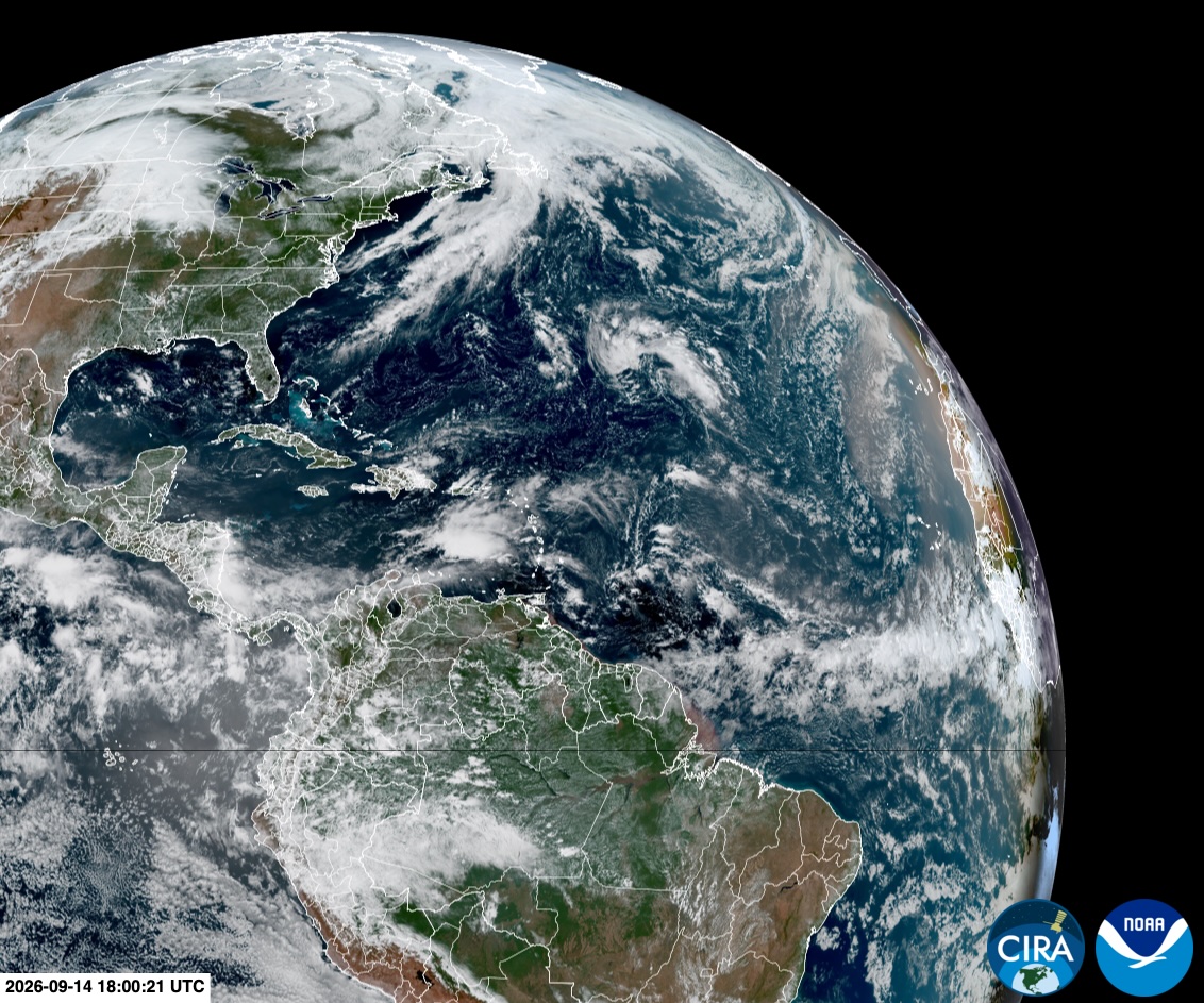
Image: Satellite image showing the western Atlantic Ocean on Monday, September 14, 2026. Source: CIRA / RAMMB.
Will there be any hurricanes this season?
It’s too early to rule out any hurricane activity this season, particularly considering we are so close to the climatological peak of the season and there is still plenty of warm water to fuel the development of tropical storms.
However, wind shear is likely to remain a problem for hurricane development while El Niño continues to gain strength in the Pacific Ocean. According to the U.S. National Oceanographic and Atmospheric Administration (NOAA), the influence of El Niño on Atlantic hurricanes is usually most pronounced between September and November.
This creates a contrast of influences – elevated wind shear will continue to hinder hurricane development while warm seas will provide fuel if any tropical systems do manage to spin up.
No season inside the satellite era has even gone from start to finish without a single hurricane in the Atlantic basin. It’s also important to point out that even a quiet season can still produce damaging late-season hurricanes.
You can track the latest tropical weather in the Atlantic basin by visiting the U.S. National Hurricane Center website.