
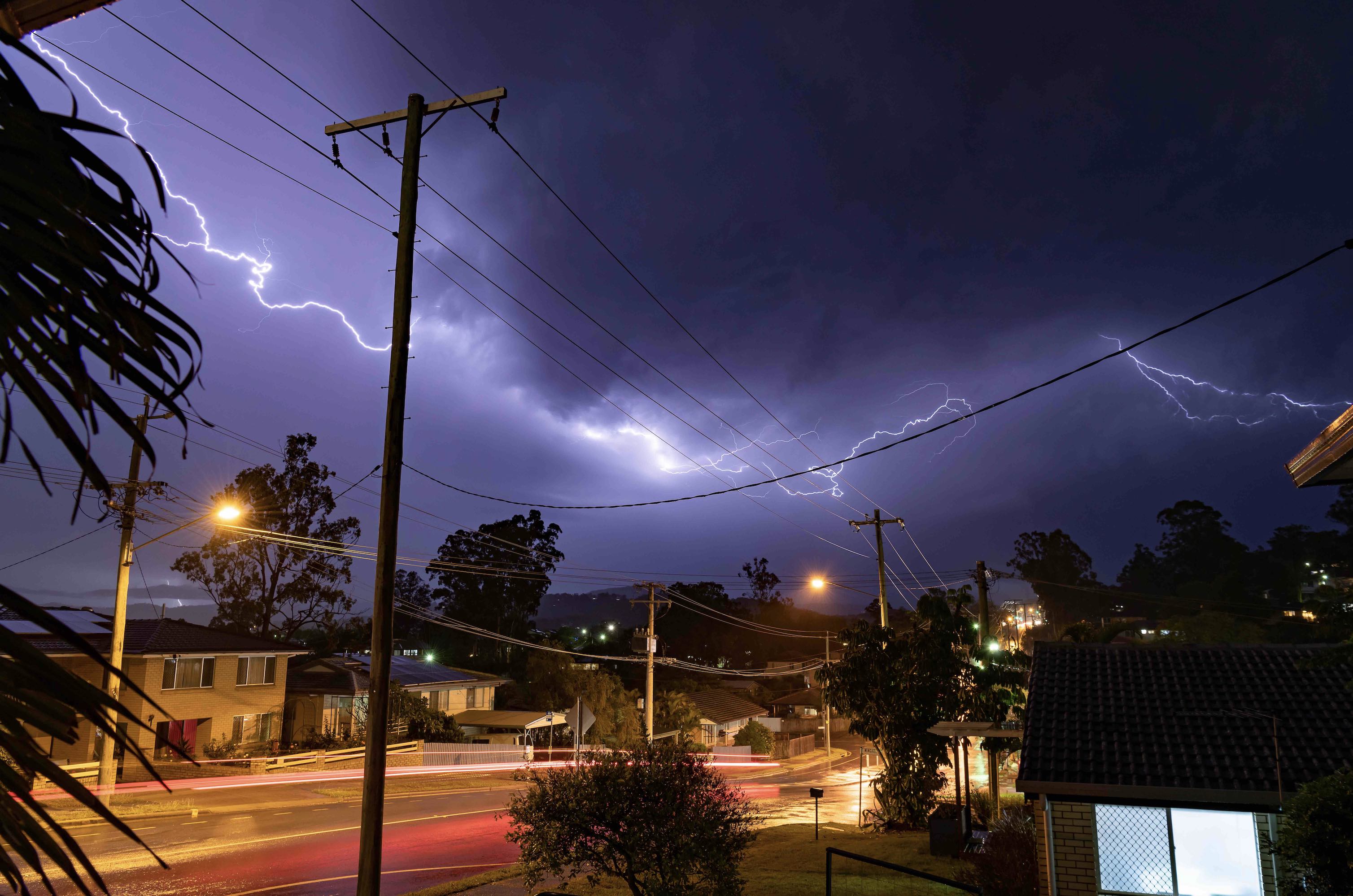
When the atmosphere is this unstable, severe storms are unavoidable
A dangerously unstable atmosphere will produce an outbreak of severe thunderstorms over several states in southern and eastern Australia this weekend, with supercells a good chance and tornadoes also possible.
What makes a thunderstorm dangerous?
All thunderstorms require three key ingredients to form:
- An unstable atmosphere, which helps air rise from the surface
- Low-level moisture in the atmosphere, which fuels the development of clouds
- A trigger mechanism that causes air to start rising away from the surface
When any of these ingredients are available in greater quantities, thunderstorms have a better chance of becoming severe. In Australia, severe thunderstorms are defined as any storm that produces large hail, damaging winds, heavy rain or tornadoes.
In addition to the three main thunderstorm ingredients listed above, there is one other factor that can make storms become even more dangerous than a regular severe storm: wind shear.
Wind shear refers to a change in wind speed and/or direction with height. The more wind changes speed and direction in the lowest few kilometers of the atmosphere, the more storms are likely to start rotating.
Regular thunderstorms often fizzle out when the rising air within the storm gets too heavy with rain and hail, causing them to collapse. However, rotating supercells displace the rising air (updraft) from the falling rain/hail (downdraft), which allows them to grow more intense and last longer.
While regular thunderstorms usually live for tens of minutes, supercells can go on for hours. Their rotation also allows supercells to move in different direction to other surrounding storm cells, which makes them very difficult to predict ahead of time. Some supercells can also produce tornadoes.
This weekend’s dangerous setup
All of the ingredients will be in place for dangerous thunderstorms in part of southern and eastern Australia this weekend.
We have already seen daily thunderstorm activity over large areas of Australia this week, which is a clear sign that there is plenty of low-level moisture available in the atmosphere.
Over the next few days, the passage of an upper-level trough will cause a pool of cold air to sweep over Australia’s southern states, accompanied by a surge of powerful upper-level winds.
This cold air aloft will significantly increase the instability of the atmosphere, while the strong upper-level winds will enhance wind shear and increase the risk of supercells and tornadoes.
One of the key indicators of atmospheric instability is the Lifted Index (LI). When the LI drops below zero, storms become possible. LI values below -2 mean storms are a good chance, while values below -4 indicate a high risk of storm development. This weekend, the LI could dip to around –8 in some parts of SA and western NSW, which suggests that there is a very high chance of severe storms.
The maps below show where one computer model is predicting showers and thunderstorms to develop this weekend and on Monday.
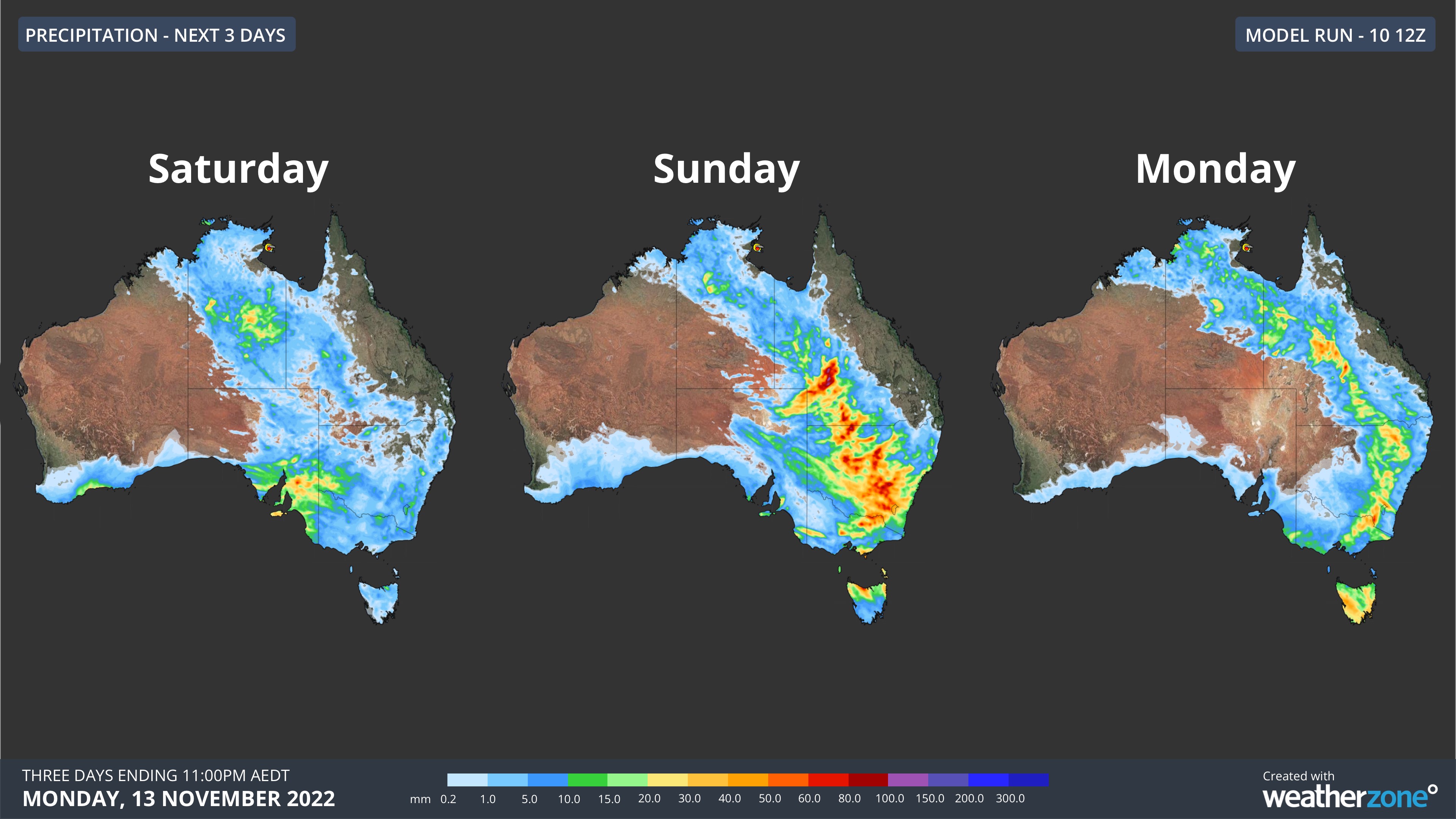
Storms are possible in parts of every Australian state and territory over this three-day period, with the most intense storm activity likely to occur in parts of SA, NSW, Vic and Qld.
The combination of rain and intense thunderstorm downpours could also exacerbate flooding across parts of Qld, NSW, Vic, SA and Tas this weekend and early next week.
Be sure to check the latest severe thunderstorm, severe weather and flood warnings over the weekend for the most up-to-date information on this dangerous system.