
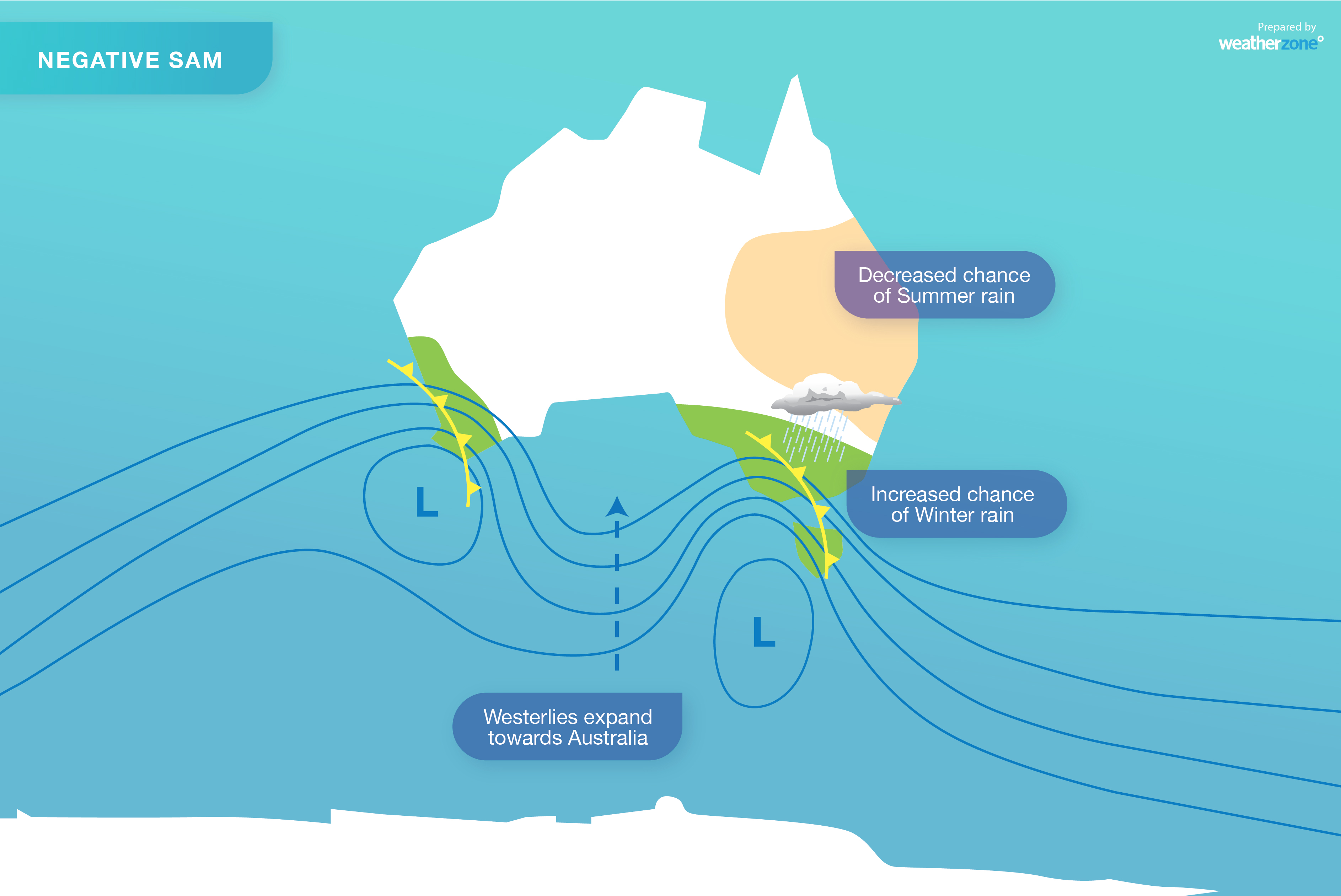
What the negative SAM means for Australia
The Southern Annular Mode (SAM), an index that influences wind, rain and snow in Australia, has just shifted into a negative phase. So, what does that mean for our weather as we head through the final week of autumn?
-- What is the SAM? --
The SAM is simply an index that's used to monitor the position of a belt of westerly winds that flow from west to east between Australia and Antarctica.
When the SAM is in a negative phase, these westerly winds, and the cold fronts and low pressure systems they carry, are located further north than usual for that time of year.
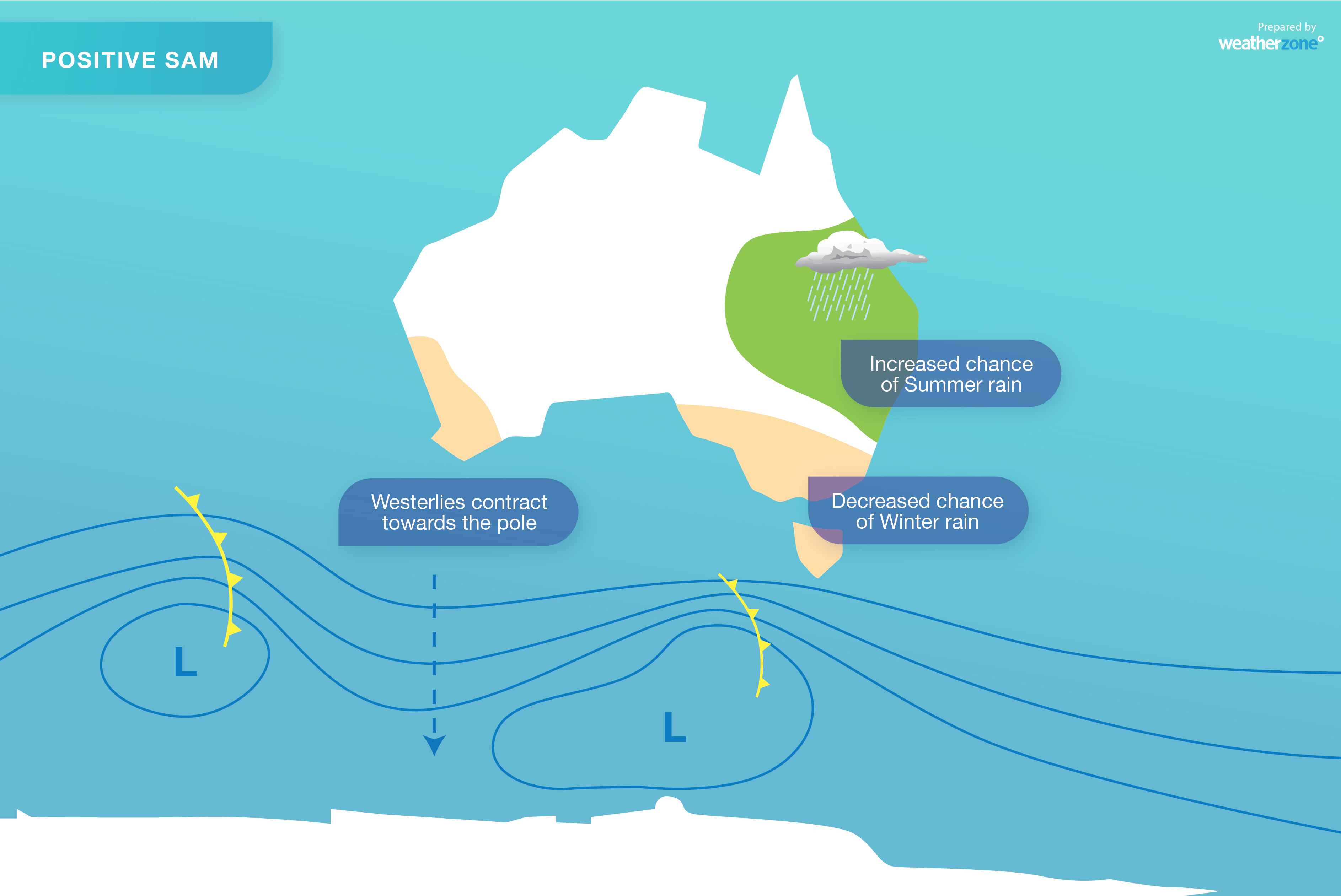
When the SAM is positive, the westerly winds, cold fronts and low pressure systems are located further south than usual.
-- How does the SAM change our weather? --
The SAM can have a notable impact on Australia's weather. Negative phases of the SAM during late-autumn and winter often:
- Increase rainfall over southwestern and southeastern Australia
- Reduce rain in parts of eastern Australia
- Cause stronger westerly winds in southern Australia
By contrast, positive phases of the SAM in late autumn and winter can:
- Suppress rainfall in Australia's southwest and southeast
- Increase rain over eastern Australia
- Make East Coast Lows more likely near Australia's eastern seaboard
For Australia's alpine addicts, the SAM can also influence snow. More snow expected to fall in the Australian alps when the SAM is negative and less snow is likely when it's positive.
-- What's the SAM doing now? --
After being in a positive phase for much of the last fortnight, the SAM has just shifted into a negative phase.
This transition has coincided with one of the strongest cold fronts so far this year crossing southern Australia. This system caused hail and a dusting of snow in WA on Monday, followed by widespread rain and damaging winds in parts of southeastern Australia on Tuesday.
The SAM is likely to stay negative for the final week of autumn. This means that people in Australia's southern states should be on the lookout for dynamic weather as we approach the start of winter.
Forecast models are already suggesting that a deep low pressure system could develop over the Tasman Sea in the final days of May. They also show another low and associated front delivering an outbreak of rain and storms in WA between this Friday and Tuesday next week.
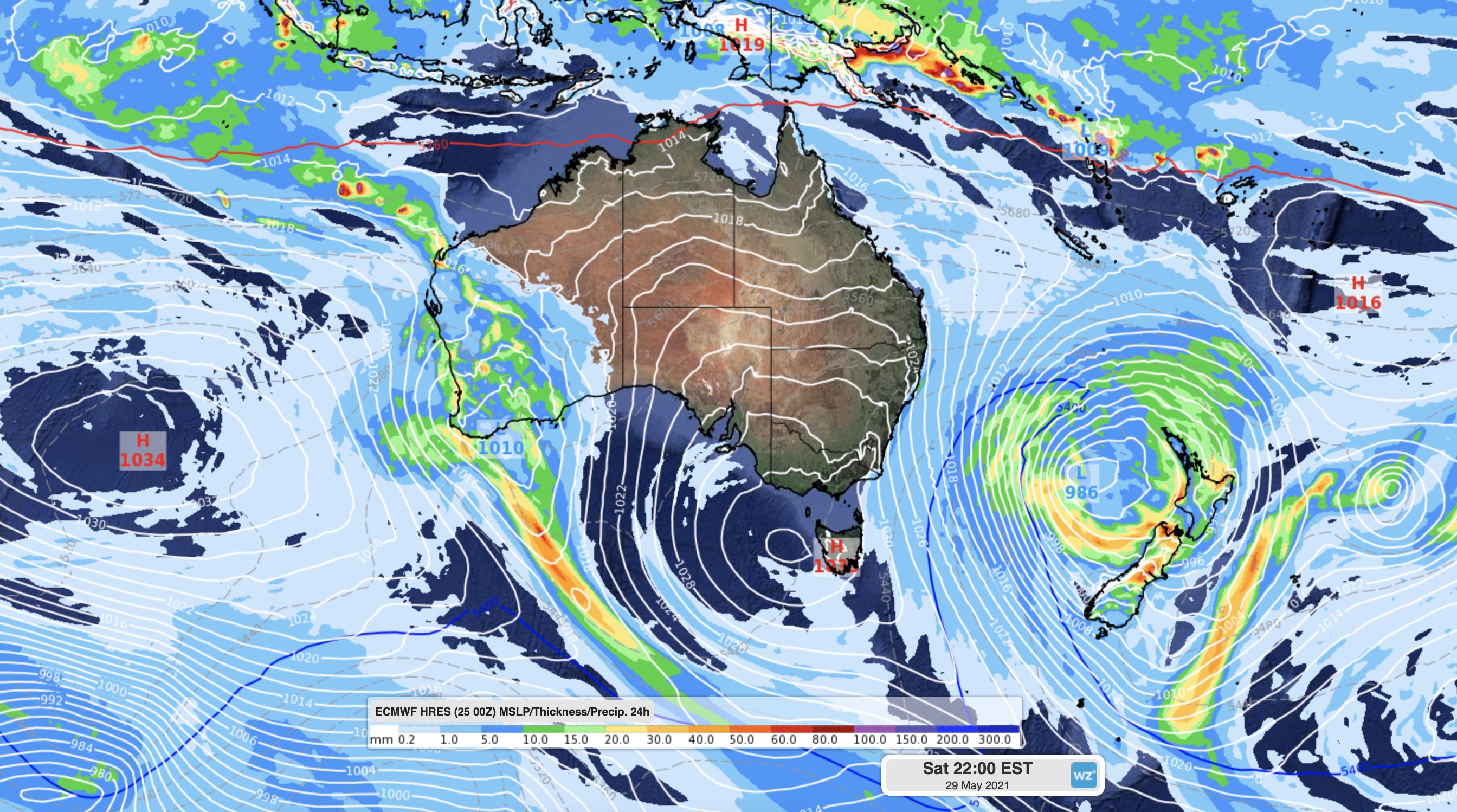
Image: The ECMWF-HRES model showing two significant low pressure systems in the Australian region on Saturday, May 29th.
Both of these systems could cause severe weather and we will have more updates on them both during the coming fortnight.