
What is a cold front?

If you've ever looked at a satellite image of Australia and seen a comma shaped cloud, you may have wondered exactly what it was.
The image below shows such a cloud, associated with a low pressure trough and cold front. The trough is linked to the cloud you can see over southern SA, whilst the cold front is just to the south, extending out over the Southern Ocean.
The cold front in the satellite image below can be easily identified by the comma shaped cloud, the tip of which is just to the south of Kangaroo Island. It then sweeps south past Tasmania, stretching around 2500km south across the Southern Ocean. The centre of the low, from which the cold front extends, can be seen centre bottom of the image.
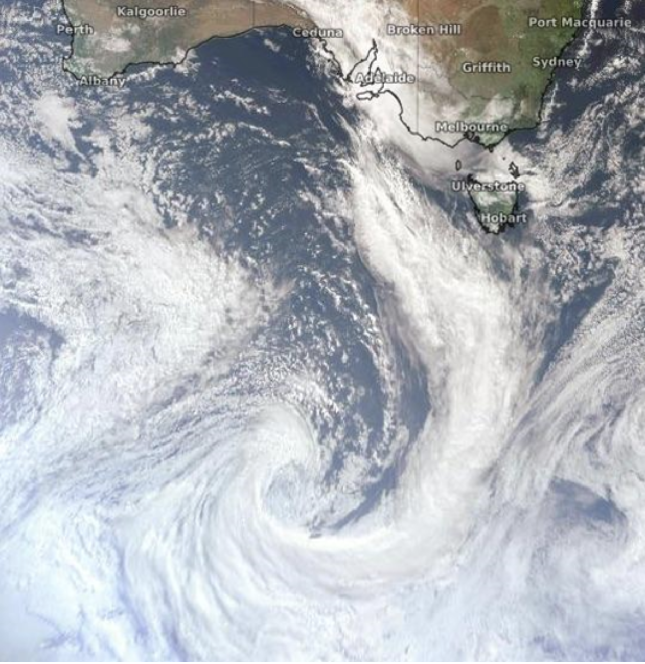
Himawari-8 visible true colour satellite image of a cold front
By meteorological definition, a front is the transition zone between two air masses of different densities. As differences in density are most often caused by temperatures differences, it follows that a front separates air masses of different temperatures.
There are a few different types of front, but what is a cold front? We already know that a front marks the boundary between two different temperature air masses, but now we need to know if the colder air is behind or ahead of the front. In the case of a cold front, the colder air is behind the front, and advances east, replacing the warmer airmass ahead of it, with the colder air near the surface and the warm air rising above it.
Knowing this, it follows that as a cold front crosses a region, temperatures will drop. Here in Australia, ahead of the cold front, winds will generally be from a northerly direction, drawing air from the hot interior. As the front passes the winds shift to south, drawing much cooler air originating over the Southern Ocean.
It should be noted that not all cold fronts have such well-defined comma shapes, however with a significant cold front expected to cross southern Australia mid-next week, see if you can spot the characteristic swirl in the satellite imagery.