
What caused the record-breaking rain in eastern Australia?
More than one metre of rain has fallen across parts of southeast QLD and northeast NSW over the past week, causing widespread and in some cases record-breaking flooding.
So, how did this colossal rain event happen?
Most significant weather events are caused by several factors combining over a certain place at a certain time. The past week's flooding rain is no exception.
Let's take a look at some of the influences that have come into play.
First is the La Niña event that has taken place over late-spring and summer in the Pacific Ocean. During a La Niña pattern, sea surface temperatures are warmer than usual in the western equatorial Pacific, which allows more moisture to build up in the atmosphere.
High levels of atmospheric moisture are one thing, but cloud and rain won't come about unless the humid air mass is lifted.
A second factor of this rain event was an area of cool upper air that drifted across SA and southern QLD last week. Cool air in the upper levels destabilises the atmosphere, allowing air that is lifted by converging winds in the low levels to remain buoyant, producing cloud and rain.
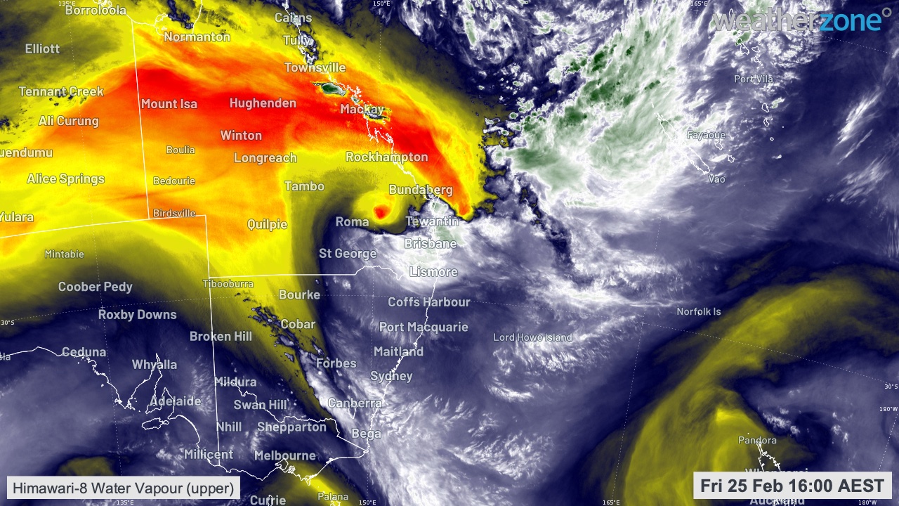
Image: Water vapour satellite imagery highlights the upper level low pressure system setting in over southeast QLD on Friday.
A third factor was a series of troughs near the coast, south of which lay a deep feed of moist, tropical air originating over the Coral Sea and beyond. These areas of converging winds provided lifting mechanisms which drifted over land at times, creating a focus for the heaviest rain and thunderstorms.
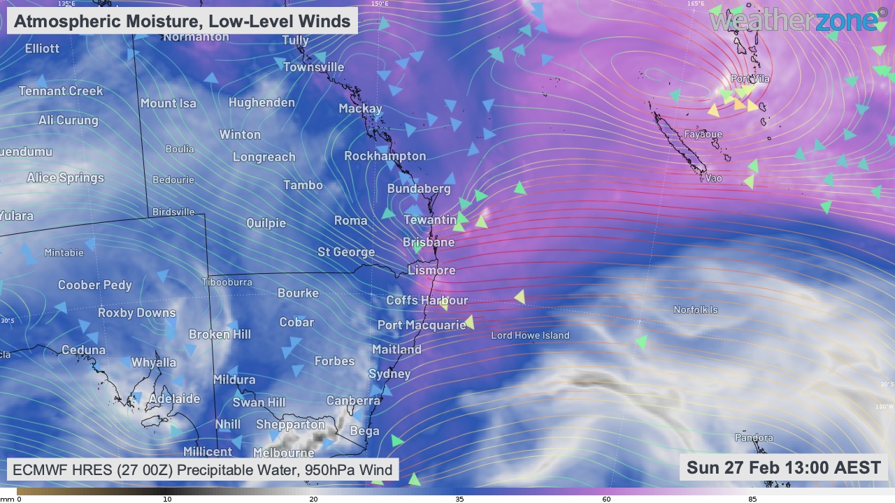
Image: Chart based on ECMWF's numerical model showing the deep, moist air mass feeding into the low pressure system over southeast QLD.
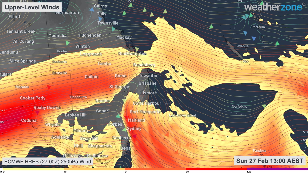
Image: Chart based on ECMWF's numerical model showing upper patterns associated with the low pressure system over southeast QLD.
Perhaps the most significant and unusual aspect of this system was its slow moving nature. The upper feature essentially stalled between Friday and Sunday, allowing the band of heavy rain and thunderstorms on its eastern and southern flank to sit over the same areas for 72 hours or more.
The slow west to east movement of the system is related to a blocking high pressure system near New Zealand.
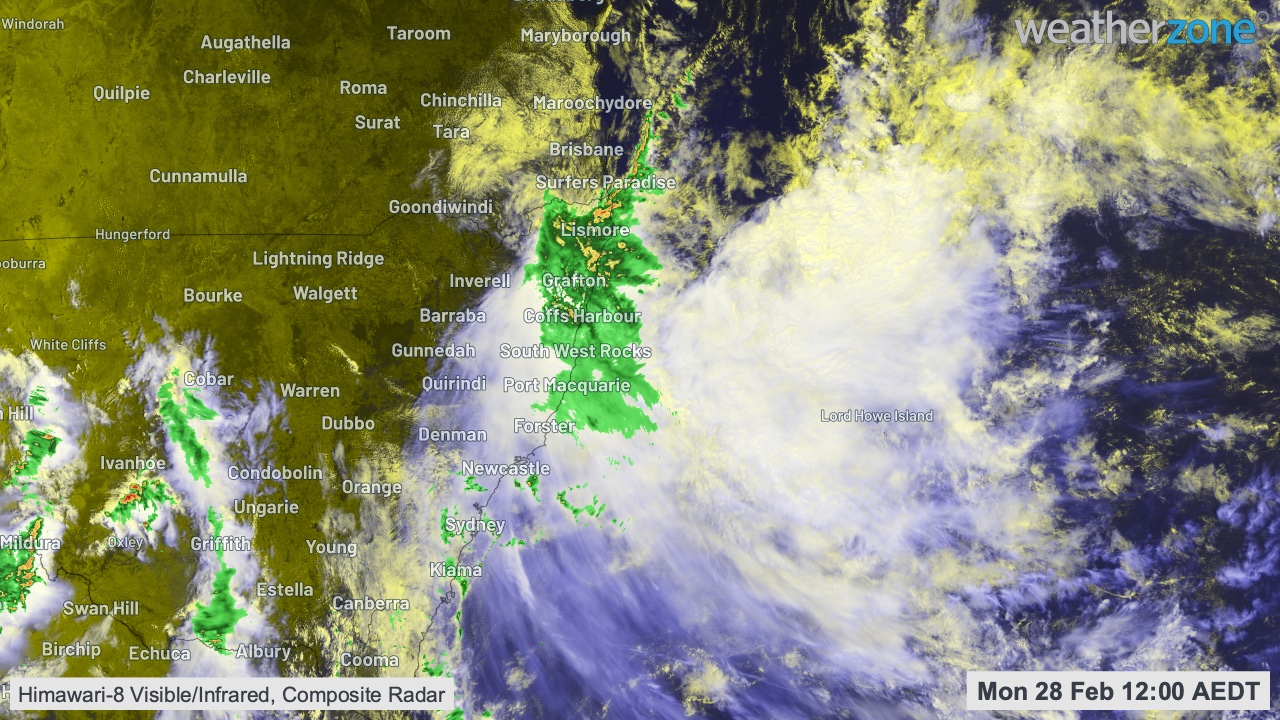
Image: Enhanced satellite and radar imagery showing low cloud (yellow) streaming into the system from the east, heavy rain falling over southeast QLD and northeast NSW, and high cloud in outflow (blue) being directed away from the system by upper winds.
In addition to the unique mix of weather-related features that underpinned this rain event, there may also have been some influence from the background climate.
Warmer oceans mean more water vapour in the atmosphere, and warmer air has a greater capacity to hold the vapour. So, it's possible that the warming trend we are observing in our oceans and atmosphere will make these types of events more severe as time goes by.
The blocking high pressure pattern centered near New Zealand, along with the approach of a second upper-level low pressure system, will ensure humid and wet weather continues along much of the east coast of Australia for at least the next week.