
Wettest September day in 37 years at Cairns Airport in unseasonable N Qld deluge
Extremely heavy rain has fallen in parts of North Queensland, with the highest 24-hour total to 9am Wednesday of 379mm recorded at the Topaz weather station, not far inland from Innisfail and just west of Queensland’s highest peak, 1622m Mt Bartle Frere.
At least a dozen nearby weather stations exceeded 100mm of rainfall, while Cairns Airport recorded 72.8mm in the 24 hours to 9am Wednesday, its highest September reading since 1988.
The city’s main weather station at Cairns Racecourse, about 10km south of the airport, recorded 95.6mm in the 24 hours to 9am Wednesday, on the back of 64.4mm the day before.
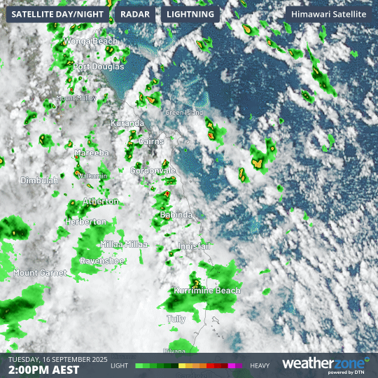
Image: The combined six-hour radar and satellite loop from 2pm Tuesday show showers pushing towards the coast and becoming heavier as they strike the coastal ranges between Cairns and Innisfail.
While these would be big totals in most parts of non-tropical Australia, North Queensland locals would consider it just another downpour – with one key exception.
This is North Queensland’s driest time of year.
While tropical North Queensland does not have a dry season as severe as Darwin’s where the rain taps virtually turn off entirely for several months, September is still considerably drier than the wet summer months.
For example:
- Cairns (Racecourse) sees just 43.6mm on average in September (the 2nd-driest month) compared to 467.8mm in January (the wettest month).
- Innisfail, around an hour south of Cairns, sees 85.3mm on average in September (the driest month) compared to 663.2mm in March (the wettest month). Innisfail has already received 326.8mm this September, the vast majority of it since Saturday.
What caused the unseasonable deluge?
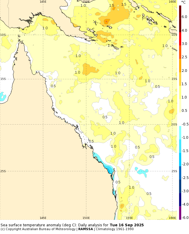
Image: Sea surface temperature anomalies (difference from the long-term average) for Qld waters as at September 16, 2025. Source: BoM.
Persistent southeasterlies have been pushing moist Coral Sea air towards the Queensland coast for several days now, with the rainfall potential enhanced by widespread above-average sea surface temperatures for this time of year. The moist winds interacted with a surface trough located just inland from the coast.
A drying trend will set in across North Queensland from the end of the week onwards. Our Cairns forecast is here.