
Wet winter outlook as potential negative IOD looms for Australia
Australia could be in for a wet winter, with new model data suggesting that a negative Indian Ocean Dipole (IOD) could emerge in the next few months.
Australia’s weather is influenced by several broad-scale climate drivers. These include:
- El Niño-Southern Oscillation (ENSO) – the Pacific Ocean fluctuates between La Niña, El Niño and neutral conditions, which influences rain and temperature in northern and eastern Australia, typically across multiple seasons.
- Indian Ocean Dipole (IOD) – the Indian Ocean constantly swings between negative, neutral, and positive phases of the IOD, which affects rainfall and temperature across large areas of Australia in winter and spring.
- Southern Annular Mode (SAM) – this index measures the north-south displacement of a belt of westerly winds flowing between Australia and Antarctica. The phase of SAM typically affects rain, wind and snow in southern and eastern Australia.
Over the last four-to-five months, Australia has been under the influence of La Niña and a predominantly positive SAM. These two climate drivers have caused above-average rain over parts of Australia.
However, La Niña events typically break down around autumn and while this current La Niña is persisting longer than usual, it is expected to end in May or June. Meanwhile, the SAM is expected to be neutral or weakly positive in the coming weeks and have little influence on Australia’s weather.
What lies ahead?
As La Niña and SAM gradually lose their influence on Australia’s weather, the focus in the coming months will shift to what is happening in the Indian Ocean.
New model data released this week suggests that the IOD could enter a negative phase in the next two-to-three months and possibly persist through winter into spring.
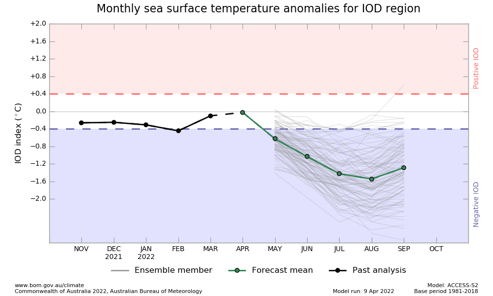
Image: IOD outlook showing a potential dip into a negative IOD this winter. Source: Bureau of Meteorology
If this outlook were to eventuate, it would strongly increase the likelihood of above-average rain and below-average daytime temperatures over parts of Australia during winter and spring.
The maps below show the average impact of the 11 of the most recent negative IOD events on temperature and rainfall in Australia.
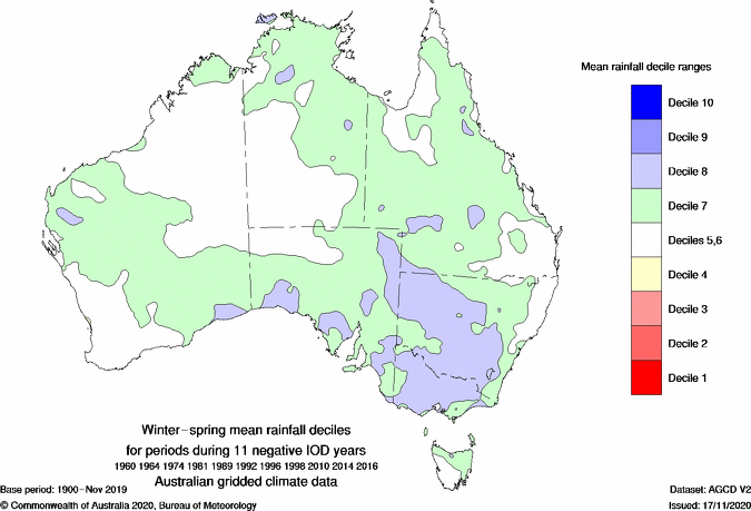
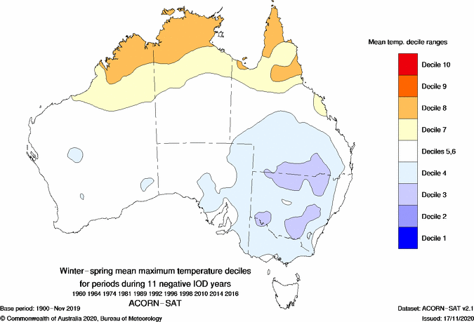
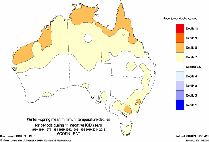
Images: Typical winter-spring rainfall and temperature anomalies in Australia during a negative IOD. These maps were produced by averaging out the observed rainfall and temperature observations from 11 negative IOD events between 1960 and 2016. Source: Bureau of Meteorology.
The footprint a negative IOD is being picked up by the Bureau of Meteorology's latest seasonal outlooks, which predict above-average rain and near to blow-average daytime temperatures over large parts of the country.
The shape of the rain and temperature anomalies in the maps below match what is typically caused by northwest cloud bands, which are known to become more prominent when the IOD is negative.
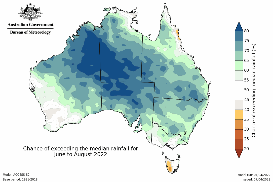
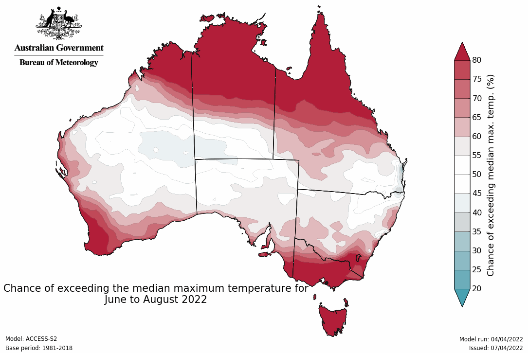
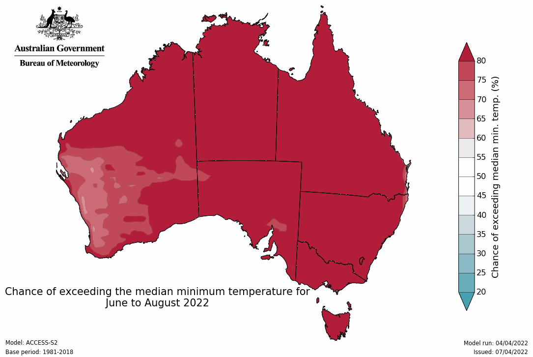
Image: Seasonal rainfall and temperature outlooks for Australia during winter (June to August) 2022. Source: Bureau of Meteorology
It is worth pointing out that seasonal forecast models have less accuracy predicting the IOD at this time of year, and usually become more reliable in winter. So, it will be important to closely monitor the IOD outlook in the next couple of months.
If a negative IOD does develop this winter, it will increase the risk of flooding over large areas of inland Australia, especially places that had a wet summer and autumn.

Image: A steady flow at Fitzroy Crossing after summer rains in late-January 2022. Source: @wal081 / Instagram