
Wet weekend for east and west coasts
The southwest corner of Western Australia and a lengthy stretch of Australia’s east coast can expect a wet weekend, with two distinct weather systems set to drench both areas.
The west coast
WA’s South West Land Division can expect a classic winter cold front, with relatively mild winter temperatures ahead of the front. The heaviest rain is likely on Friday night into Saturday.
You can see the pre-frontal rainband already approaching the west coast on Friday morning, with a stream of tropical moisture from the Indian Ocean streaming towards the Gascoyne and Central West forecast districts.
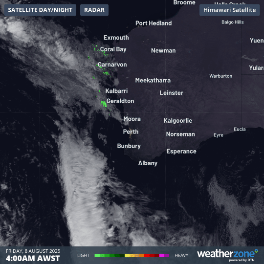
Image: Four-hour combined radar and satellite loop for southwest WA from 4:00am to 8:00am (AWST) on Friday, August 8, 2025.
For Perth, rainfall totals between 10 and 20mm are possible this evening, with a likely rainfall range of 20 to 40mm on Saturday.
Daytime temperatures then drop a few degrees on Sunday in the cool air behind the front, as the rain eases to showers.
While showers will be more frequent near the coast, there’s still a good chance that fans will stay dry at the footy at Optus Stadium, which starts at 3:10pm (AWST). Whether the last-placed West Coast Eagles can overcome the ladder-leading Adelaide Crows is another story.
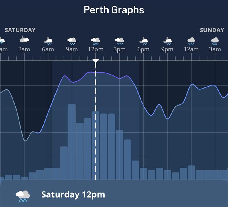
Image: 90% chance of rain and 2.9mm rainfall at 12:00pm AWST for Perth, WA, on Saturday, August 9, 2025. Source: Hourly Forecast Graph on the Weatherzone app.
The east coast
While the west coast’s rain will arrive from the west, the east coast rain will blow back onshore from the east.
As the synoptic chart below shows, air circulating anti-clockwise around the large high pressure system centred over Tasmania will direct moisture from the Tasman and Coral Seas onshore, generating showers.
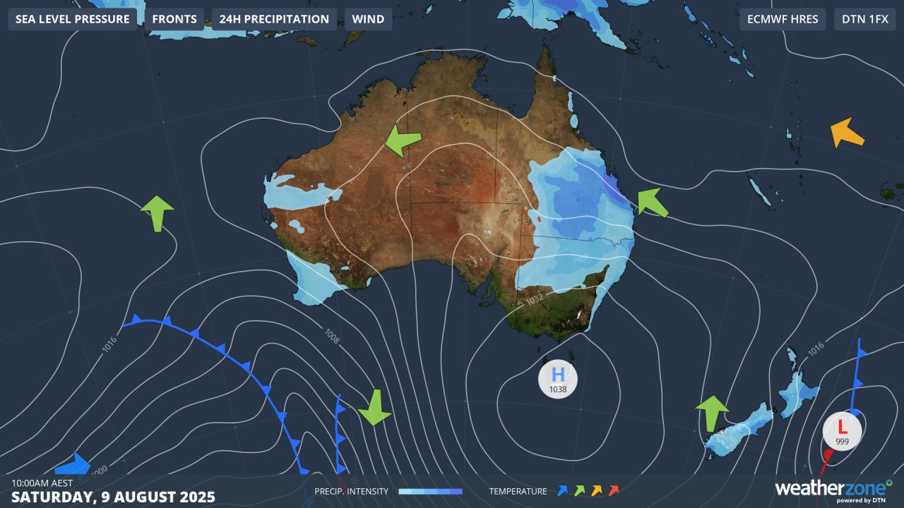
Image: Predicted synoptic chart for Saturday, August 9, 2025.
The timing of the east coast rain event is similar to southwest WA – starting this Friday night and heaviest on Saturday.
Showers can be expected along the Queensland coastline from the Gold Coast up to the Capricornia forecast district around Rockhampton, with a drying trend setting in by Sunday.
For the New South Wales coast and adjacent ranges, the heaviest rain is also likely to fall this weekend, but showers will persist into the new week on most parts of the coast.
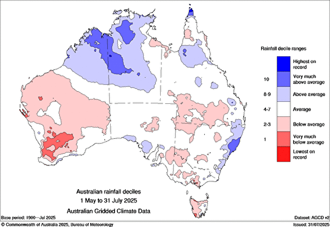
Image: Australian rainfall deciles from May to July, 2025. The dark blue area on the NSW coastline is the area around Taree, which experienced historic flooding in May. Source: BoM.
The chart above shows how virtually the entire NSW coastline has seen above-average rainfall over the last three months. Another persistent rainy spell is not what most residents would be hoping for, but at least the overall totals shouldn't be huge this time.
For Sydney, rain is in the forecast right through to next Thursday, with the heaviest falls in the range of 10 to 20 mm likely on both Friday night and Saturday, with totals of 5 to 10mm probable on Sunday.