
Wet week to come for NSW
Following a fine and largely dry weekend across the state, conditions will turn wet and stormy from the start of next week.
A low pressure trough will deepen and gain moisture on Monday and Tuesday, which will lead to showers and thunderstorms over the eastern half of New South Wales.
Thunderstorms could generate damaging winds, localised flash flooding and large hailstones each day.
Wednesday and Thursday will see an upper level low pressure system transiting west to east across the state, which will act to enhance rainfall and result in more widespread thunderstorm activity.
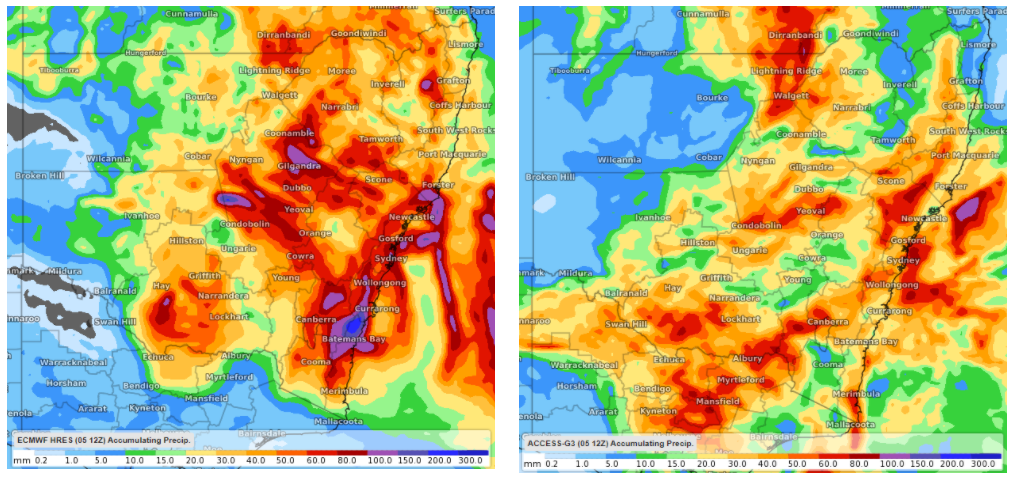 Image: forecast rainfall accumulation by 11pm Thursday 11th March according to the Friday 12z runs of ECMWF (left) and ACCESS-G3 (right).
As it stands, many central and eastern parts of New South Wales are expected to collect 10-30mm of rain by the end of Thursday, with some locations potentially seeing four-day rainfall accumulations of over 80mm.
Appreciable rainfall totals and thunderstorms will also affect parts of Queensland and Victoria at times next week.