
Wet week ahead for east coast
Get ready for a showery and possibly thundery week, East Coasters, as rain is expected for eastern Queensland and eastern NSW every day this week, particularly along the coastal fringe. As you can see from the image below, rainfall accumulation over the next week could amount to as much as 30-70mm along the coastal fringe, with some coastal areas possible seeing highly localised accumulated falls over 100mm. Western Tasmania will also see some decent rainfall accumulation this week, as frequent fronts and troughs collide with the state’s west coast.
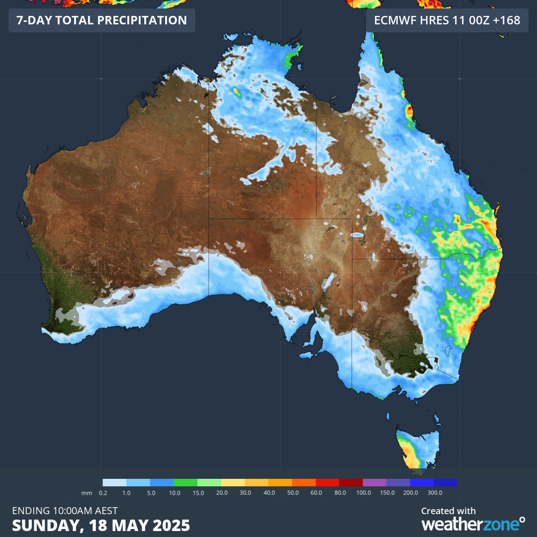 Image: Weekly rainfall accumulation across Australia to 10am AEST, Sunday, May 18, according to the ECMWF model.
Ok, so we know what’s bringing all the rainfall to western Tas, but what about all that rain over Qld and NSW?
To start, a high pressure system will linger in the Tasman between now and Tuesday while a tropical low develops just south of the Solomon Islands. The net effect will be that showery easterly component winds will be directed along the eastern seaboard as coastal troughs develop over eastern NSW and far northeastern Qld.
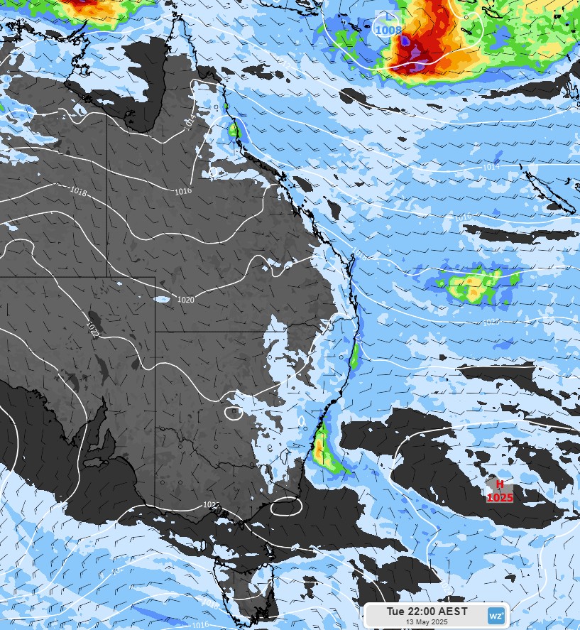 Image: Mean sea level pressure (white lines), wind (black barbs) and 24-hour rainfall to 10pm AEST, Tuesday, May 13, according to the ECMWF model.
From Wednesday, a combination of coastal and inland troughs will impact NSW and Qld, with showers affecting a large swath of eastern Australia, stretching from Qld’s northern goldfields to NSW’s far south coast. At this stage, rainfall is most likely to be heaviest on Thursday and Friday as a low pressure system develops offshore. Thunderstorms have a strong chance of developing over southern Qld and northeast NSW on these days.
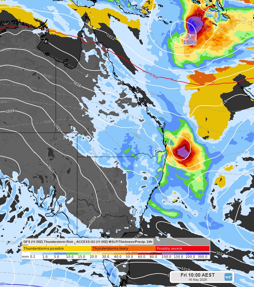 Image: GFS thunderstorm forecast overlaid with the Access-G model’s forecast mean sea level pressure and 24-hour rainfall to 10am AEST, Friday, 16 May. The mean sea level pressure shows a tropical low to the south of the Solomon Islands and a low pressure system developing off the coast of southeast Qld and northeast NSW.
On Saturday, the low pressure system is expected to make a beeline for New Zealand, allowing showers and thunderstorms to ease over most areas, although there is a chance that another trough could develop over southeast Qld and northeast NSW, bringing further heavy showers to the coastal fringe.