
Wet weather looms for parched WA

A series of cold fronts will bring welcome rain to parts of Western Australia during the next five days.
Large areas of Western Australia's west coast have had a notably dry start to 2019.
Perth only received 76mm of rain during the last five months, making this its third driest start to a year in more than 140 years of records. The city also had its second driest May on record.
A cold front interacting with a stream of moisture from the Indian Ocean will cause a band of rain to spread over western and southwestern districts of WA on Thursday night and Friday.
This system should bring widespread falls of 20-40mm from the Gascoyne down to the South West District.
In addition to the impending rain, strong northerly winds and large waves are developing ahead of the approaching front. These winds were fanning a number of bushfires in the state's southwest on Thursday, near Busselton.
A severe weather warning for damaging winds, damaging surf and abnormally high tides has been issued for parts of the state's southwest.
This first cold front will weaken as it moves over the Bight on Saturday, although another strong system is approaching WA in its wake.
The next front will hit the southwest corner of WA on Saturday, cause another burst of rain and blustery winds during the weekend. This system will bring another 10-20mm to parts of the state's western and southwestern coasts over the weekend, with some showers also extending inland across the Southwest Land Division.
Another front will hit on Monday, maintaining cold, wet and windy weather over southwestern districts of WA early next week.
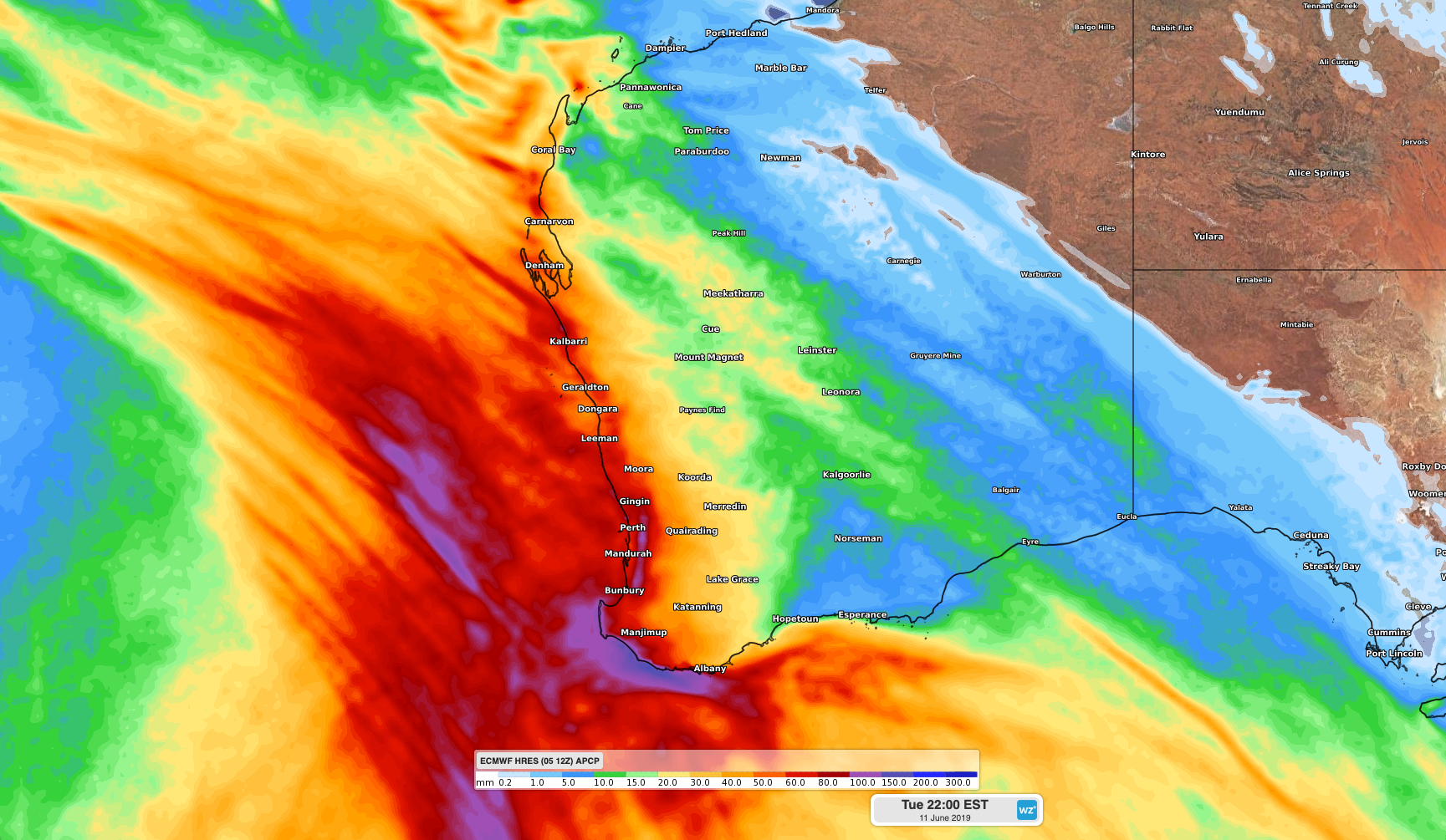
Image: Forecast accumulated rain up to next Tuesday night, according to the ECMWF-HRES model.
Accumulated rainfall totals from this flurry of fronts should exceed 50mm in some western and southwestern districts of WA by next Tuesday. The heaviest falls are likely near the coast, where some places may see more than 100mm in total.
Visit https://www.weatherzone.com.au/warnings.jsp for the latest warnings.