
Wet weather incoming for Queensland's north coast
Queenslander's living along the north coast will need to pull out their umbrellas and gumboots this weekend, with heavy rain expected to drench areas around Cairns. While it hasn't been too dry over the North Tropical Coast these past few months, weather stations at Cairns Airport and South Johnston recorded below average rainfall for the months of February and March.
With models as they currently are, April's rainfall for the region is set to either come close to, or even beat averages for the month. April's rainfall average for South Johnston is 397.1mm (records beginning in 1920), and Cairns Airport is 845.2mm (records beginning in 1943).
A tropical low or trough could develop either today or tomorrow, and intensify later this week. There is only a low chance at this stage that a tropical low would further develop into a tropical cyclone. Conditions are not considered too favourable for future development, but that's not to say it won't deliver strong winds, and a deluge to the area.
Accumulated rainfall totals to Monday 25th could be as much as 300-500mm, with heavier localised falls possible. Majority of this rain will fall over the weekend and also moving into next week. Port Douglas to Tully are the most likely areas for this intense rain.
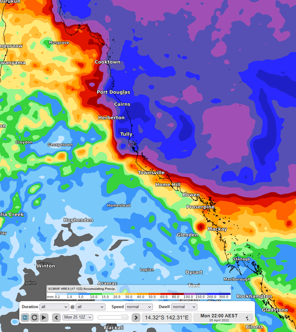
Figure 1: Accumulated precipitation to 22:00 AEST Monday 25th using ECMWF
Winds are also expected to increase towards the end of the week, with wind gusts of 60-80km/h expected for coastal areas.
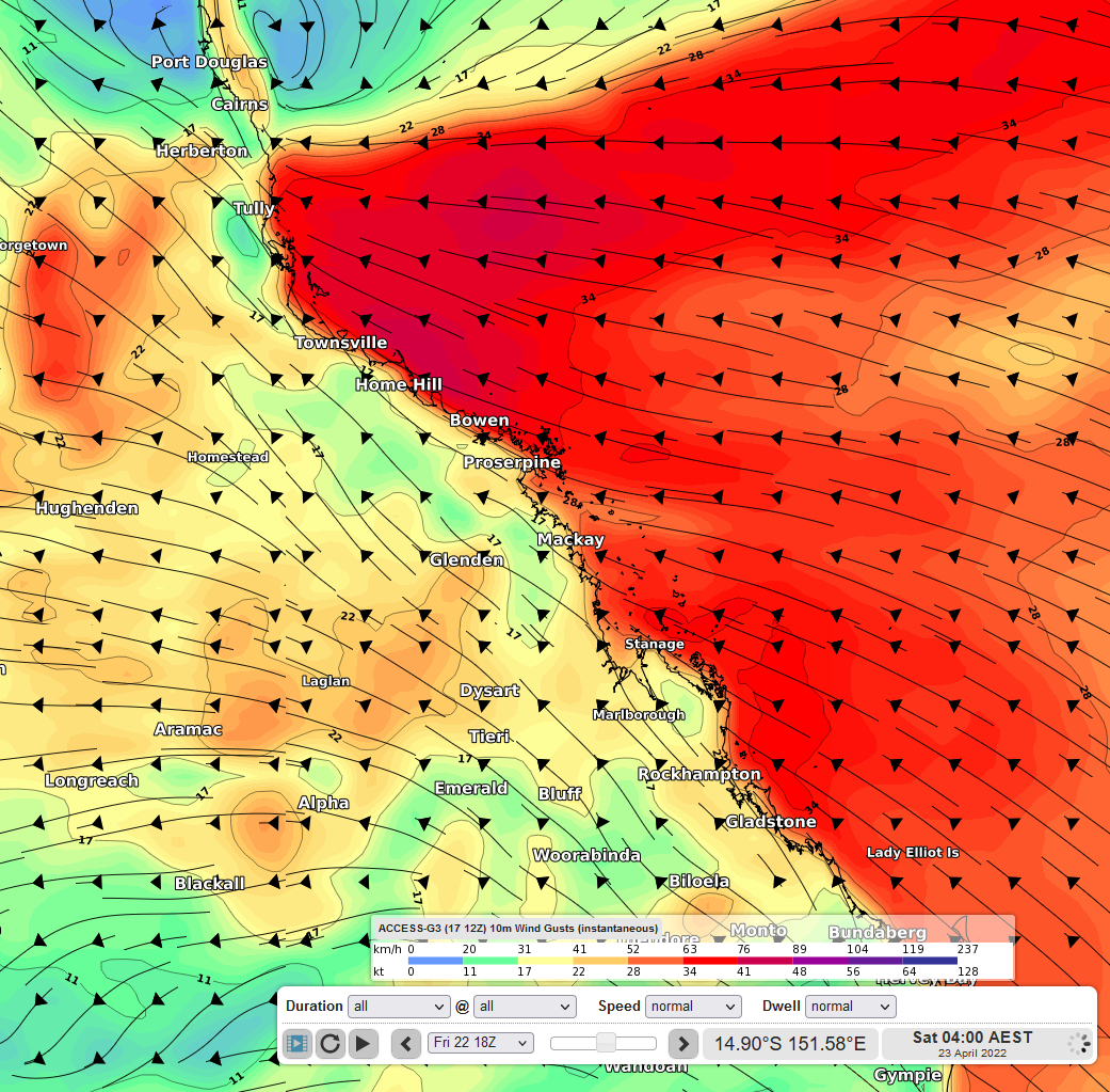
Figure 2: Wind Gusts at 04:00 AEST Saturday 23rd using ACCESS-G