
Wet start to October in WA
Parts of Western Australia could pick up close to half a month’s worth of rain during the next two days.
Rain and thunderstorms will spread across western and southern districts of Western Australia on Friday and Saturday, with and behind the passage of a cold front.
The rain from this system should reach as far north as the Gascoyne District and as far east as the Goldfields and Eucla Districts, dampening soil across more than a third of the state.
However, the rain will be hit and miss, particularly inland, so some places could get a good drop and others could miss out altogether.
The heaviest rain over the next 48 hours will fall along the state’s western and southern coasts and adjacent inland areas.
Perth and surrounding areas in the Lower West and Central West costs could pick up about 10-30mm of rain across Friday and Saturday, with most of this falling on Friday. Two-day totals could reach 5-15mm over the Central Wheatbelt, Great Southern and Goldfields Districts.
Below is a map of how much rain one computer model is predicting on Friday and Saturday combined, followed by a map showing the average rainfall in Western Australia during October.
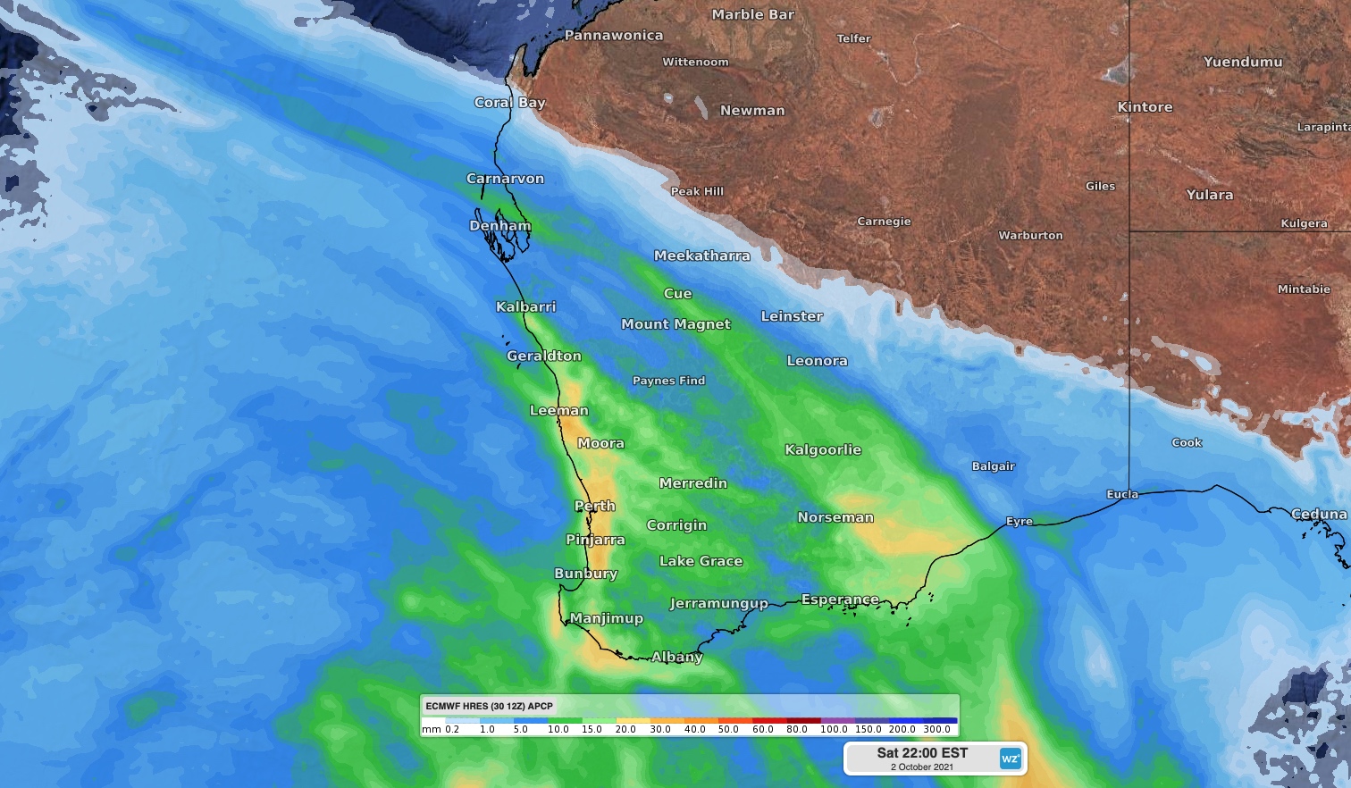
Image: Forecast accumulated rain on Friday and Saturday, according to the ECMWF-HRES model.
Another two cold front will clip southwest Australia between Sunday and Tuesday, causing a few more showers over Western Australia’s the South West Land Division.
Drier weather will return to Perth and most other areas of southwestern Australia during the second half of next week.