
Wet start to autumn in southwest WA
Showers and thunderstorms will characterise much of the next week across the South West Land Division with a month's worth of rain possible in some places - accumulating over just a few days.
A low pressure trough will deepen and gain moisture across the region enhanced by a pool of upper cold air and warm waters along the west coast. The showery activity will kick off over coastal regions on Monday and spread to eastern parts during the day. Storms will be confined to northern parts of the region, mainly the Central West district. Rain should continue and affect the remainder of WA's southwest during Tuesday, possibly intensifying on Wednesday.
Models are indicating widespread accumulated rain of 10-40mm between Monday and Thursday with some outcomes displaying localised total rainfall exceeding 60mm. While these falls may not sound very high, they represent a month's worth of rain for many places as March is generally quite dry.
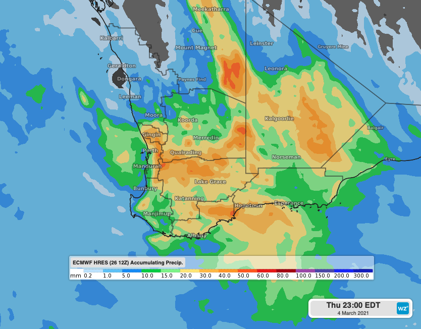 Image: Forecast accumulated rain to Thursday, showing the heaviest falls east of the Darling Range.
Some towns could see their best rain in months. Norseman and Hopetoun have seen only 40mm for the last 3 months. This rainfall event could deliver a similar amount in these two places during the first week of autumn.