
Wet spring on the way for large parts of Australia
Abnormally warm oceans surrounding Australia and a developing negative Indian Ocean Dipole will increase the likelihood of abnormally wet weather across large parts of the country this spring, along with an increased risk of flooding and severe thunderstorms.
Spring in Australia runs for three months from the start of September to the end of November. This time of year is characterised by rising temperatures and increasingly active weather, typically featuring vast rain-bearing cloudbands, prolific thunderstorm activity and building tropical moisture in the lead-up to the northern wet season.
Spring weather this year is expected to be influenced by several broad-scale features:
- A negative Indian Ocean Dipole (IOD) is expected to emerge to the northwest of Australia this spring, increasing the amount of moisture-laden air flowing over Australia from the tropical Indian Ocean.
- The Pacific Ocean is expected to stay in a neutral phase this spring (neither La Niña nor El Niño), although a weak La Niña-like pattern may develop.
- Sea surface temperatures in the Australian region are expected to be warmer than average throughout spring. These relatively warm waters will help supply additional atmospheric moisture for rain and clouds over the Australian continent this spring.
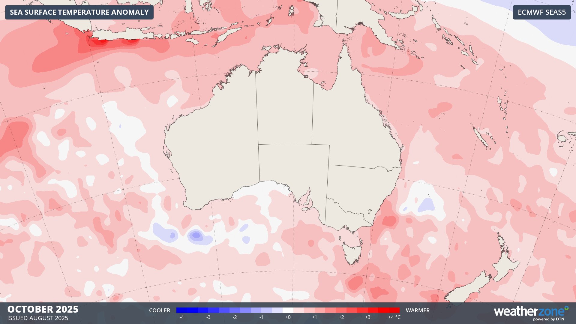
Image: Forecast sea surface temperature anomalies around Australia in October 2025.
Rain and thunderstorms
Both rain and thunderstorm activity are expected to be above average over large areas of Australia this spring, mainly in the eastern two-thirds of the country. This will be due to the combined influence of enhanced moisture in the atmosphere and an increased likelihood of cut-off lows occurring near Australian longitudes.
By contrast, some northern and western parts of Australia are expected to see below average rain this spring. This contrasting rain outlook between the east and the west suggests that the upper-level pressure patters will favour the types of systems that initiate rain and storms over central or southern Australia before moving towards the east.
The maps below shows one model’s prediction for the chance of having a wetter than normal spring in 2025.
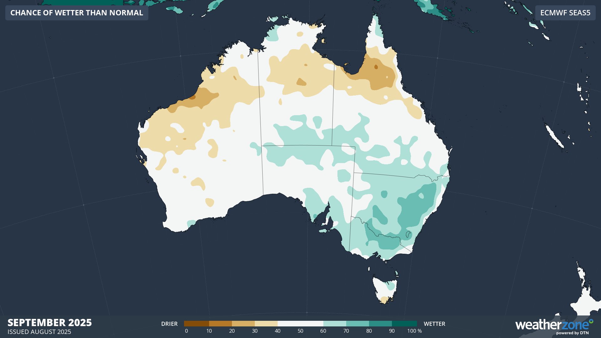
Image: Probability of exceeding median rainfall during September 2025, according to the ECMWF SEAS5 model.
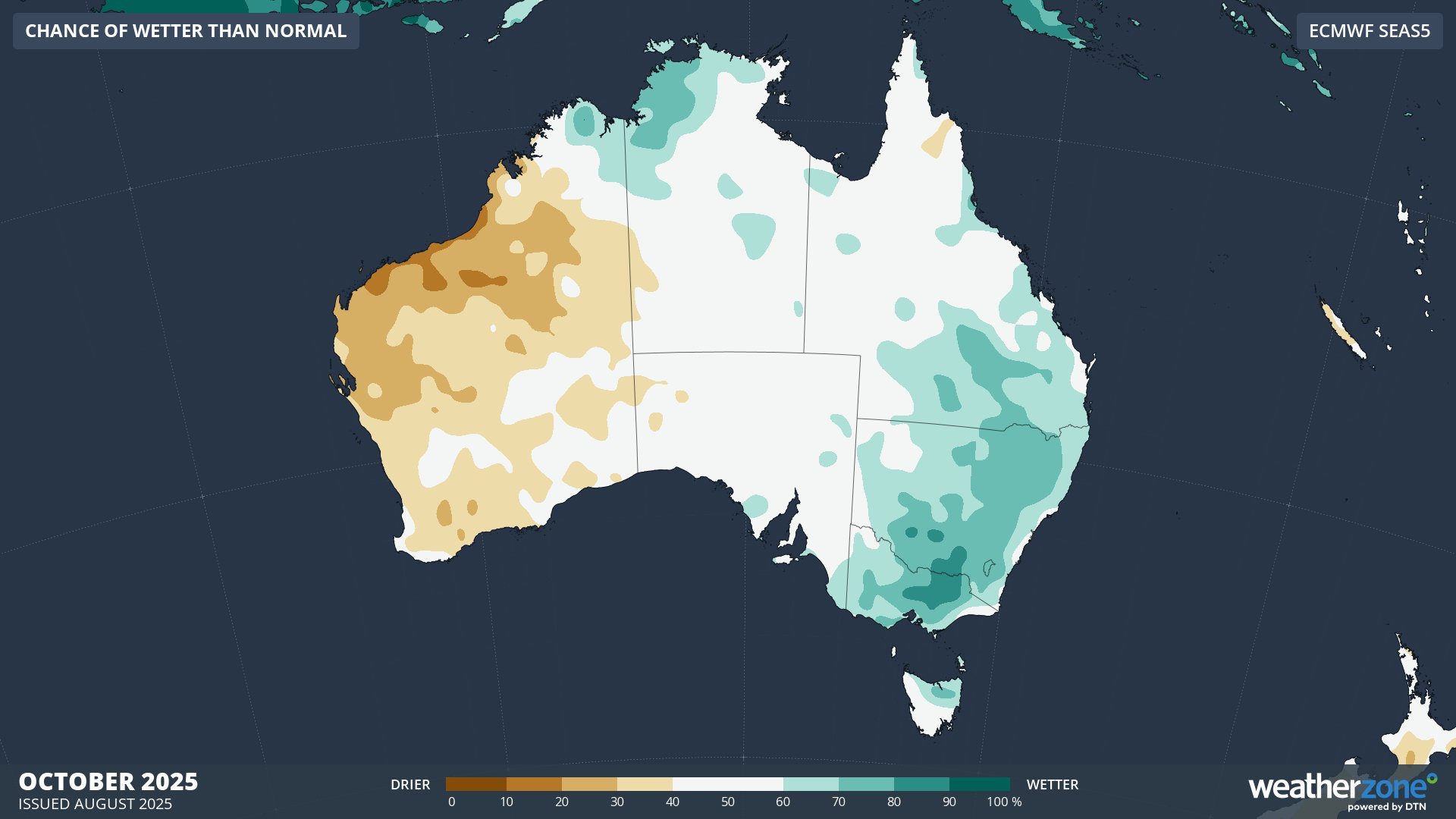
Image: Probability of exceeding median rainfall during October 2025, according to the ECMWF SEAS5 model.
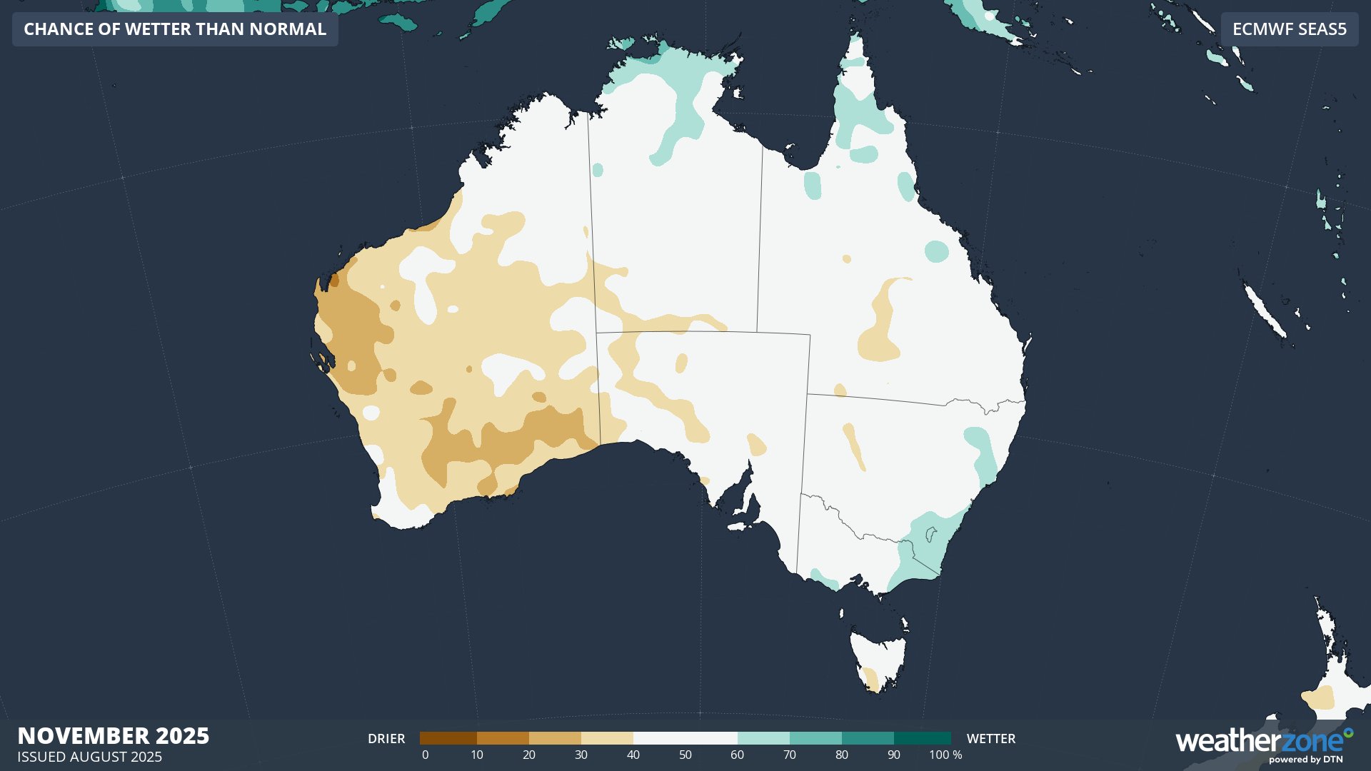
Image: Probability of exceeding median rainfall during November 2025, according to the ECMWF SEAS5 model.
Temperature
Increased cloud cover over Australia this spring is expected to help moderate maximum temperatures, with much of southern and eastern Australia predicted to see cooler-than-average daytime temperatures between September and November.
Note that temperatures will still rise throughout spring and gradually become warmer in the lead-up to summer. However, days should be a bit cooler than you would expect to see in an average spring in some parts of the country.
This spring’s ample cloud cover should also reduce the likelihood of outbreaks of intense early season heat in eastern Australia.
Some areas of northern and western Australia could buck the trends mentioned above and experience warmer-than-average daytime temperatures this spring. Some forecast models even suggest that mean maximum temperatures will be in the top 20% of historical records this spring across parts of northern Australia. These abnormally warm temperatures may help enhance bushfire activity in the final months of the dry season.
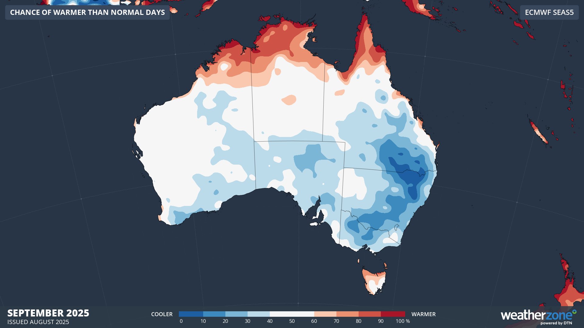
Image: Probability of exceeding median maximum temperature during September 2025, according to the ECMWF SEAS5 model.
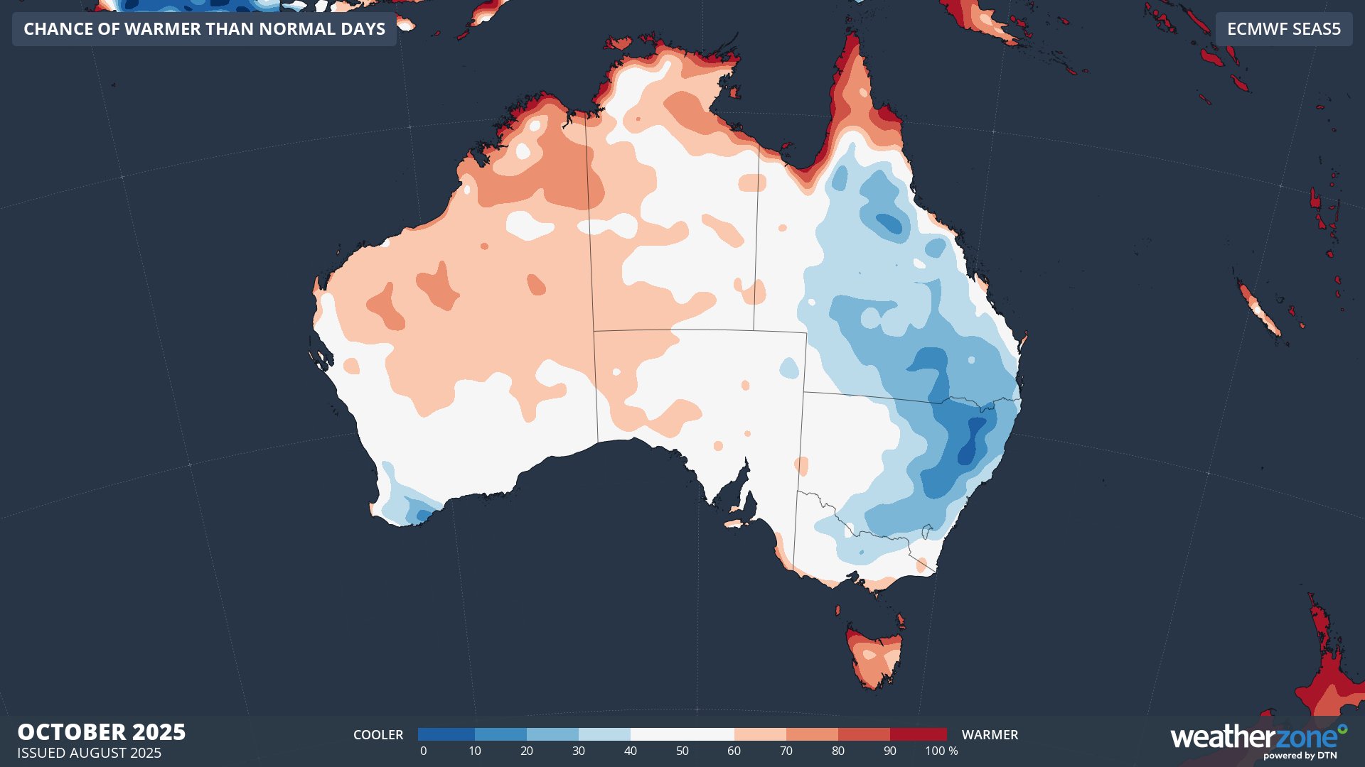
Image: Probability of exceeding median maximum temperature during October 2025, according to the ECMWF SEAS5 model.
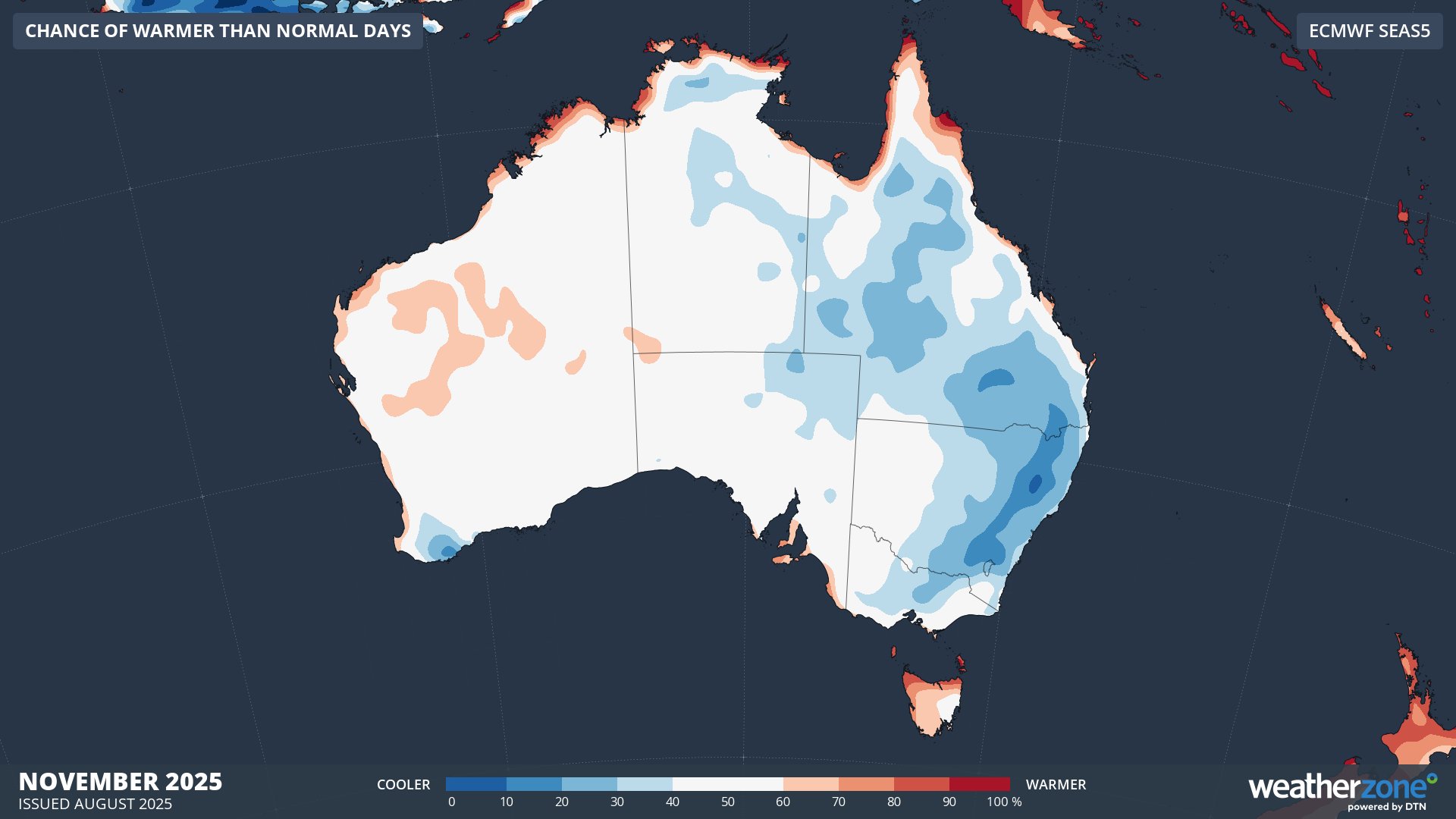
Image: Probability of exceeding median maximum temperature during November 2025, according to the ECMWF SEAS5 model.
This spring is expected to feature a contrasting mix of rain and temperatures across Australia. Spring also marks the beginning of the severe weather season in Australia, which runs from about October to April during the warmer months of the year. This spring could kick the severe weather season off with a bang thanks to increased rainfall and thunderstorms in some parts of the country.