
Wet in the southwest with rare WA snow possible
Moisture associated with a cold front generated significant rainfall in the southwestern corner of the country overnight, and an accompanying pool of cold air could cause snowfalls on the highest peaks of the Stirling Range in WA's Great Southern district on Monday evening.
Let’s deal with the rain first and then look at the potential for a relatively rare West Australian snowfall.
Rainfall totals exceed 25mm across a wide area
The 12-hour satellite and radar loop below shows a narrow but quite intense rainband crossing WA’s South West Land Division on Sunday.
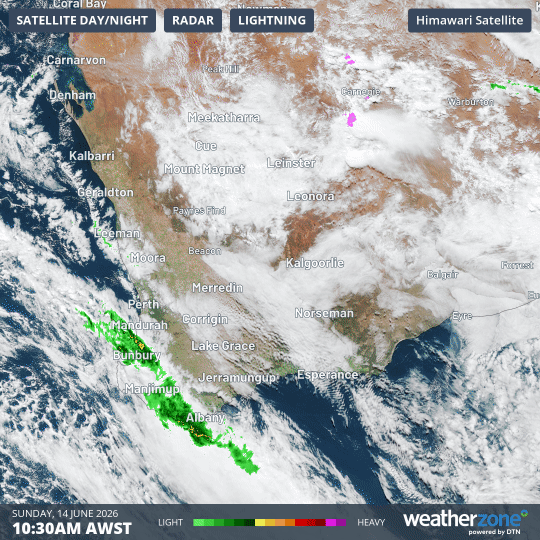
Image: 12 hour combined radar and satellite loop over southwest WA on Sunday, June 14, 2026. Source: Weatherzone.
Notable rainfall totals in the 24 hours to 9am Monday included:
- 41.2 mm at Fouracres, a weather station in the South West forecast district.
- 40.4 mm at North Walpole in the South West forecast district, the town’s wettest day since March 2023.
- 39 mm at Eradu, just east of Geraldton in the Central West forecast district, while Geraldton Airport received 27.4 mm.
- 35.4 mm at Jerdacuttup, about 90 minutes west of Esperance in the South East Coastal forecast district.
- 29 mm at Denmark, just west of Albany in the South Coastal forecast district.
- 27.8 mm in the coastal Perth suburb of Swanbourne.
- 12.6 mm at Perth’s main city weather station.
The fact that more than 30 mm of rain fell from the same rainband at locations that were almost 1000 km apart (in the case of Geraldton and Jerdacuttup) illustrates the scale of the system.
Snow possible for Stirling Range
Monday’s official BoM forecast for WA’s South Coastal forecast district predicts that snow is possible on the highest peaks of the Stirling Range on Monday evening, and for a brief pre-dawn period on Tuesday morning.
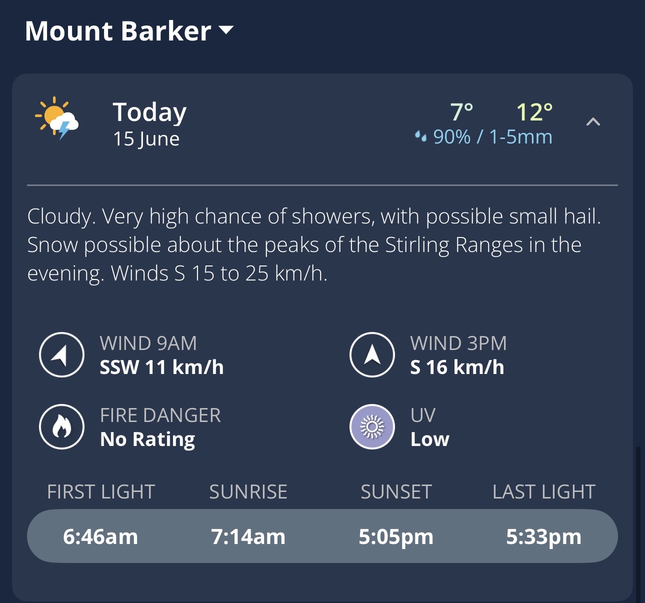
Image: Forecast for Mount Barker (in WA’s South Coastal district, about 80 km SW of Bluff Knoll) on the Weatherzone app.
Bluff Knoll is the 1099-metre highest summit of the Stirling Range, about an hour northeast of Albany.
While there are no official statistics for the frequency of Bluff Knoll snowfalls, snow generally falls there at least once each winter. The trick is catching it.
Because the mountain is barely high enough for snow, any snow that accumulates usually melts within hours or even minutes, which means you’ve generally got to be there when it’s happening to see it.
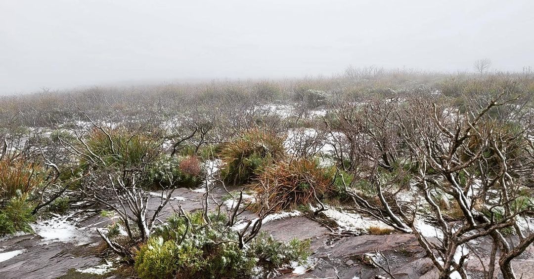
Image: It’s not your classic winter wonderland landscape, but that’s definitely light snow (not hail) on the ground near the summit of Bluff Knoll. Source: Steve Sertis, Bibbulmun Track Foundation on Instagram.
Over the years, numerous hikers have undertaken snow chases from the car park, from where it’s only about two hours each way to the summit and back. But beware: the upper part of the track is highly exposed, so it’s wise to carry warm, waterproof gear, head torches and an emergency beacon – not to mention food and water.
For those who love a bit of geography, Western Australia’s highest peak is Mt Meharry at 1249 metres, 1600 kilometres north of Bluff Knoll in the state’s Pilbara Region. Obviously it’s far too warm up there for snow.
Southwest WA weather outlook for the coming days
Showers and cool temperatures will persist along WA’s southern coast in south to southeasterly stream in coming days.
Perth skies should clear from Tuesday through to Saturday, although maximums will be a couple of degrees below the average June high of 19.5°C all week.