
Wet and windy night ahead for southwestern Australia
A cold front will cause a burst of wind, rain and thunderstorms over southwestern Australia on Monday night and Tuesday morning, with damaging winds likely in some areas.
Northerly winds and showers will increase over Western Australia's southwestern districts on Monday evening, ahead of the approaching cold front. These winds could cause damaging gusts in the Southwest Capes from about 8pm WST and other areas of the South West Land Division, south of a line from about Lancelin to Walpole, later in the evening.
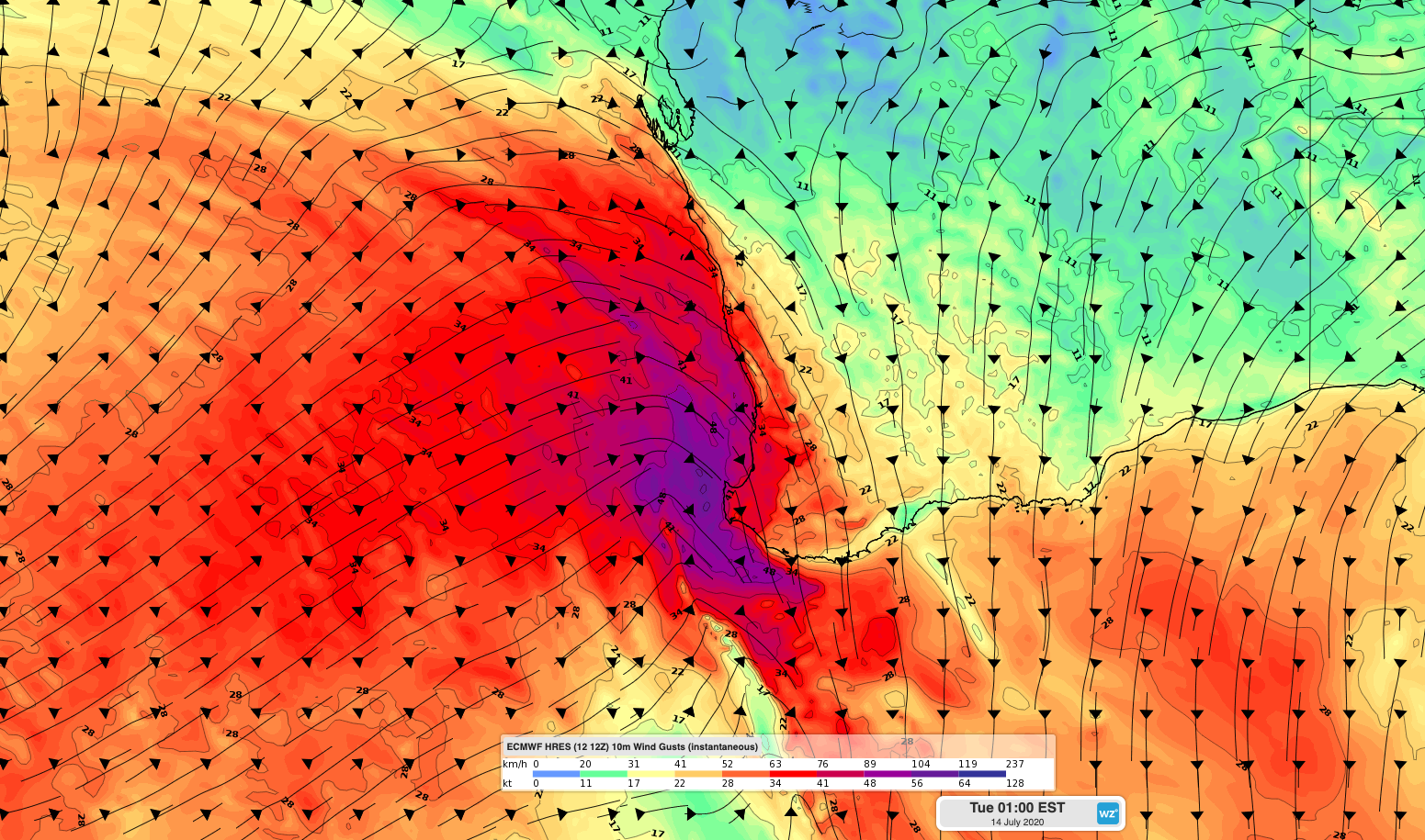
Image: Forecast surface wind gusts in Monday night according to the ECMWF-HRES model.
The strongest winds on Monday night are likely to occur south of about Mandurah, where guests could reach 125km/h, which is strong enough to cause significant property damage.
Heavy rain and thunderstorms will also accompany the front during Monday night and Tuesday morning. The heaviest falls will occur in the Lower West and South West Districts, where some places could see 10-30mm.
While wind and rain will gradually ease over the state's southwest on Tuesday, large waves could cause beach erosion between Bubury and Walpole throughout the day.
Looking ahead, another cold front will affect southwestern Australia on Thursday, possibly causing another round of severe weather over the region.