
Wet and stormy weather looms for parts of eastern Australia

Showers and thunderstorms will affect parts of NSW and Queensland during the next few days, with some places likely to see severe storms.
A low pressure trough passing over eastern Australia will cause showers and storms from central NSW up to central western Queensland on Wednesday. Some of these thunderstorms are likely to become severe, with heavy rain, damaging winds and large hail all a risk. While Wednesday's shower and storm activity will be widespread, rainfall will be hit and miss. Some places could see bursts of heavy rain or intense storms and others will miss out altogether.
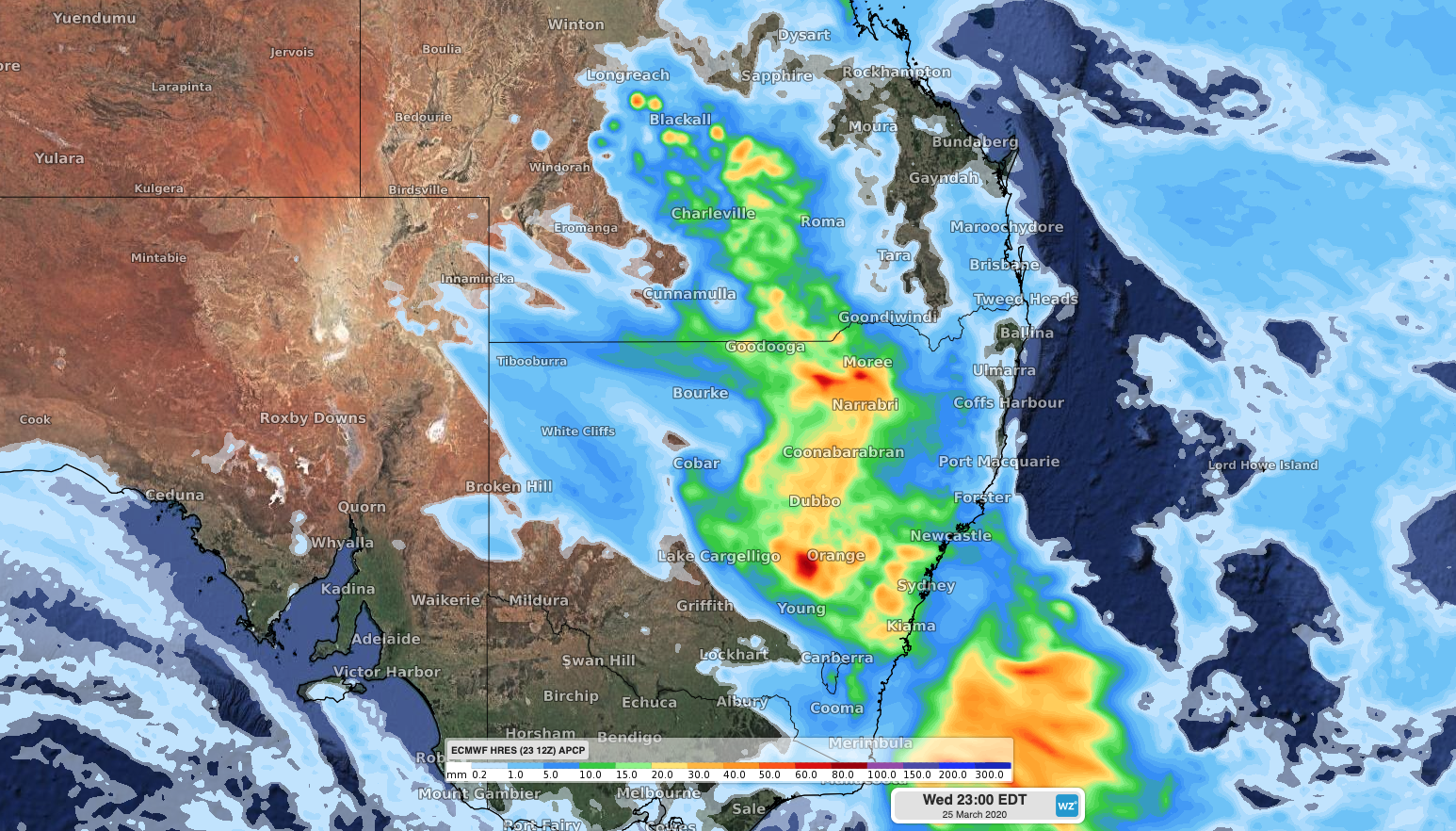
Image: Accumulated daily rainfall on Wednesday according to the ECMWF-HRES model
On Thursday, showers will continue to affect areas of eastern, central and northern NSW and southern and central Queensland. However, thunderstorm activity will ease and become more confined to northeast NSW and southeast Queensland as an upper-level trough weakens and moves off Australia's east coast.
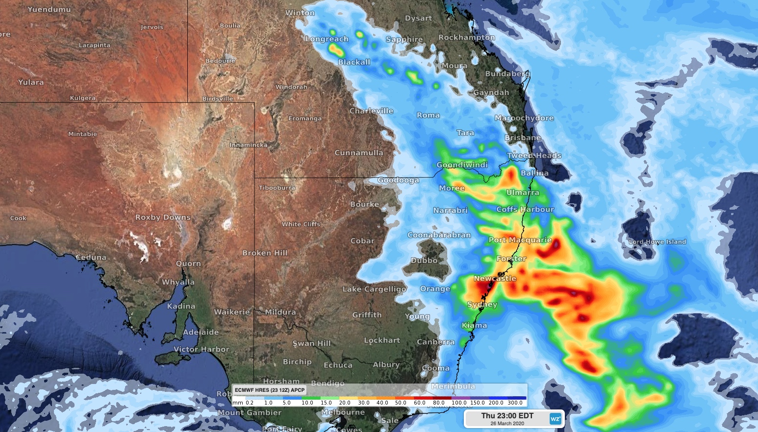
Image: Accumulated daily rainfall on Thursday according to the ECMWF-HRES model
Later in the week, showers and thunderstorms will continue to affect parts of Queensland and NSW from Friday into the weekend as moisture-laden onshore winds feed into low pressure troughs.
Be sure to check the latest forecasts and warnings in the coming days.