
Wet and cool across most of Australia in September
It will come as no surprise to many, but September was wet and cool across most of the eastern half of the country. The west didn't escape, with unseasonable rain at the beginning and end of the month.
Over the east, rain was persistent—another non-surprise. Many centres, including Sydney, Richmond, Canberra and Bendigo had their highest number of September rain days since the early to mid-nineties, totalling half or more the month's 30 days.
Most other areas over southern Queensland, inland NSW and Victoria had their highest number of September rain days since 2016.
In terms of amounts, rain totalled more than 200% of the average across large areas of the east and west of the continent (first figure). Achieving this doesn’t take much in some places like the far north of the country where long-term average rainfall is very low in September—if the monthly average is 5mm, a single 20mm fall will take the monthly total to 400% of average. But a decent shift in typical spring weather patterns is required to bring about such anomalies over the southeast inland where average rain values are much higher (compare first and second figures).
The repeated pattern of unseasonable troughs drawing moisture inland across the continent, including multiple cut-off lows over northern Victoria and southern NSW, was the cause of the wet start to spring over the southeast.
Associated persistent cloud cover led to cooler than average daytime temperatures and warmer than average nights in an arc from central Queensland down to northern Victoria.
Richmond averaged 20.8oC over September, the coolest for the month since 1990, beating out 1995 and 1997. Yet the average minimum was a mild 9.6oC with frequent blanketing cloud, the fourth warmest on record. Sydney days averaged 20.6oC, the coolest since 1997, despite being slightly above average.
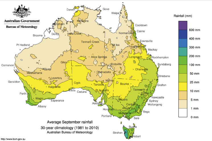
Figure 2: Long-term average September rain.
October is not off to dry start, for NSW at least. As of 11am October 1st, most centres east of the NSW divide have already recorded rain. West of the divide and over Victoria, South Australia and Southern Queensland, it’s a brighter day, and brighter long weekend in store.
Eastern NSW and ACT will get their turn for some sun and dry on Monday when onshore winds slacken; Monday is definitely the pick of the long weekend in the east.
The dry will be short-lived. Yet another rain-bearing trough and low are set to slowly cross the southeast from next Tuesday/Wednesday, bringing more school holiday drear.
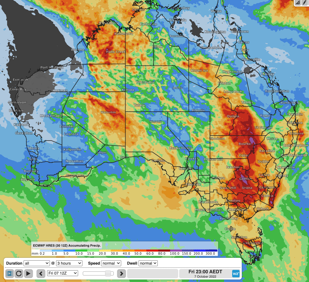
Figure 3: Accumulated precipitation forecast by ECMWF for the week Fri 30 September to Friday 7th October.