
Welcome rain in outback QLD, NSW

The best rain in a few years has fallen in parts of northwest NSW and southwest Queensland during the last couple of days.
A slow-moving low pressure trough interacting with an upper-level pool of cold air is producing showers and storms in Australia's eastern inland.
Wilcannia's 65mm during the 24 hours to 9am on Monday was their heaviest rain in four years. Griffith's 44.6mm during the same period was its heaviest April rain in more than 60 years.
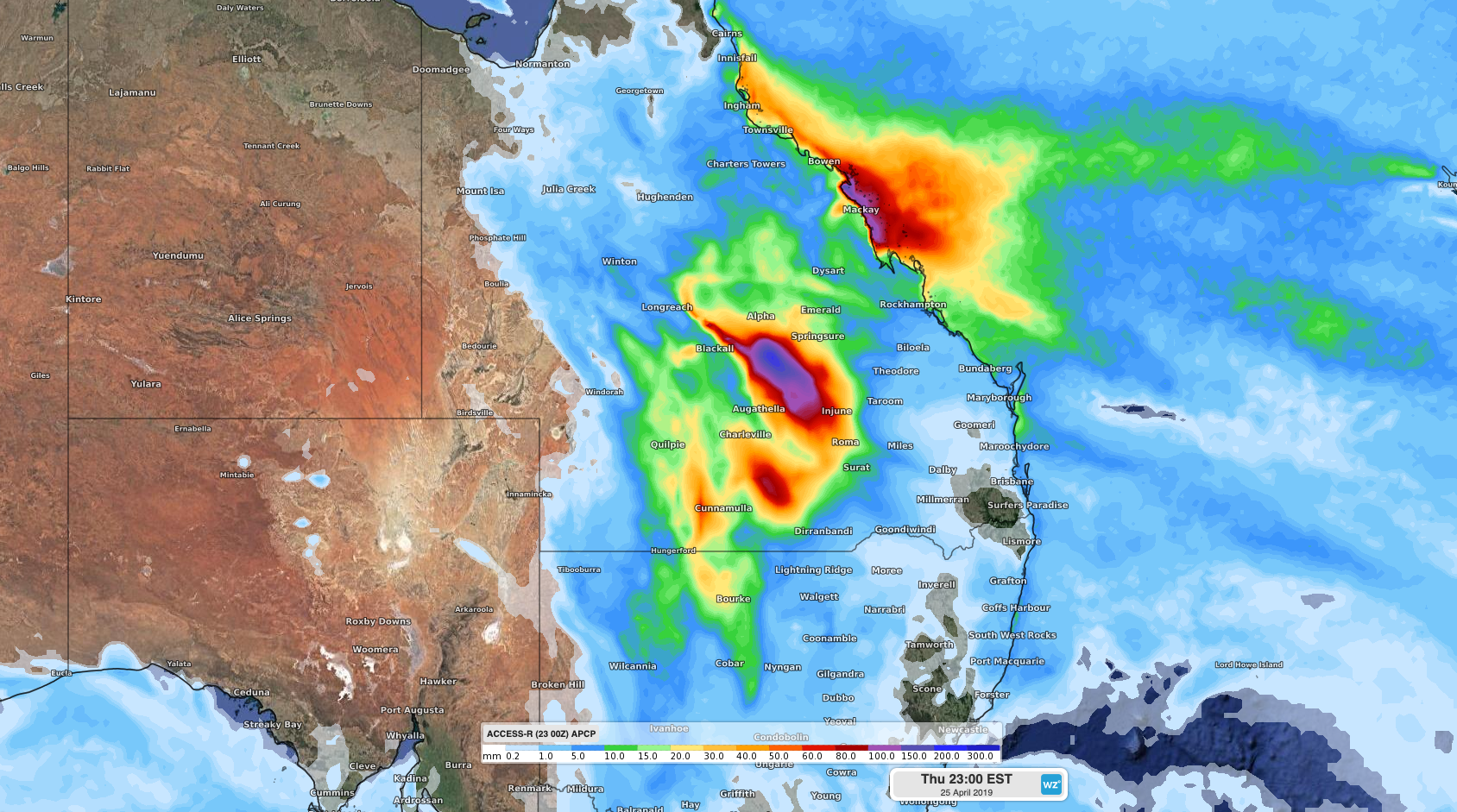
Image: Forecast accumulated rainfall between Tuesday and Thursday this week, accordig to the ACCESS-R model.
During the 24 hours to 9am on Tuesday, Queensland's Cunnamulla (47.2mm) picked up its best rain in three years. Another rain gauge south of Cunnamulla collected 56mm, its heaviest rain in five years.
Elsewhere, Thargomindah (11mm) and Borke (24) both had their best rain in five months during the 24 hours to 9am on Tuesday.
Showers and thunderstorms will continue over parts of northwest NSW and southwest Queensland on Tuesday. As of 2pm AEST, a severe thunderstorm warning had been issued for heavy rain in parts of southwest Queensland, including areas around Quilpie and Euola, to the west of Cunnamulla.
Showers and storms will spread over central inland Queensland on Wednesday as the trough moves further north and east. Severe storms are likely once again, with heavy rain causing areas of flash flooding.
Showers and storms should become more confined to eastern districts of Queensland from Thursday, with drier weather returning to Australia's eastern inland.