
Week-long soaking ahead for northern Australia
Widespread rain and thunderstorms will affect northern Australia over the coming week, soaking large areas of Queensland, the Northern Territory and Western Australia.
A broad area of low pressure over Australia, featuring numerous low pressure troughs and low pressure systems, will interact with moisture-laden air to fuel the week-long soaking in the tropics.
The map below shows how much rain one computer model is predicting during the next seven days.
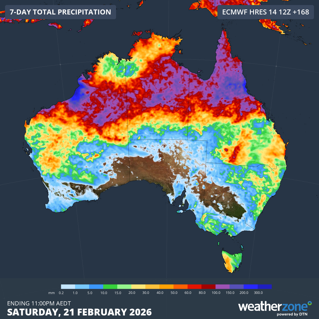
Image: Forecast accumulated rain during the seven days ending at 11:00 pm AEDT on Saturday, February 21, 2026. Source: Weatherzone.
While it’s difficult to know exactly where the heaviest rain will occur, current forecasts suggest WA’s western Kimberley district and Qld’s North Tropical Coast could be the focus for some of the heaviest falls.
These areas have the potential to receive more than 200 mm of rain over the coming week, while a broad area of 100 mm+ rainfall is likely in between these two areas.
The upcoming rain may cause flooding and road closures in all three states and territories, particularly in areas that see several days of heavy rain or intense rainfall during severe thunderstorms.
Being the wet season, this type of rain is not uncommon in northern Australia at this time of year, but it may still be hazardous. Be sure to check the latest flood warnings and road closures before travelling in northern Australia over the coming week.