
Weather gods battle it out over Newcastle
Newcastle copped a light show and a drenching yesterday when a series of storms rolled on through the region.
It all began fairly early in the day. Storms sparked up along the NSW coast from Wollongong to Port Macquarie throughout the morning as a high-pressure ridge was wedged along the coast between an inland low-pressure trough and Severe Tropical Cyclone Dovi over the Coral Sea, with southerly onshore winds driving moisture into the region.
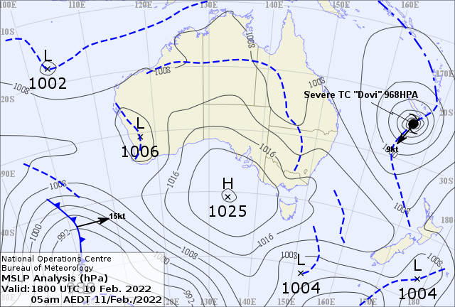
Image: Mean Sea Level Pressure (MSLP) analysis chart for 5am on Friday 11 February. Source: Australian Government Bureau of Meteorology
The storms continued into the afternoon, with a hotspot emerging between Gosford on the Central Coast and Muswellbrook in the Hunter Valley.
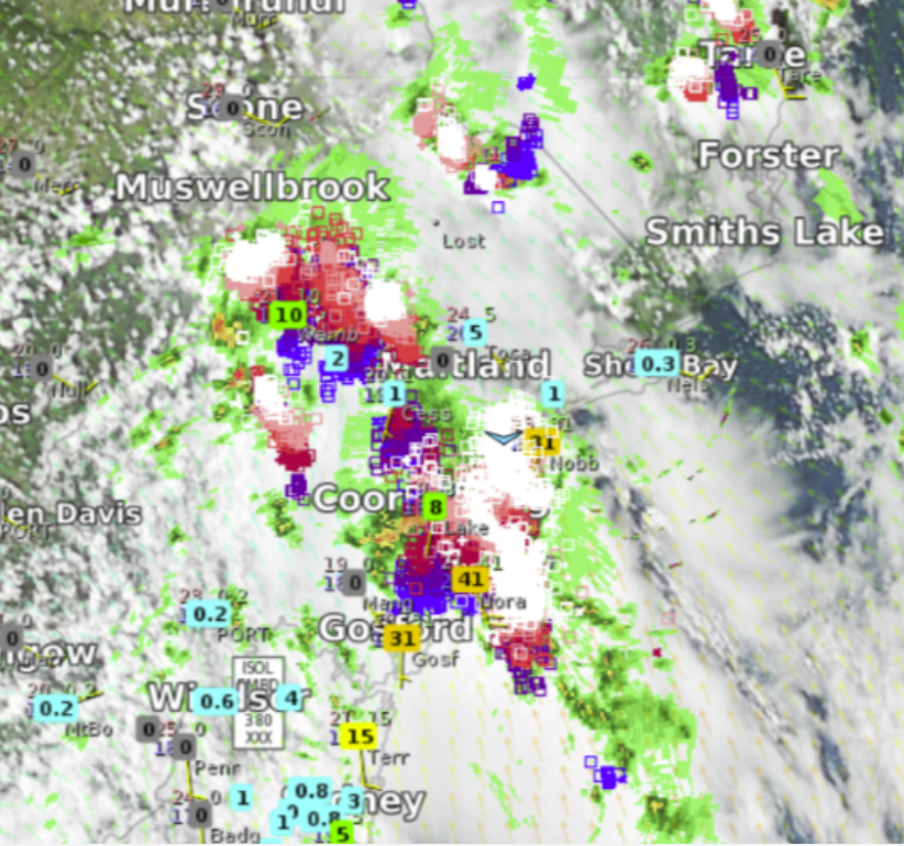
Image: Lightning tracker and radar data acquired at 3:35 pm on Friday 11 February, showing a hotspot of thunderstorm activity between Gosford and Muswellbrook
By 4:10 pm, a Severe Thunderstorm Warning was issued for the Greater Newcastle and Maitland/Cessnock districts, citing heavy rainfall as the biggest concern. The warning was finally cancelled at 5:40pm.
The result of all this activity was more than 50,000 lightning strikes within 100km of Maitland (an area encompassed by Murrurundi to the north, Gosford to the south, and Kandos to the west) between 11am and 7pm yesterday. Additionally, there were some significant 24 hour rainfall totals in the Newcastle area, all as a result of this series of thunderstorms. In the 24 hours to 9am this morning, Shepherds Hill had received 93mm, Mereweather had received 81mm, Newcastle TAFE at Tighes Hill had received 72mm, Broadmeadow and Nobbys Head had both received 60mm, and Lookout Road Reservoir had received 57mm.
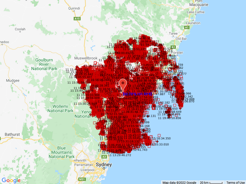
Image: Detected lightning strikes within 100km of Maitland between 11am and 7pm on Friday 11 February
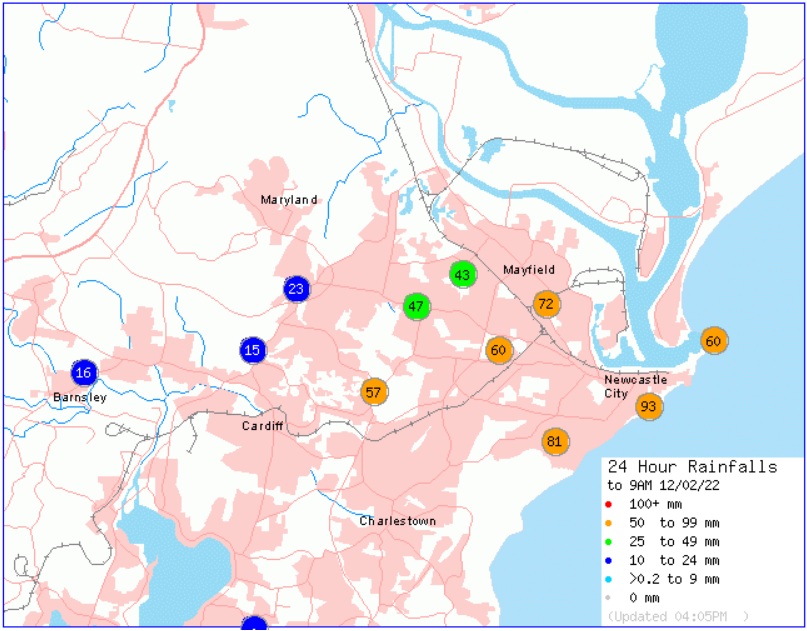
Image: Newcastle 24 hour rainfall totals to 9am Saturday 12 February. Source: Australian Government Bureau of Meteorology
The significant rainfall totals didn’t stop there. In the Central Coast district, Nords Wharf received 76mm, Martinsville received 74mm, Wyong and Dora Creek both received 68mm, and Mandalong had received 57mm in the 24 hours to 9am this morning as a result of yesterday’s storms. Quorrobolong in the wider Hunter region also received 69mm in the 24 hours to 9am this morning.
Thankfully for residents of the Hunter and Central Coast regions, the weather looks to be much drier (and quieter) until at least the middle of next week, when a high pressure system in the Tasman will butt heads with a trough over central NSW, bringing the risk of more thunder battles between the weather gods. Let’s hope they’re a little more considerate of us mere mortals this time.