
Watch for snow over the southeast Tablelands on Sunday then brace for a windy Monday
A cold front is crossing the southeast and, on Sunday, will suck in humidity and stir up a low, bringing snow showers down to 700-800 metres and increasing blustery winds that will make Sydney feel barely into the teens on Monday.
The front is currently over eastern NSW, moving relatively slowly. On Sunday, cold post-frontal air colliding with warmer, humid air over the southern Tasman Sea will spin up a low. This low will pull moisture back over southeast NSW, particularly southeast of Cooma. Heavier showers due to this enhanced moisture could allow snow to fall to lower levels than indicated by the freezing level due to a latent cooling affect.
When snow or frozen precipitation falls into warmer low-level air near the ground, it melts. But–if you remember your high school chemistry classes–to melt something, you need to put in energy. The surrounding atmosphere puts heat energy into melting the frozen precipitation and thus cools, gradually lowering the freezing level. Snow can then fall to lower levels than expected from the initial freezing level before the precipitation started. The effect only works effectively when rain is heavy.
On Sunday, the heaviest precipitation looks to fall southeast of Cooma, so Nimmitabel and even Bombala are in the firing line for snow showers. It all depends on where the precipitation is heaviest, which depends on just where that low forms.
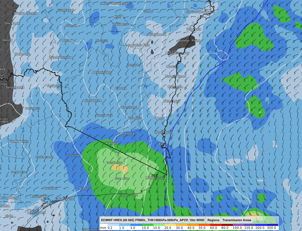
Images: Precipitation (3hrly) and near-surface wind 4pm Sunday 7th afternoon according to ECMWF.
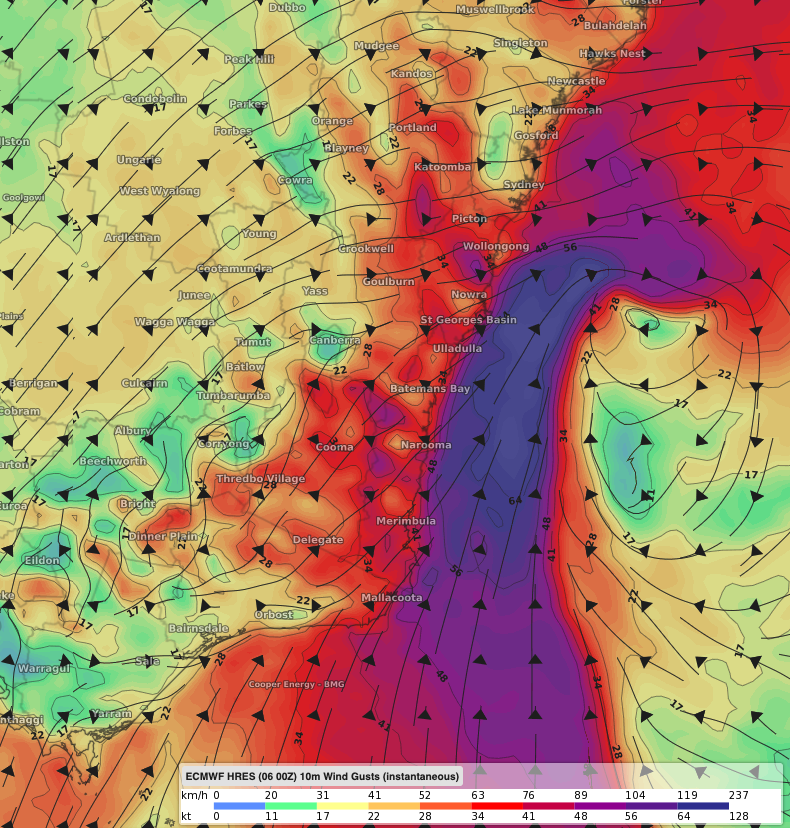
Images: Near-surface wind gusts for 1am Monday 8th according to the ECMWF model.
As the low spins up overnight Sunday into Monday, winds will increase, gusting over 80km/h and possibly over 100km/h along parts of the coast. The wind, combined with lingering cloud and showers, will make it feel multiple degrees cooler than actual temperatures with even balmy Sydney unlikely to feel warmer than 14 or 15 degrees at the beginning of the week.