
Warm-up on the way for the UK
A shift in the weather pattern will cause warmer conditions to develop across the United Kingdom next week, although showery weather will continue for the next few days before the warmth arrives.
Cool and stormy this week
Late April and early May brought warm and fine weather across much of the UK, with temperatures peaking at 25.4°C on May 1 at Kew Gardens, Greater London.
Conditions more recently have taken a decidedly cooler turn, as the wind swung around into the north. These chiller winds have brought numerous showers and thunderstorms over the last few days. In places, hail covered the ground, and there was some fresh snow on the higher mountains of Scotland, and even down into north-west Wales, over Yr Wyddfa (Snowdon).
There have been some cold nights too, with an air frost having been recorded on most nights, somewhere in the UK, so far this month. This will not have been good news for those who want to get their young plants outdoors.
Weather pattern shift to bring warmer weather
Over the coming week, the larger-scale pattern will undergo a major change. Instead of high pressure being located to the west of the UK, which brings colder northerly winds, it will end up to the southeast or east of the UK by the end of next week. This will shift the winds into the south or southwest, bringing warmer air across much of the UK.
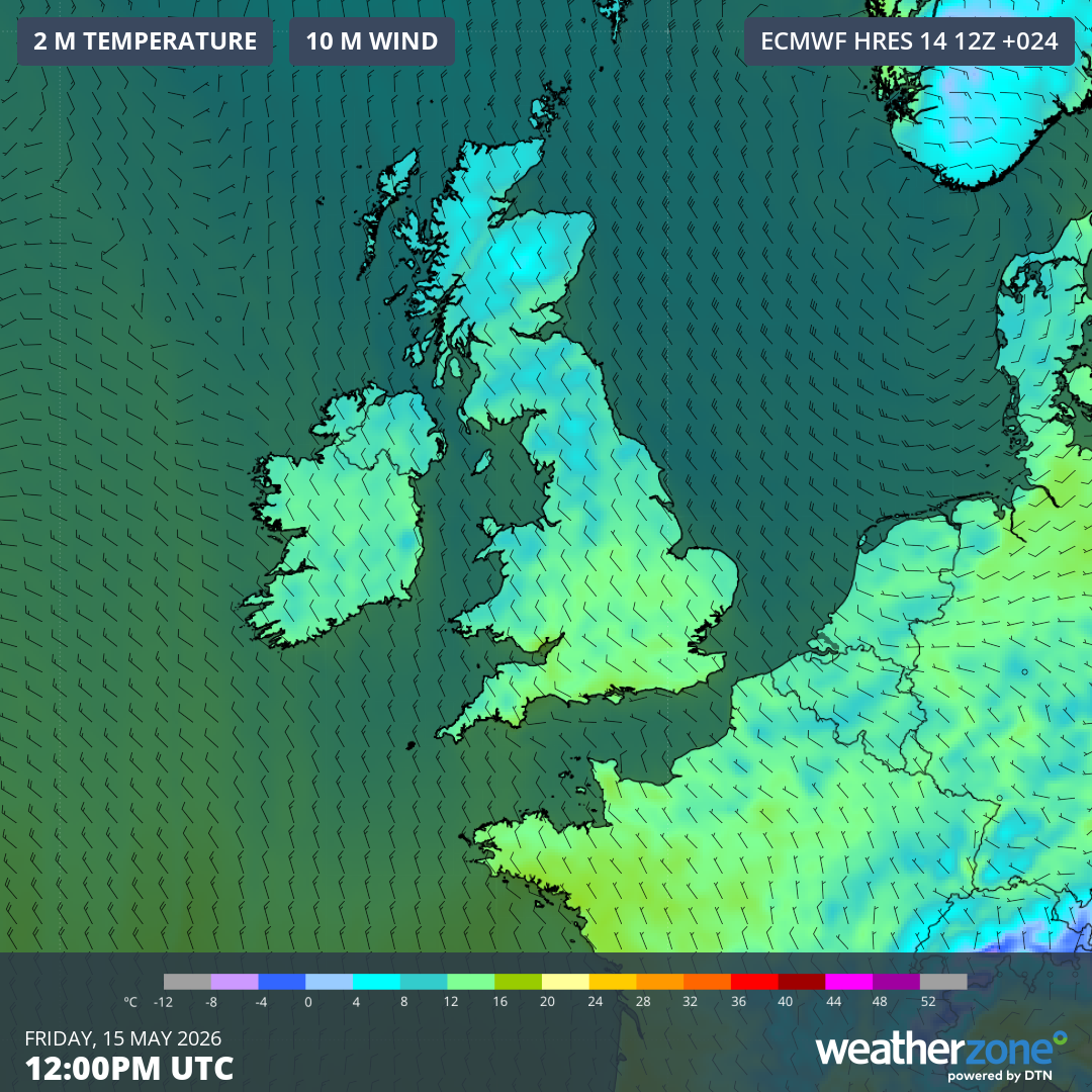
Image: Forecast air temperature and wind on Friday, May 15, showing cool northwesterly winds over the UK. Source: Weatherzone.
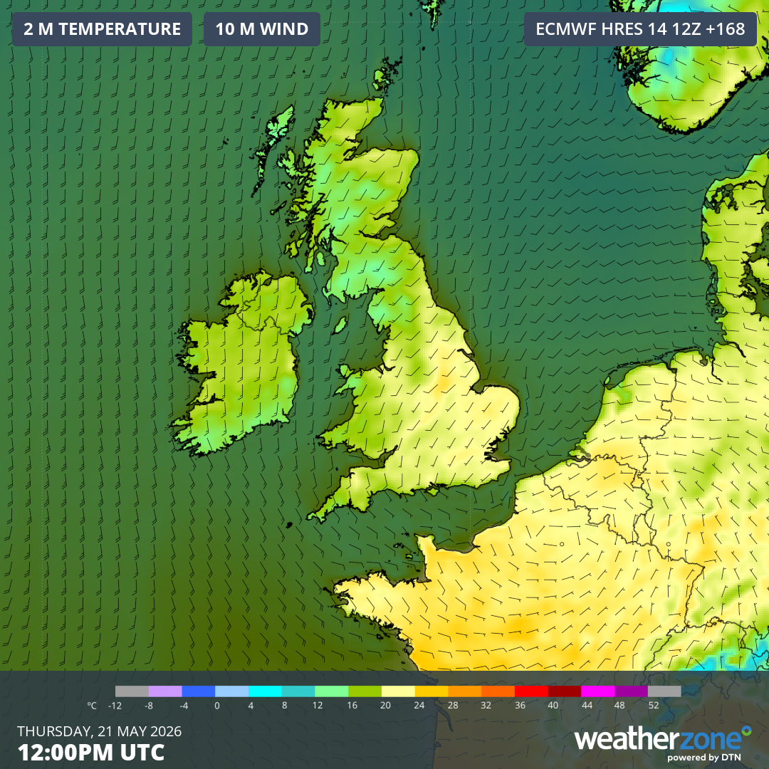
Image: Forecast air temperature and wind on Thursday, May 21, showing warmer south-southwesterly winds over the UK. Source: Weatherzone.
It won’t be a simple transition into warmer and drier conditions though: Further spells of rain are possible over the coming days, into around the middle of next week. Such rain will be welcome to many growers, as the spring has been dry for many central and southern areas so far.
By late next week, much of the UK should be dry with spells of warm sunshine. Temperatures are expected to rise into the mid-20s Celsius across parts of England and Wales, with low 20s possible for Scotland and Northern Ireland. Some computer model guidance shows temperatures into the high-20s for central and southern areas.
The longer-term outlook suggests that, overall, drier and warmer conditions are likely across parts of the UK this summer.