
Warmth turning to storms in WA
After a burst of warmer weather this weekend, a flood of moisture moving in overnight will ensure storms spark up on Sunday over Western Australia.
A trough over the west coast of WA is helping to draw heat down over the south. Temperatures are widely in the high twenties and low thirties across the region on both Saturday and Sunday, about 3-7 degrees above average for November.
Overnight tonight, moisture will start to move into the currently dry heat trough, thanks to a link-up with a tropical low that has formed near Christmas Island.
Thunderstorms are likely to form over the Gascoyne from the morning, extending through the southern inland and southwest during the afternoon and evening, when they will be most widespread. The most likely districts to get storms are Great Southern, Central Wheatbelt, and Goldfields but will likely spread into most of the districts in the south, west and north. In fact, all districts except the Northern Interior could see a flash or two on Sunday or Monday morning.
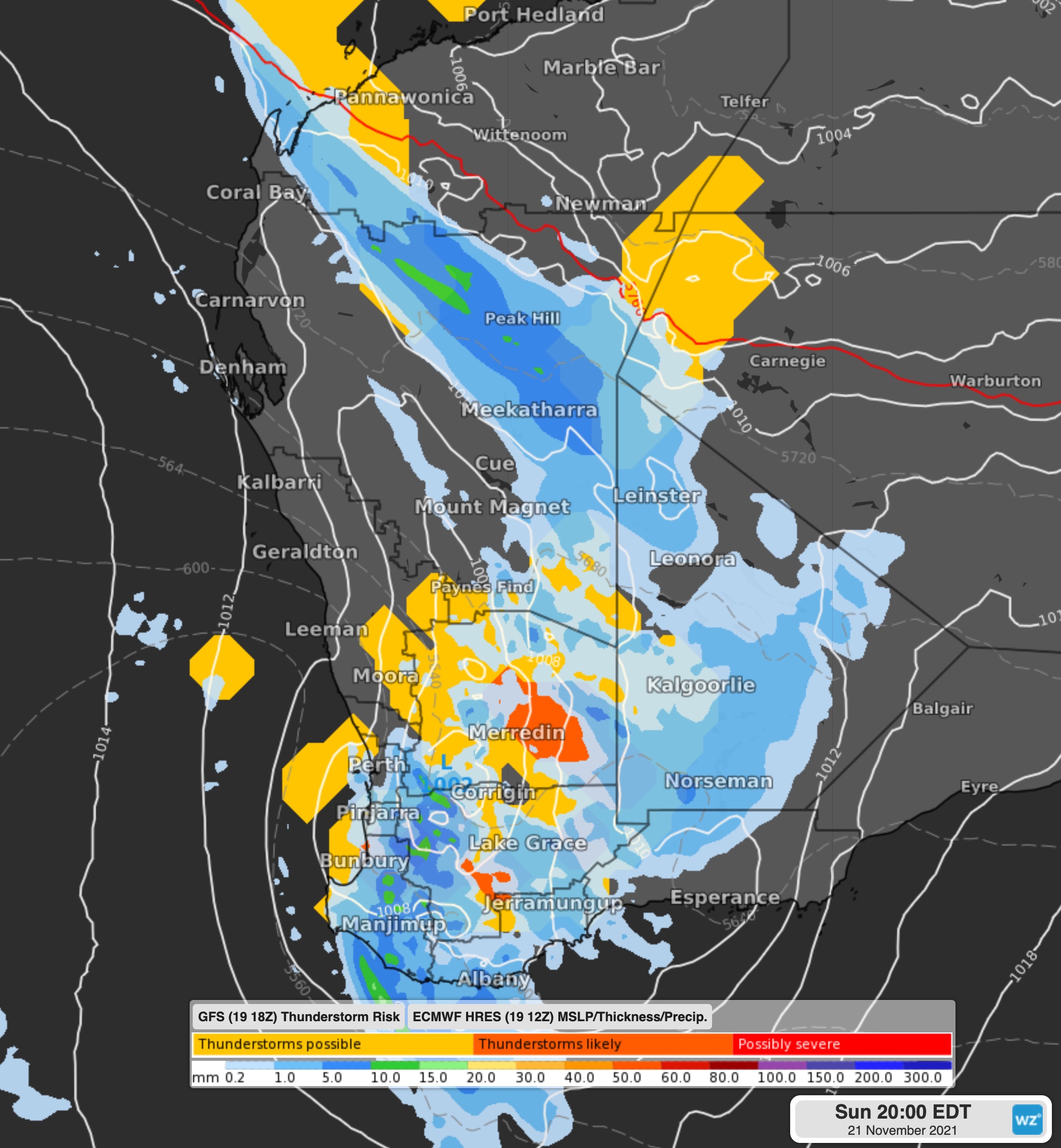
Image: Rain and storms predicted on Sunday afternoon.
Some thunderstorms could be severe with heavy rain the most likely to occur, but damaging winds throughout and large hail possible in the west.
A low will form in the trough, helping to direct rainfall of 15-30mm over the far southwest districts, as well as some fairly gusty winds of around 60-70km/h for elevated parts near the west coast.
This burst of rain and storms will be fairly brief, with high pressure starting to move in, clearing skies from Wednesday.