
Warmest start to May in decades about to give way

Adelaide climbed to 29.0 degrees on Saturday, making it the equal warmest May day since 1921. Surrounding areas of South Australia and nearby Tasmania, including Hobart, Naracoorte and Neptune Island had their warmest May day since 2014 or earlier.
It is very early in the month but the warmth is still significant given its persistence—Friday night leading into Saturday was warm (6 to 8 degrees above average) and then much of Saturday night leading into Sunday was also very warm.
Cape Otway in Victoria's southwest barely made it below 20 degrees in the early hours of Sunday, its warmest May minimum since the 1950's, while Ballarat and surrounds stayed in the mid-teens, their warmest May night since 1997. Melbourne reached 25 degrees on Saturday and is forecast to do the same Sunday.
The source of the late season warmth is a stalled front near the SA/VIC border that is dragging northerly winds ahead of itself.
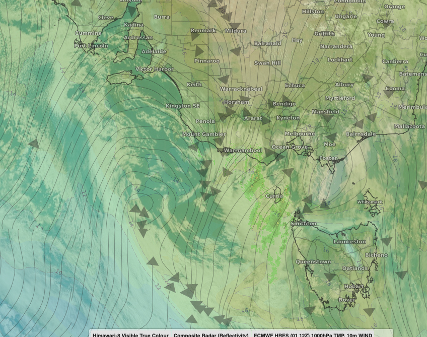
Image: Satellite and model imagery showing the low brewing southwest of VIC with warm northerly winds to its east and cold air building to its west.
It's about to stop. As cold air starts to bank up behind the front, a low is brewing offshore of southwest Victoria. This low will swing over the southeast from Sunday night, sending a surge of cold air, showers and thunderstorms northwards.
Cooler air has already started to encroach on Adelaide and will reach Melbourne later today and Canberra and the Sydney area on Tuesday. Tuesday will be the likely coldest day, with temperatures up to 15 degrees lower than on Saturday and Sunday for southern South Australia and Victoria. Widespread showers and gusty winds will make it feel even colder.
The bulk of the showers and gusty winds will then contract to the east coast of NSW and adjacent slopes on Wednesday. The positioning of the low once it moves back offshore will force heavy showers over parts of the NSW coast and adjacent ranges on these days with some areas likely to pick up in excess of 50mm. Further inland, rainfall totals will grade off sharply over the western slopes to generally less than a few millimetres over the plains.