
Warm weather causing spike in QLD fire danger
Large areas of Queensland will see Very High fire danger ratings during the next few days as spring warmth starts to build over the state.
September is typically a time of rising temperatures and fire danger in Queensland, thanks to progressively longer days, fewer intrusions of cold air and low humidity.
On Monday, a warm air mass will cause temperatures to reach the high-twenties to mid-thirties across most of the state. This warmth will help cause Very High fire danger ratings in the Central Highlands and Coalfields, Maranoa and Warrego and Darling Downs, and Granite Belt Forecast Districts.
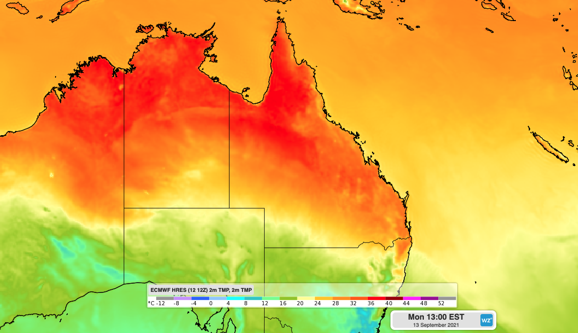
Image: Forecast surface temperature on Monday afternoon, according to the ECMWF-HRES model.
Even Brisbane is expected to reach around 31ºC on Monday, which hasn't happened since the other side of winter.
The hot weather end elevated fire danger ratings will spread further north and east on Tuesday. Very High fire danger ratings have been forecast for the Peninsula, Gulf Country, Northern Goldfields and Upper Flinders, Capricornia, Central Highlands and Coalfields, Wide Bay and Burnett, and Southeast Coast districts.
Cooler air will spread into southern Queensland from Monday into Tuesday, lowering the fire risk and causing temperatures to drop by around 10ºC in some areas.
Toowoomba is expected to reach about 27ºC on Monday and only 18ºC on Tuesday. After reaching around 31ºC on Monday, Brisbane is forecast to hover in the mid-twenties from Tuesday until at least Friday.
Visit the Queensland Fire and Emergency Services website for details on current bushfires and warnings.