
Warm then wet for southeastern Australia

Heat is expected to briefly build during the middle of next week across the southeast of the nation, courtesy of a low pressure trough.
The mercury is currently expected to peak more than eight degrees above average on Wednesday in Adelaide, with a similar deviation from average on the cards for Sydney on Thursday.
Melbourne's spike in temperature on Wednesday does not look to be as pronounced, although the thermometer is still expected to read at least five degrees above the norm for mid-September.
An upper level cut off low is expected to develop on Thursday. This system should tap into a plentiful supply of moisture from the tropics, which should translate into meaningful rainfall and widespread cloud cover across the southeast of Australia.
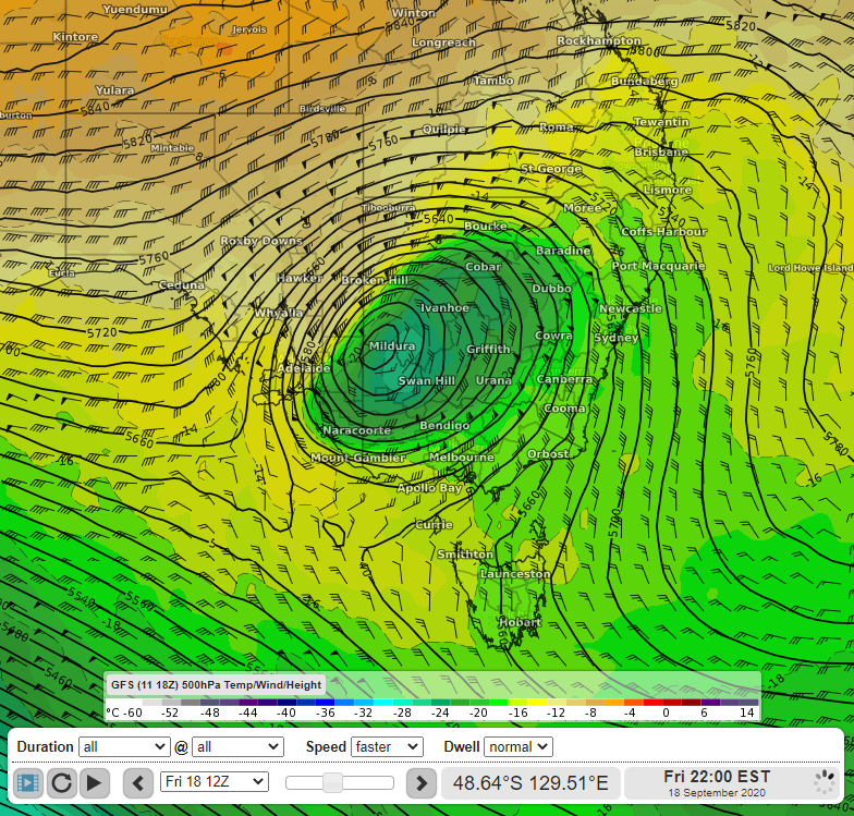
Image: The 500hPa temperature, wind and geopotential height field over southeastern Australia on Friday 18th September at 22:00 AEST, according to the latest GFS model run.
Victoria, southeastern South Australia and central and southern New South Wales look to see the largest rainfall accumulations at this stage, with 20-40mm expected generally and localised falls of more than 60mm possible; however, model uncertainty is high at this range.
There is also the possibility of some intense thunderstorm activity, mainly on Thursday and Friday in parts of New South Wales and central Queensland; damaging winds and localised flash flooding are the main concern, but large hailstones are also a chance.
This is a dynamic system, so it would be a good idea to keep up to date with the latest forecast in the lead up to this event.