
Warm and windy day in southeastern Australia
Vigorous high-level winds will surge across southeastern Australia during the next 48 hours, causing potentially damaging gusts in mountain areas of SA, Victoria and NSW.
Northwesterly winds will strengthen over Australia's southeastern states on Thursday and Friday ahead of an approaching cold front.
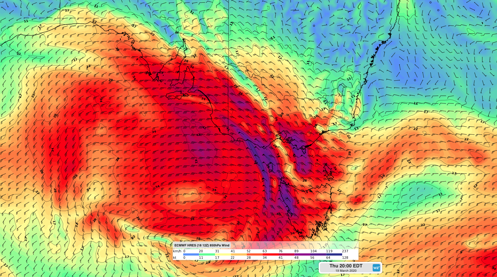
Image: Forecast wind speed and direction on Thursday evening at the 850hPa level, which is arounf 1500 metres above sea level.
The strongest winds during the next two days will occur a couple of kilometres above sea level, prompting severe weather warnings for damaging winds in mountain areas of SA, Victoria and NSW.
In SA, gusts of around 90km/h are possible on and east of the Mount Lofty Ranges on Thursday. These blustery conditions will combine with temperatures reaching 30 to 40 degrees in some parts of the state, causing severe to extreme fire danger ratings.
As the system moves further east, wind will increase in Victoria, southern NSW and Tasmania. Damaging gusts are possible in alpine areas of northeast Victoria and NSW from Thursday evening into Friday morning. Elsewhere, Thursday's strengthening winds could also cause areas of raised dust in some inland areas of southeastern Australia, along with Very High to Severe fire danger ratings in parts of NSW and Victoria.
Warm air ahead of the approaching front should cause temperatures to exceed 30 degrees in Adelaide and Melbourne on Thursday and possibly reach 35 degrees in Sydney on Friday. For Sydney, this is about 10 degrees above average for this time of year.